
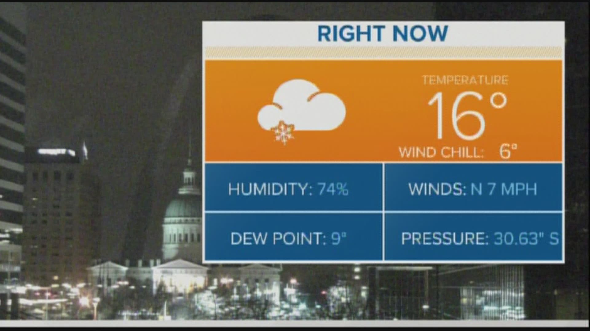
ST. LOUIS — Howling winds overnight Saturday into Sunday brought a blast of arctic air into the Bi-state region. Despite plenty of sunshine Sunday afternoon, temperatures struggled to get much above 20° in many locations. Wind chills throughout the day have been mainly in the single digits. Even though the gusty winds will ease a bit during the evening and overnight, wind chills are expected to be near zero in many places. A few clouds are expected overnight and even a few flurries are possible.
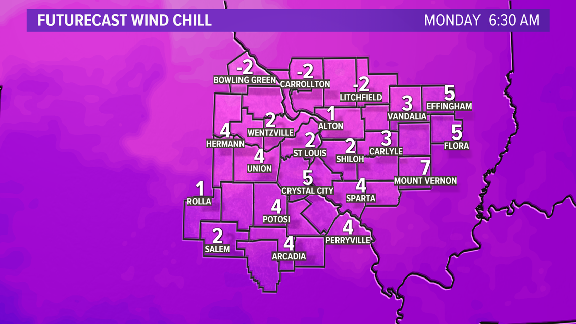
By early Monday morning, temperatures will be in the single digits to lower teens and wind chills in some cases a little below zero, mainly north of the metro area.

Download the free 5 On Your Side app to get the latest watches and warnings and track conditions live with our interactive radar. Use the links below to download now.
5 On Your Side news app
iPhone | Google Play
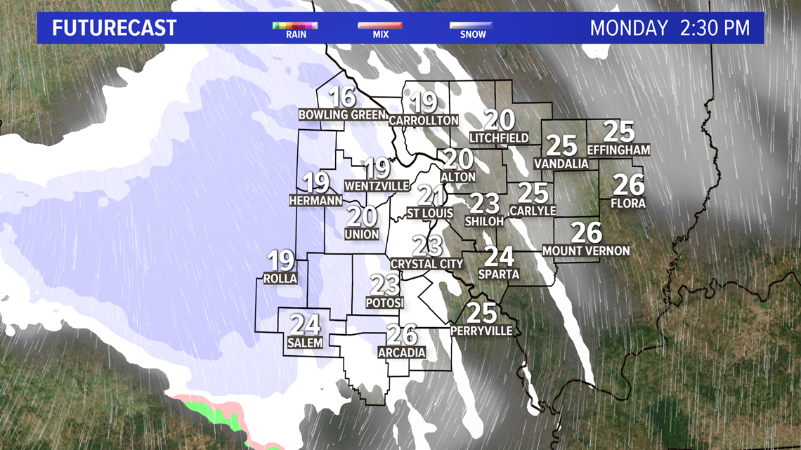
Clouds will increase during the morning Monday and become mostly cloudy by the afternoon. There is a chance of snow showers or flurries, especially west of St. Louis during the afternoon. Any accumulation should be over far western portions of the viewing area from about Hermann to Ironton and points west. Less than an inch of snow would be expected. Afternoon temperatures will climb into the upper teens and lower 20s for Martin Luther King, Jr. Day.

RELATED: Live interactive radar
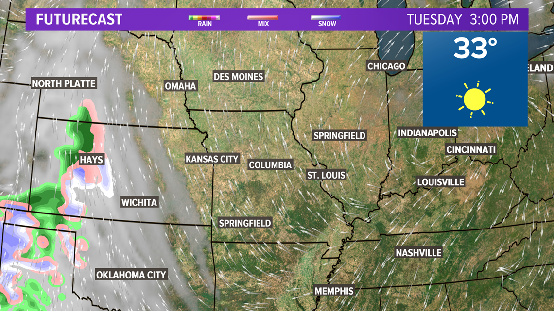
Warmer weather begins to return by Tuesday afternoon as we climb above freezing. Near-average temperatures can be expected for the end of the week along with a chance of rain or snow showers.

More local news:
RELATED: Children damage Crown Candy office