ST. LOUIS — A winter weather advisory is in force for much of Saturday in the St. Louis region. A winter storm will move across the area Friday night through Saturday evening.
Rain develops tonight. We could have some pockets of heavier rain toward daybreak. The rain snow line will be just north of St. Louis around 6 a.m., moving southeast. Right after the changeover to snow, the snow may come down at a pretty intense rate for a brief period. That could muck up the roads pretty quickly.
Before you head out on the roads, be sure to check our weather app. If you don't have it, you can download it for free for iPhones and Androids, and can be downloaded from the iTunes and Google Play stores.
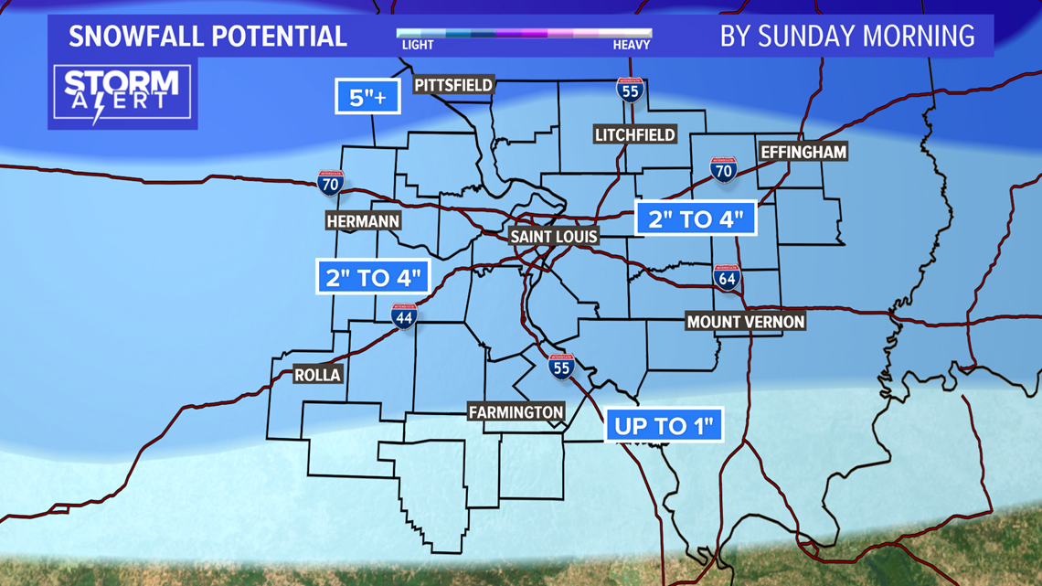
The heavier snow will push away during the afternoon.
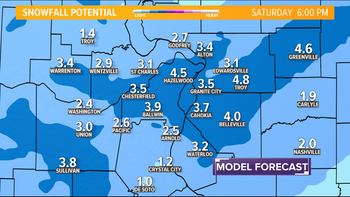
We are generally in a 2-4 inch range for most areas, but there will probably be some banding of heavier snow and that won’t become evident until it starts to develop.
RELATED: Keeping snow on your car isn't illegal in Missouri, but it could cost you money
The wind will also howl Saturday afternoon and whip snow around and make it more difficult for crews to clean the roads.
Arctic air should continue to surge in on Saturday night with lows near 10 above and highs close to 20 on Sunday. There is little warm up on Monday into Tuesday, but it doesn’t last.
We will be tracking the storm and timeline for the changeover to snow.