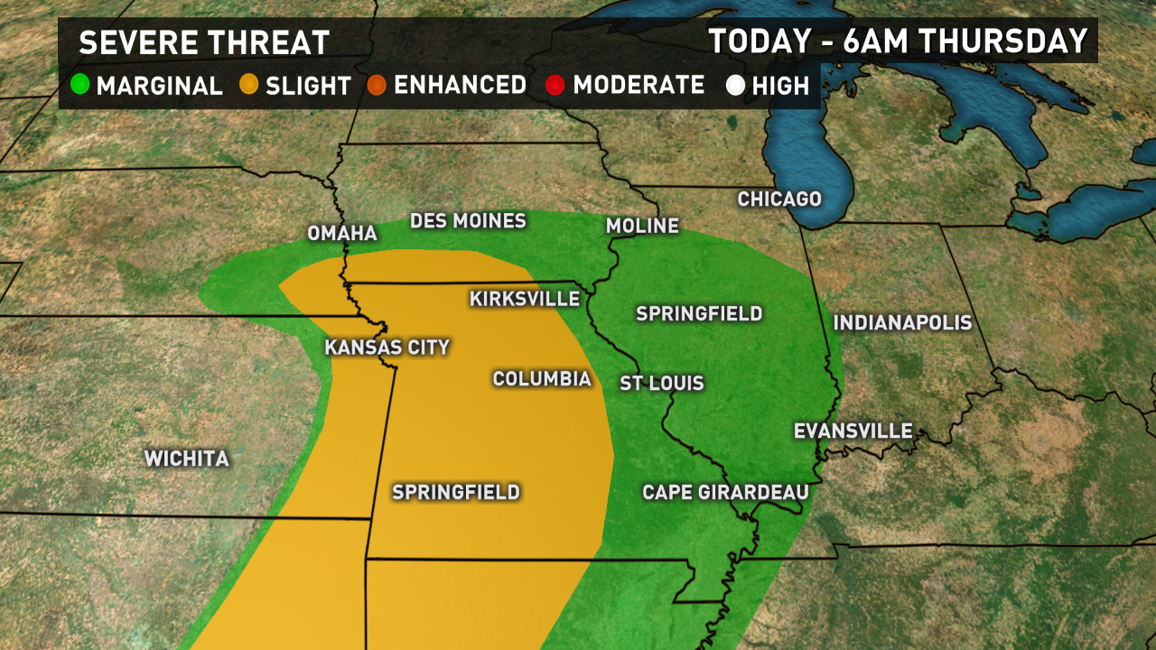
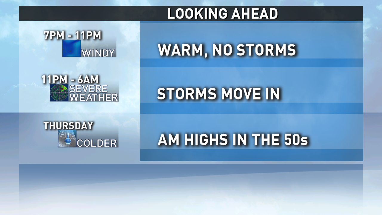
The winds of change have been blowing strong and warm these past few days and tonight they may just send us a few strong to severe thunderstorms!
Clouds and southerly winds this evening will keep temperatures in the 60s all the way to midnight but we’ll be dry most if not all the way.
After midnight things change. Showers and storms move in from the southwest and there is a chance some of those could be severe, especially between 3am and sunrise. Temperatures at sunrise will still be in the upper 50s.
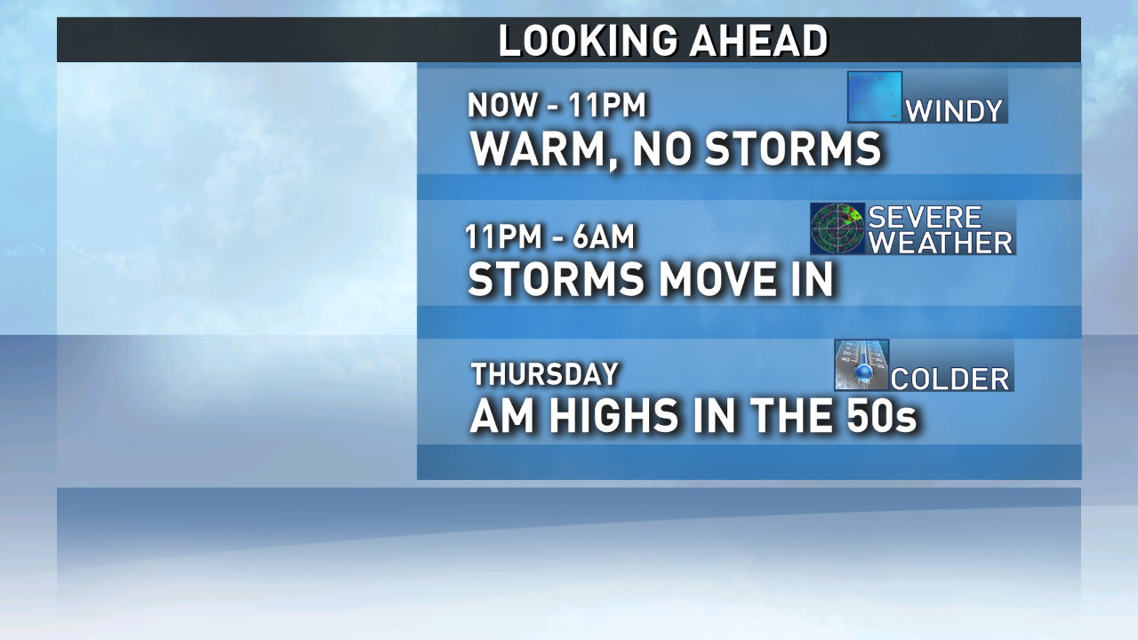
Thursday a cold front pushes through quickly in the morning and after is passes any precipitation will be spotty and in the form of showers but temperatures will plummet. We’ll likely be close to 40 by sunset and by Friday morning some areas may be cold enough for a light frost. Again.
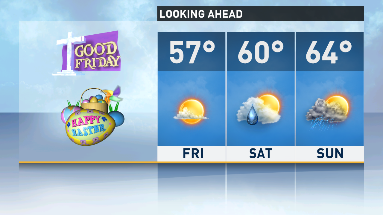
During the Day on Good Friday we’ll see plenty of sun with highs in the upper 50s.
Saturday warms nicely with increasing clouds, showers after sunset and highs in the mid 60s and Easter, well, lays a bit of an egg. Look for a good chance for showers and highs in the upper 50s.