
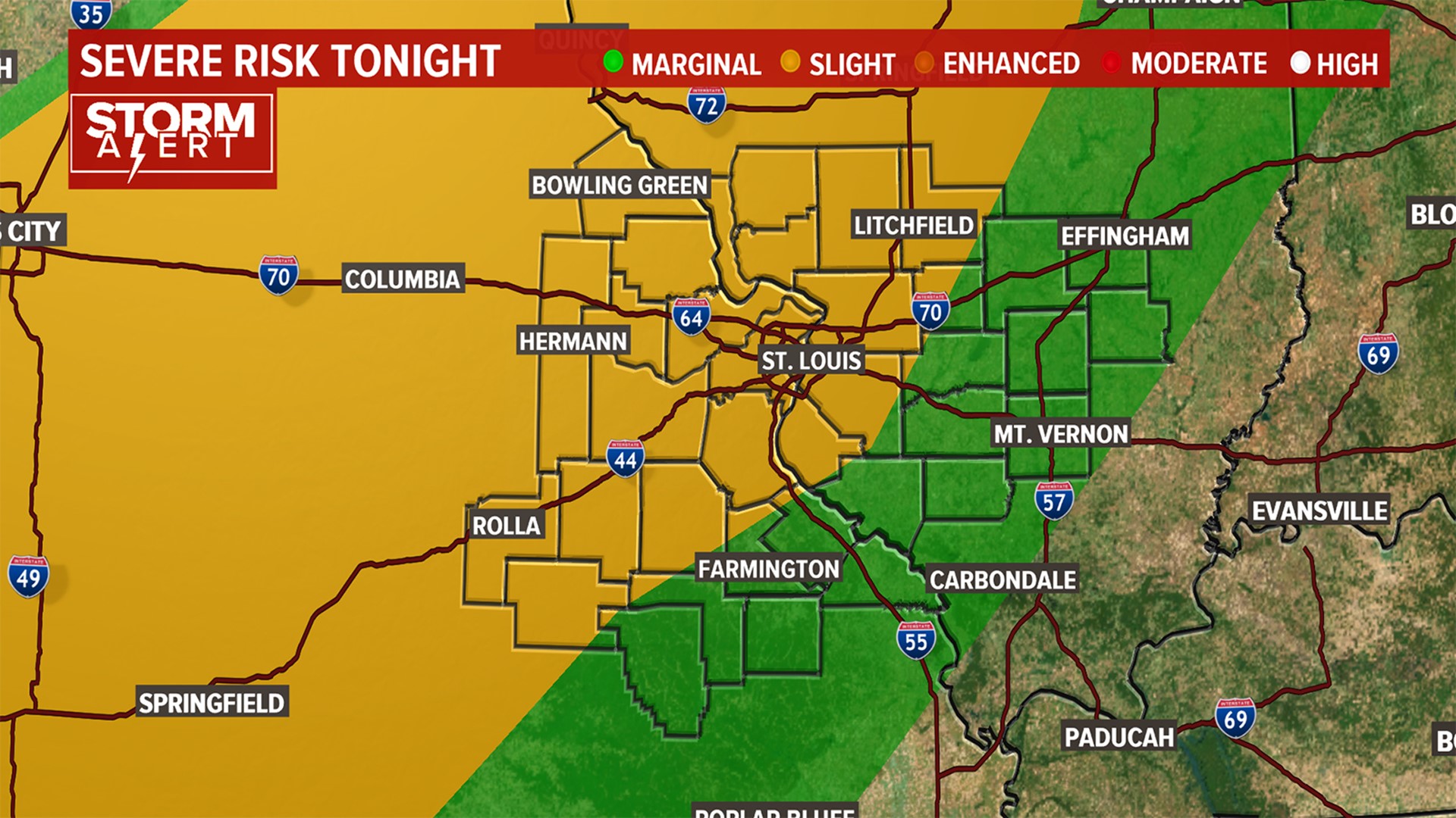
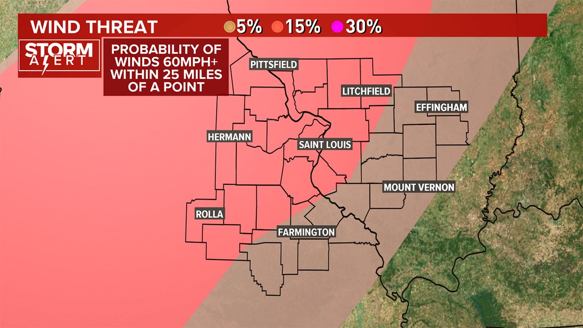
A line of strong to severe thunderstorms will race across Missouri late Wednesday night, impacting the St. Louis area after 11 p.m. There is a possibility of damaging winds and large hail as the squall line of storms moves across Missouri and into Illinois, bringing with it a cold front is coming through are area tonight.

The Storm Prediction Center reports that most of the St. Louis region is under a slight (level 2 out 5) risk for severe storms. The southern portions of the St. Louis Area have a moderate risk of severe weather, the lowest risk level. The storms will move eastward after midnight and are most likely to cross the metro between 1 a.m. and 4 a.m.

RELATED: Live interactive radar
A tornado threat appears to be low, but severe weather may wake you up overnight thanks to some high winds.
Thunderstorms and showers will be in the St. Louis area for Thursday morning, with the severe threat easing away.
A cold front will cross the St. Louis region Thursday, leading to more showers and a few thunderstorms into the afternoon, though severe weather will no longer be a threat. High temperatures will cool off into the 60s.
Friday is cloudy, with a few morning showers, and much cooler. Highs in the 50s for Friday. Warmer and dry weather is forecast for the weekend.
5 On Your Side weather app
iPhone | Google Play
5 On Your Side news app
iPhone | Google Play