GRAFTON, Ill. — The Mississippi River's newest islands have popped up near Grafton, Illinois, but their presence could pose dangers to recreational boaters soon, according to the U.S. Army Corps of Engineers.
Rising water levels may hide the ephemeral, or temporary, islands between river miles 218 and 222 underwater or cause them to be unstable, officials said. Increased river flows can also make it difficult for boaters to maneuver safely and avoid debris. Click here to monitor local river and lake water levels.
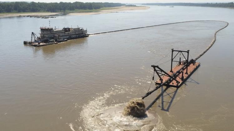
A 300-foot-long floating pipeline is helping the corps create the ephemeral islands, the corps said in a press release. The islands act like natural sandbar formations and will be used for habitat restoration to benefit a variety of fish and wildlife.
"Ephemeral islands, when exposed, provide safe feeding and resting habitat for a variety of shorebirds," a corps press release said. "If exposed for long periods during the breeding season, these sand bars may also provide nesting habitat for species like the Interior Least Tern. When these temporary islands are underwater they provide habitat for species of minnows and young fish."
Crops spokesperson George Stringham told 5 On Your Side that the practice of creating ephemeral islands in the area has been ongoing for years, and is often dependent on proper river conditions. The practice is similar, but separate, from the corps' Piasa and Eagle's Nest Island Project, which focuses on deepening side channels and creating three new islands to benefit fish and wildlife on the river.
Top St. Louis headlines
Get the latest news and details throughout the St. Louis area from 5 On Your Side broadcasts here.