ST. LOUIS — It's been an incredibly warm February so far, but it's important to remember that it can turn in an instant here. Now we are back to Winter for a few days.
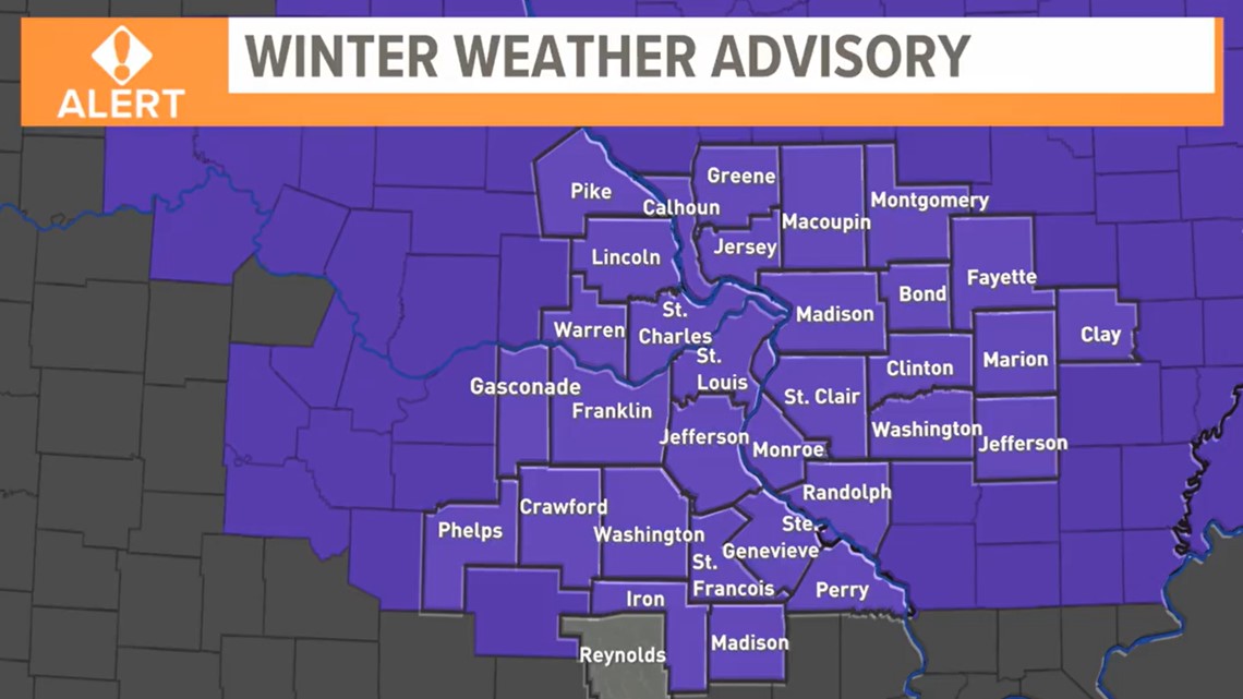
A Winter Weather Advisory is in effect!
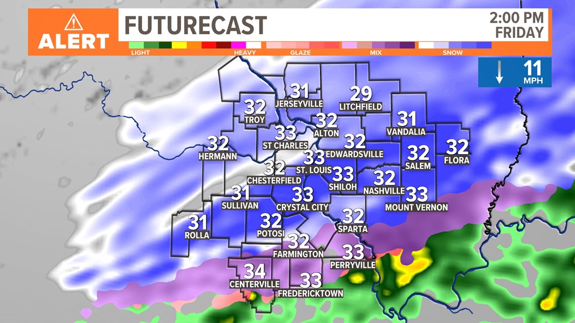
A Winter Weather Advisory is in effect for ALL areas now, except Reynolds County, Missouri. The advisory has been extended in the St. Louis metro until 6 p.m. Further north in Green County, Illinois, and Pike County, Missouri, it ends at 3 p.m. South and east of the metro some of the advisories end later this evening. A wintry mix of mostly heavy wet snow is here. Also, thunder with sleet and thunder with snow have been reported around the area. The wintry mix has changed to snow quickly and the snow is expected through most of the day ending in the St. Louis metro by 5 p.m. In the areas south and east of St. Louis, the snow ends by 6 p.m.
During a two-to-five-hour period, the snow has been locally intense at times. During this time, some roads have become snow-covered and slick. While some accumulation may occur on the main roads, the side streets have been a problem, also it's more likely to see very slick conditions on elevated surfaces where temperatures are just below freezing.
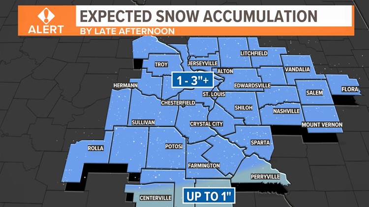
Snow and sleet are creating problems, but this is not a huge snowstorm. The ground is very warm still, but there will be a few heavier bands of snow in our area. Many areas are likely to see two to three inches of snow, perhaps locally a few spots more.

A rain, snow, and sleet mix didn't have much impact on early morning rush hour in the immediate metro area, but things have changed rapidly by the middle of the day. Some of the heavy wet snow is overcoming the warm ground temperatures, also heavier snow rates will overcome this in localized areas. Roads will become slushy and slick and elevated surfaces may be problematic.
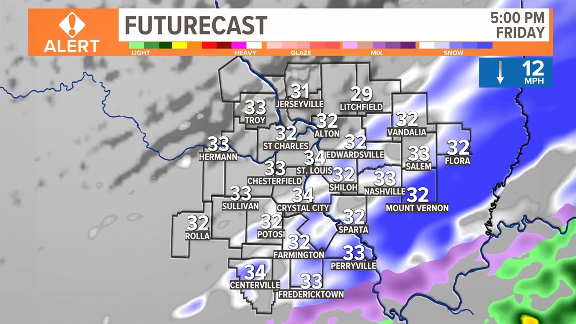
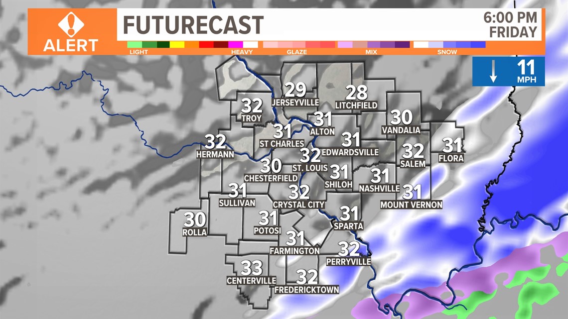
Snow ends from the northwest by late afternoon and to the southeast of the metro by 6 p.m. Temperatures have been below freezing and we get frigid overnight with lows in the teens. Any standing water and any snow will freeze over.


To recap: temperatures have fallen below freezing in most areas. With locally heavy snow bands can we expect some accumulation on the roadways. For a majority of us, wet roads that are well treated and slightly slower than normal conditions can be expected this afternoon. Better conditions are expected by early evening.

To watch 5 On Your Side broadcasts or reports 24/7, 5 On Your Side is always streaming on 5+. Download for free on Roku, Amazon Fire TV or the Apple TV App Store.