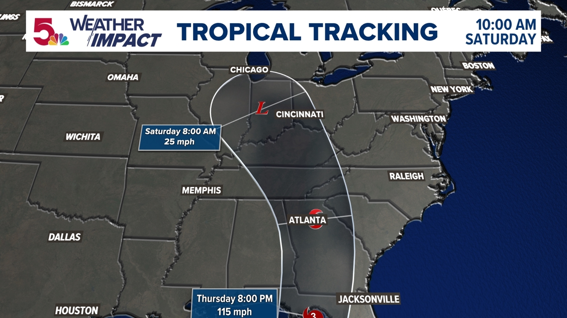
ST. LOUIS — 8:30 p.m. Friday: "Post tropical cyclone Helene" currently sits in Tennessee and has merged with another upper low that impacted our weather earlier in the week.

While we have seen a bit of a lull in the intense rain, we will still have a few periods of clouds and showers throughout the weekend.

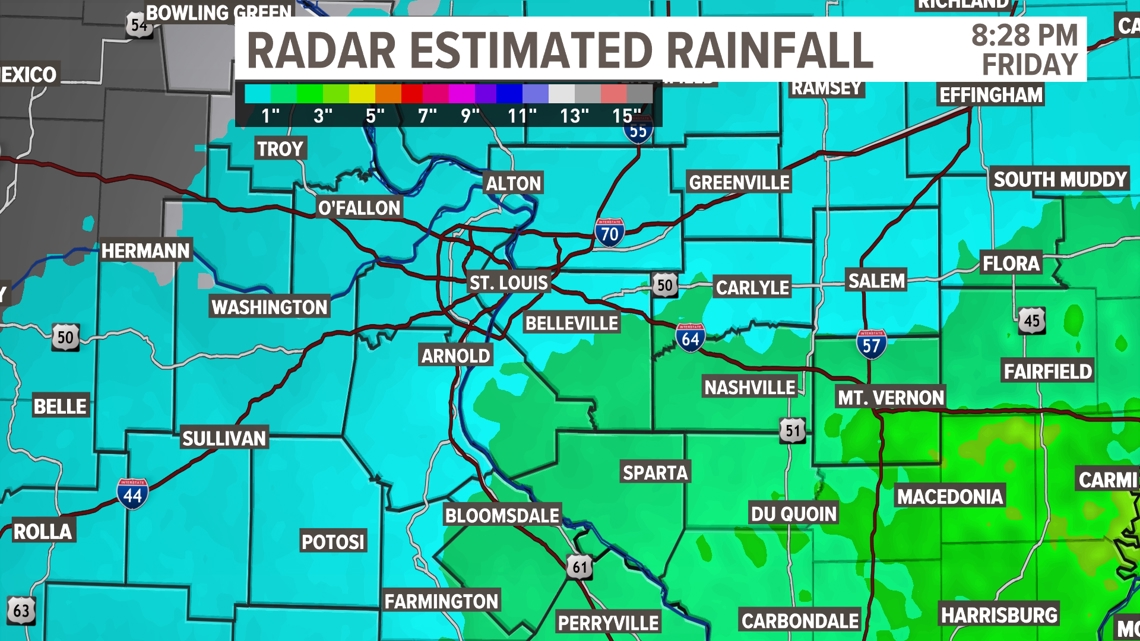
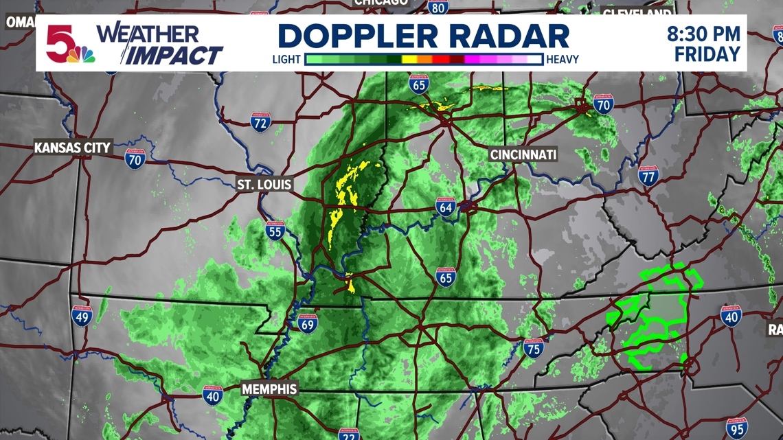
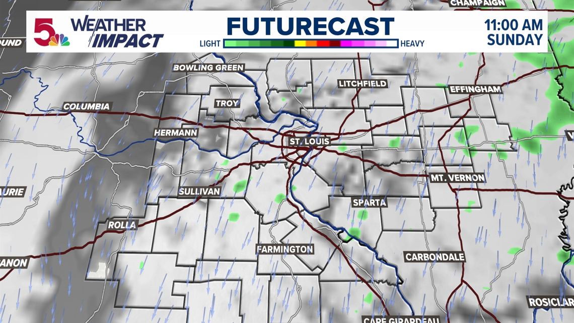
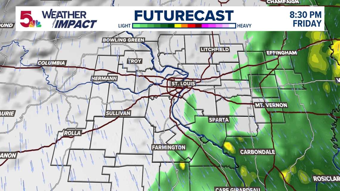
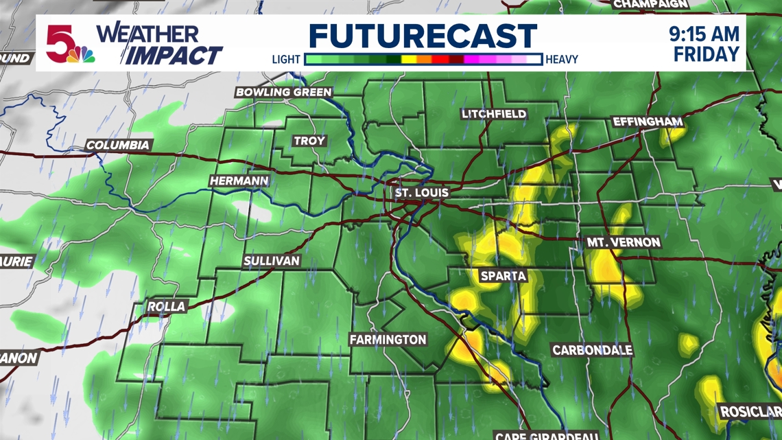
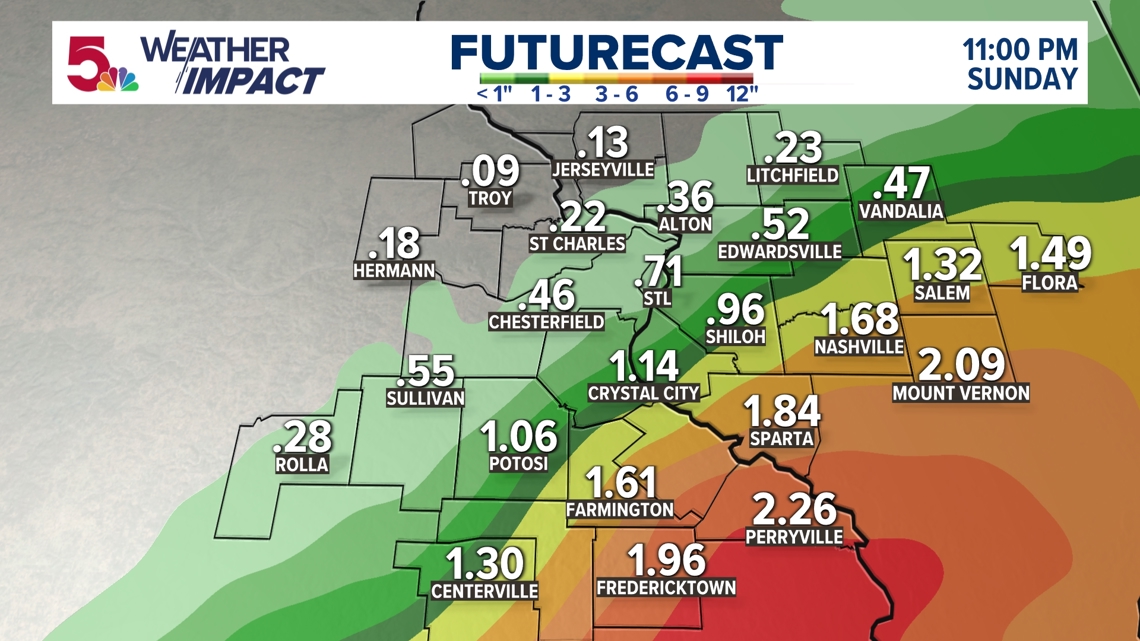
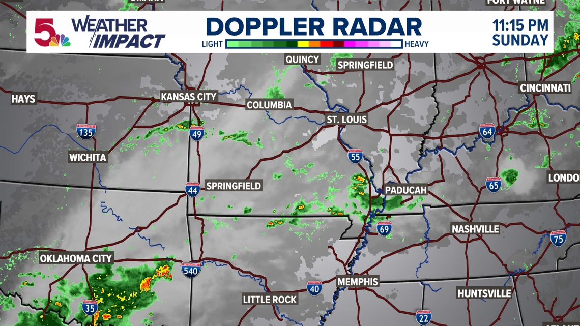
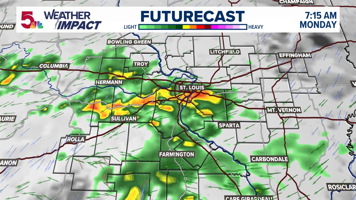
You can see where the heaviest rainfall has been. Belleville, Farmington, and Carlyle have really been the cutoff point for more steady periods of rain today.

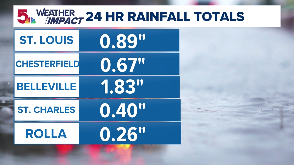
Observed rain totals have lined up pretty well with the radar estimates. Almost an inch (and maybe counting) in St. Louis, but much more to the east.

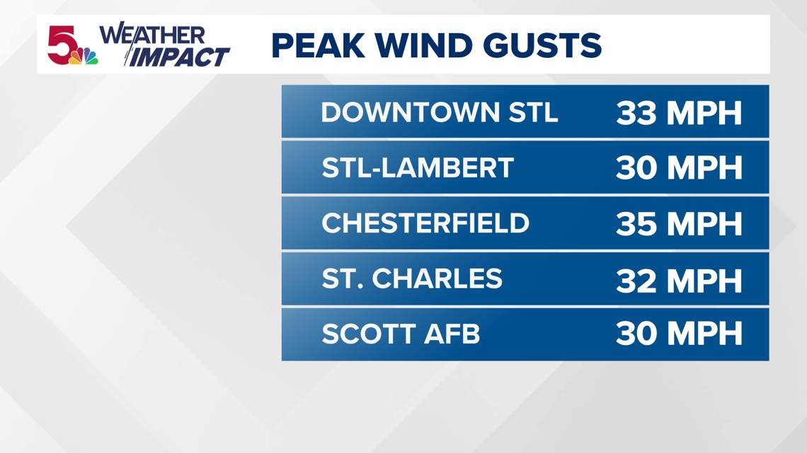
Our wind gusts have also been consistently over 30 mph throughout the day, as well.

Showers like this will be pretty common this weekend. Areas of drizzle, light rain, and cloud cover will pretty much be around for most of the weekend.

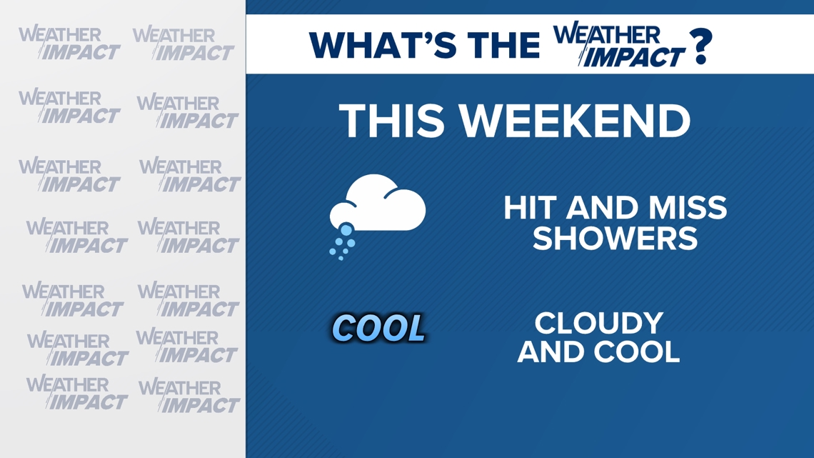
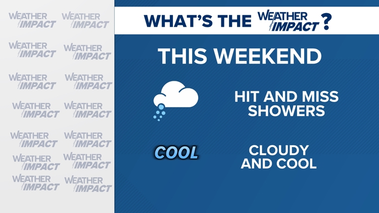
Just expect hit and miss showers this weekend. I really don't think it will impact your outdoor plans much, but rain will be with us off and on throughout the entire weekend.
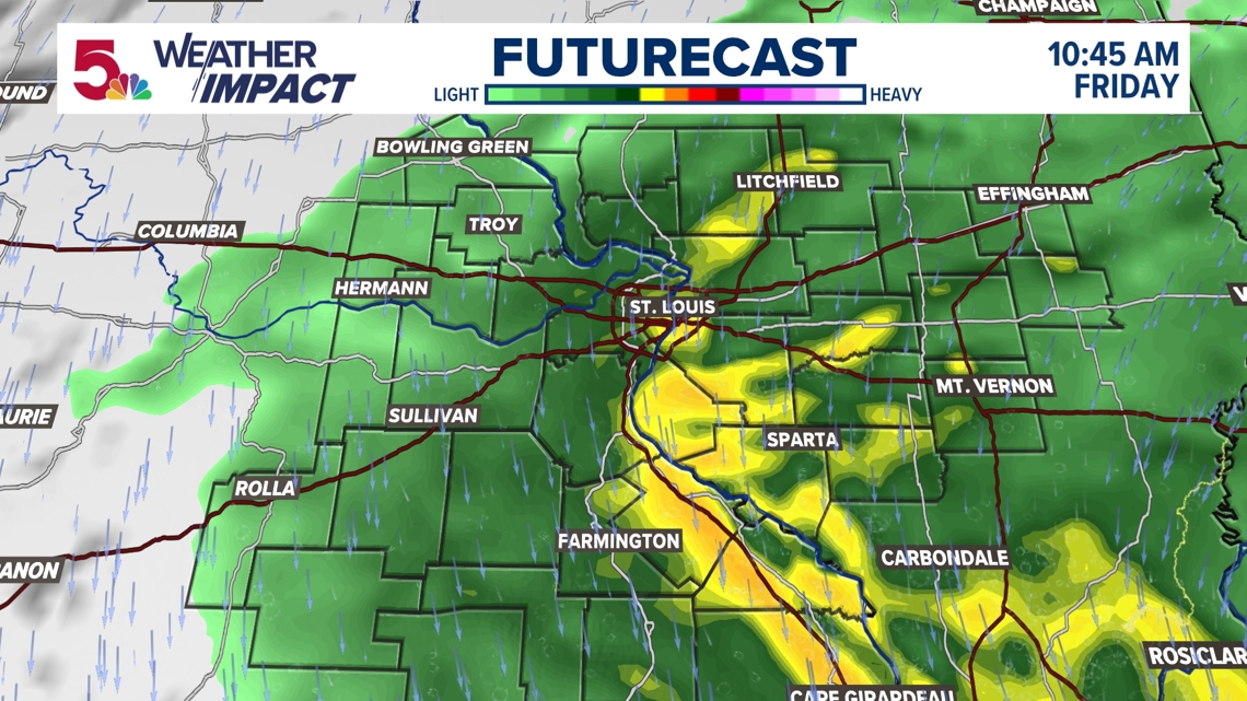
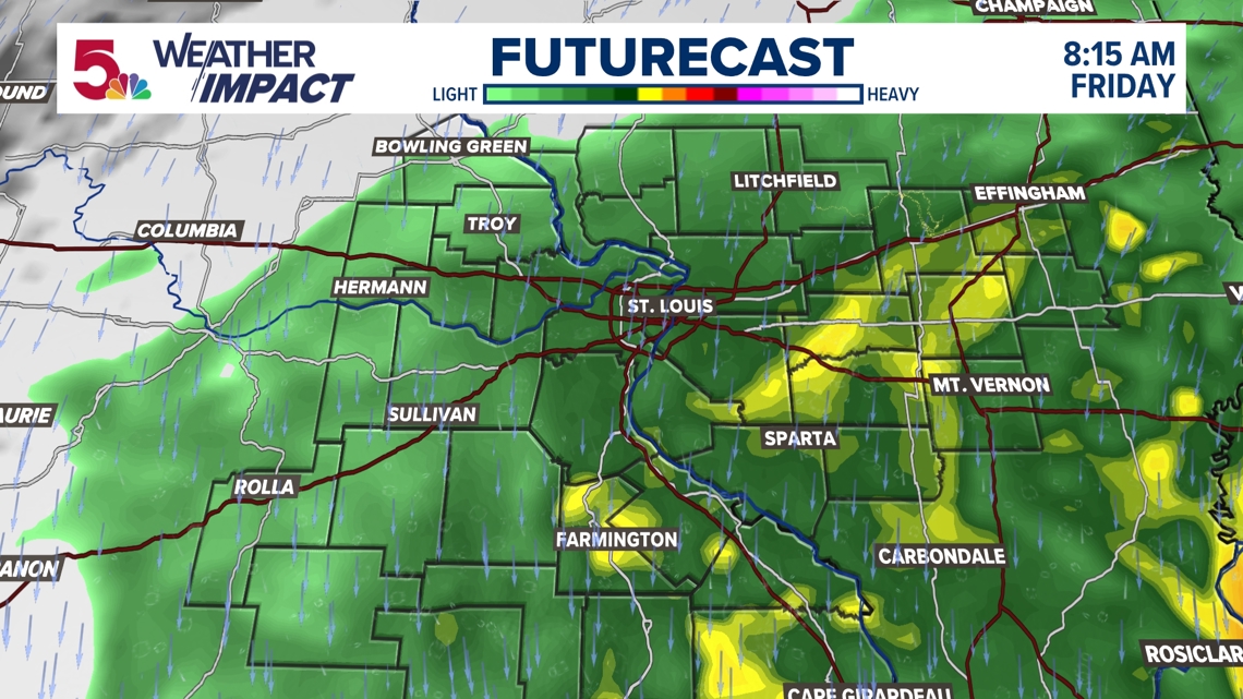
10:00 a.m. Friday: It's raining in most of the area, and it's a really gloomy fall day. A wide area of rain, as forecast, has spread throughout the entire region.

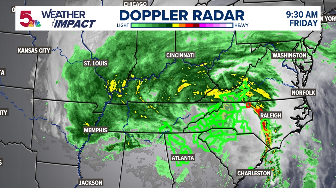
We are on the very edge of the significant rainfall. While some of us are getting quite the soaking, others are on the lighter edge of a gentle rain. This is how it will be most of the day.

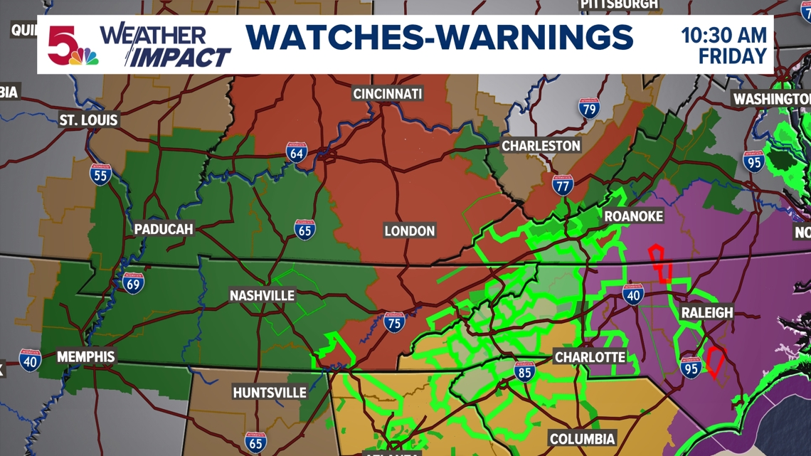
The magnitude of watches and warnings throughout the entire region is incredible. Between flood watches and warnings, tornado watches and warnings, and wind advisories, there is a lot to cover. We are on the edge of the pressure gradient, and that's why some of us in the metro east are under a wind advisory.

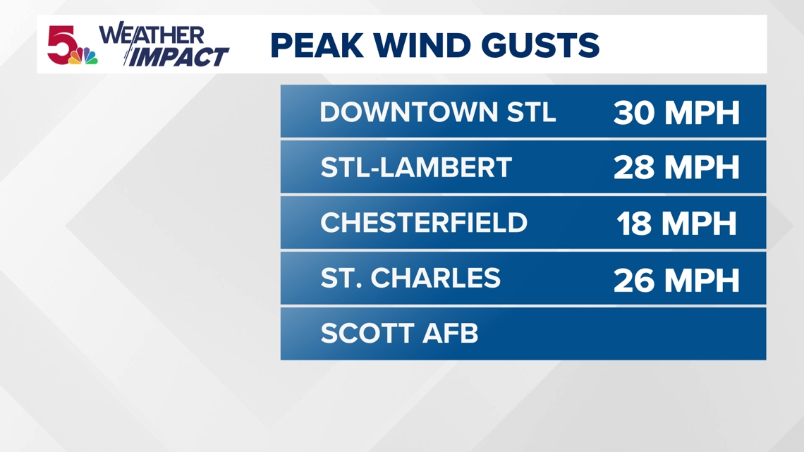
Our highest wind speeds have reached around 30 mph in the region, with numbers expected to get close to 40 mph in some areas on the Illinois side today. It's definitely a breezy one today.

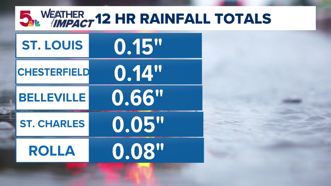
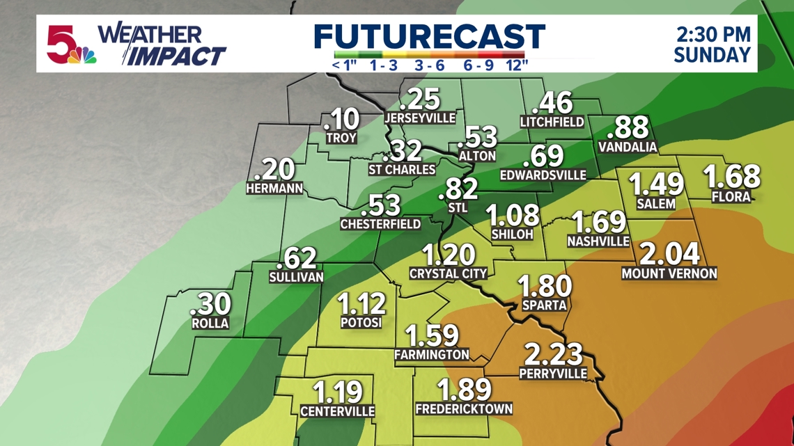
As expected, some of the higher rain totals have been further east today. Rain totals south and east will be higher.

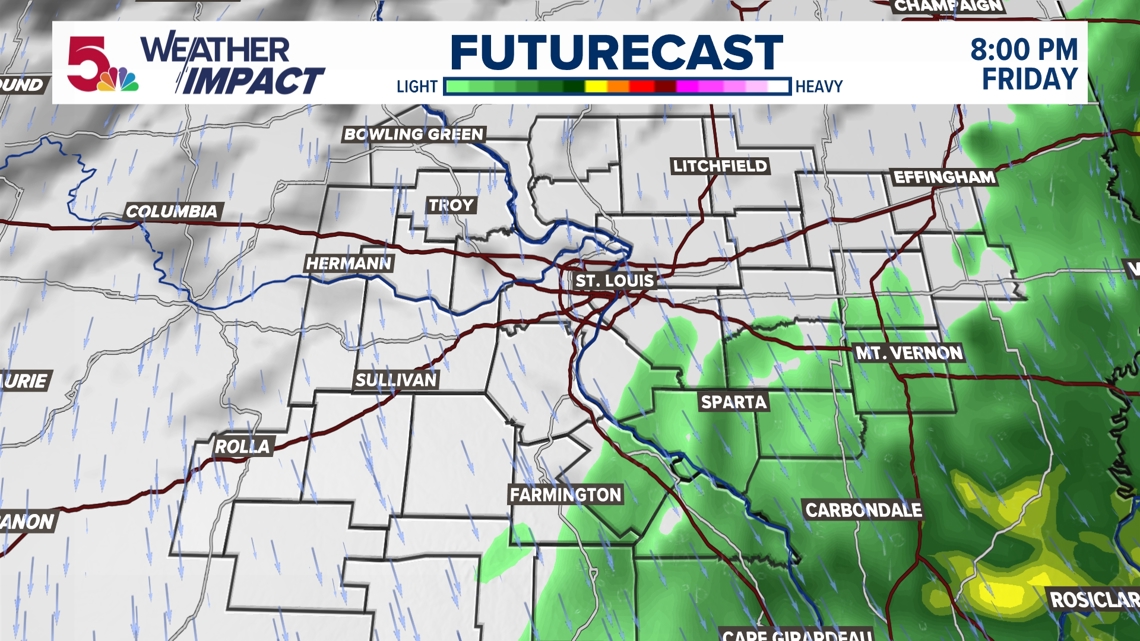
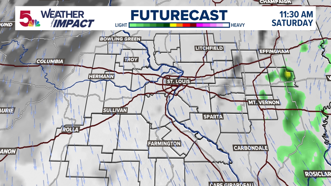
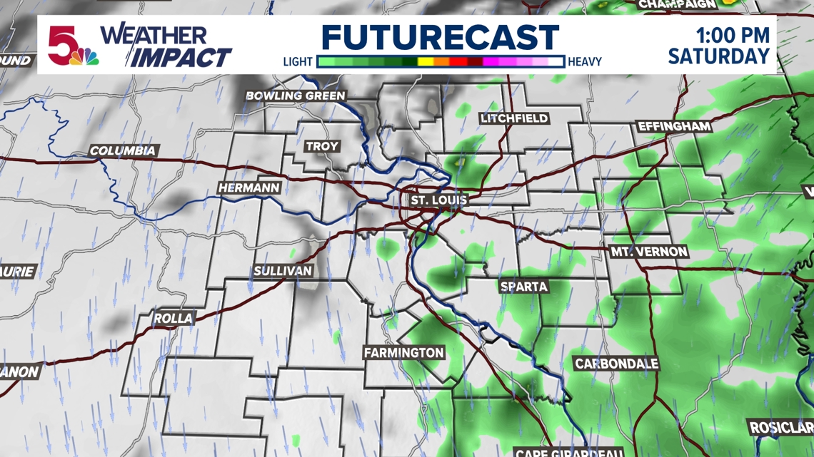
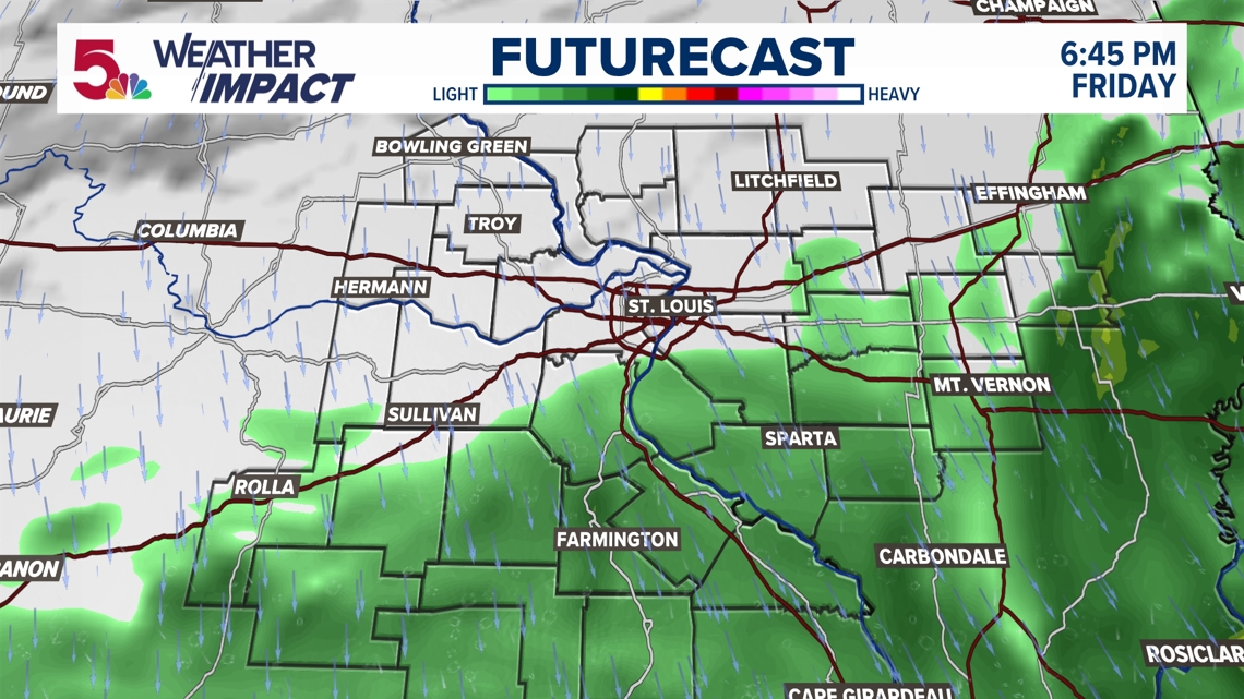
By this evening, the bulk of the rain shield is much further to the southeast. I really think the majority of the rain will be over by this point.

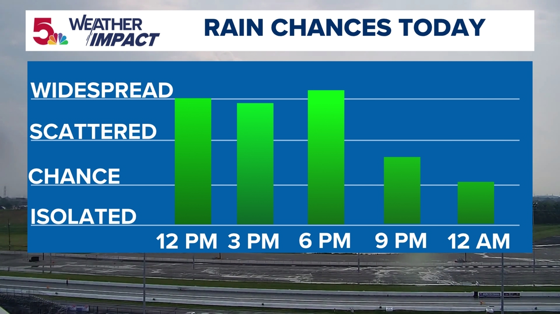
Our rain chances will really wind down the rest of the day, especially after sunset. Light showers will spin our way at times, but not much rain is expected after tonight.

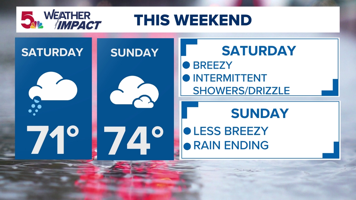
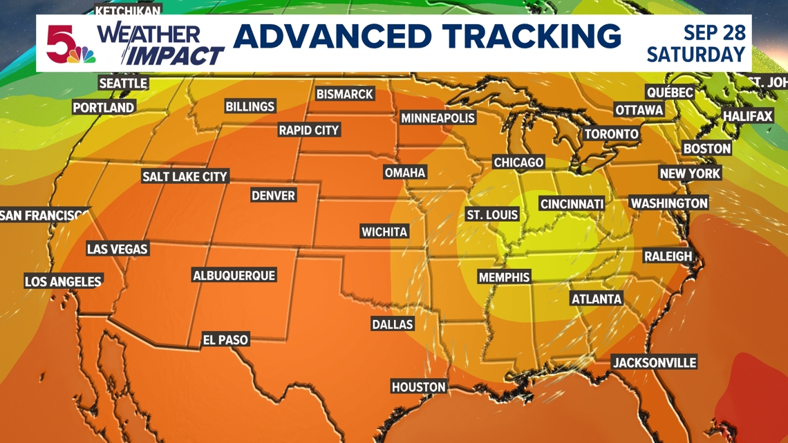
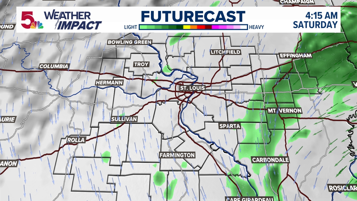
Overall, this weekend will be somewhat dreary. Light showers will be around Saturday, with pockets of heavy drizzle. But Sunday things will start to dry out, and we have less windy conditions than we have had the last 36 hours.
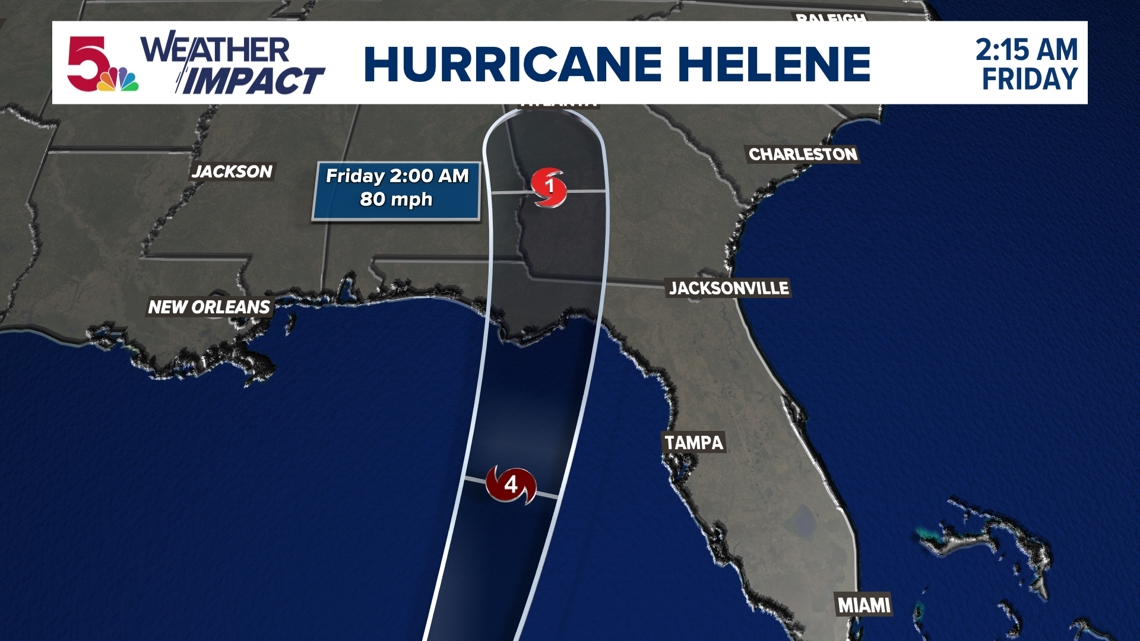
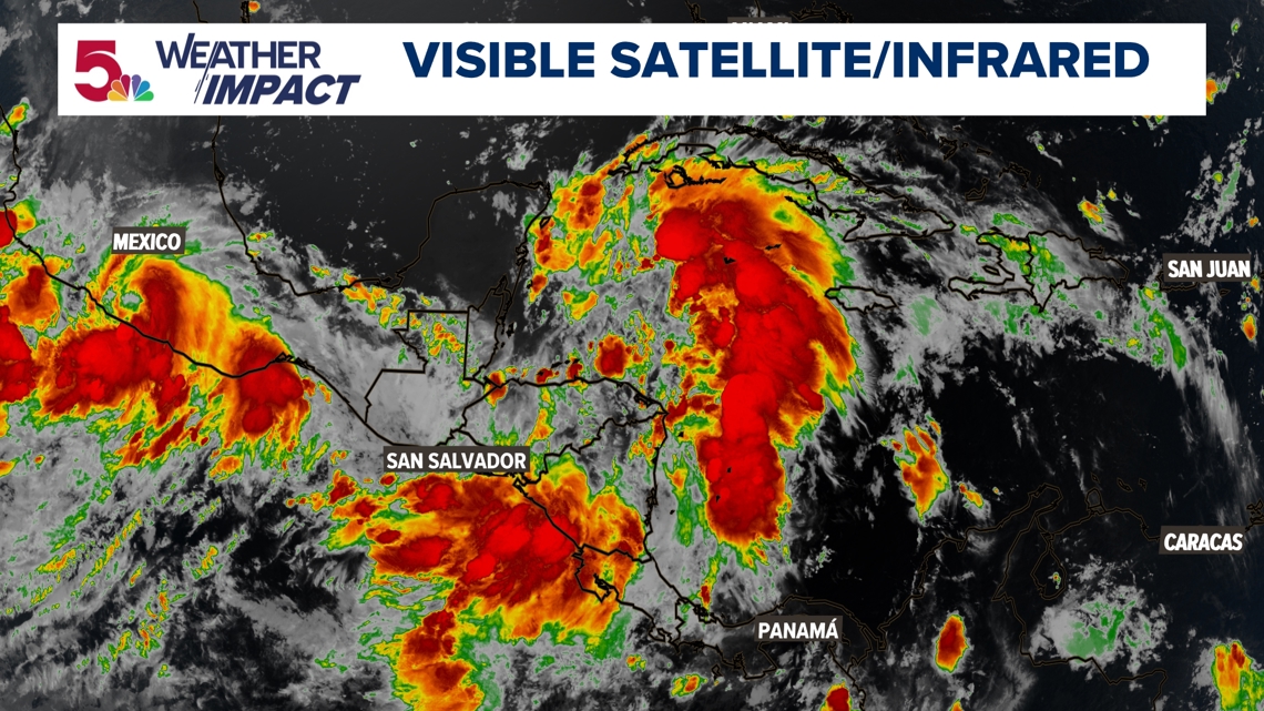
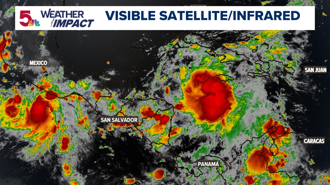
8:30 a.m. Thursday: The hurricane has continue to strengthen overnight. We are also starting to see the outer bands of rain impact Florida already. This is getting picked up as it gets closer to the radar. This will be making landfall later on tonight.

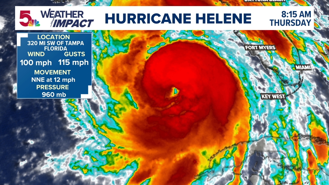
This hurricane now sits at 100 mph sustained wind, with gusts up to 115 mph. You'll notice an eye is developing as well. The next 12 hours are set for rapid intensification as it approaches land.


Unlike last night, this is now only forecast to reach category 3 status. That doesn't mean it won't have a major impact, so don't get focused too much on the lower category number, the flooding impacts and storm surge will be massive.

Rain wise for us, not a lot has changed from last night's update. The trends remain the same: more rain for us Friday....really not a lot the rest of the weekend!

In fact, Friday evening may start to dry out just a little bit from west to east. There will still be some football games and Friday night plans impacted, but there is hope we may dry out a little bit in the evening.

But Saturday and Sunday may look a lot like this: scattered showers, drizzle, and cloud cover....but not much more rain. This system is finally starting to take shape, where the combination of the tropical system and upper low remains far enough south that we don't get dragged into that much rain.

I keep showing you the same model for continuity's sake. You can see from the previous times I've showed you this particular model, our trends have gradually gone down. We are still going to get a decent soaking rain on Friday, but the rest of the days won't quite amount to much.

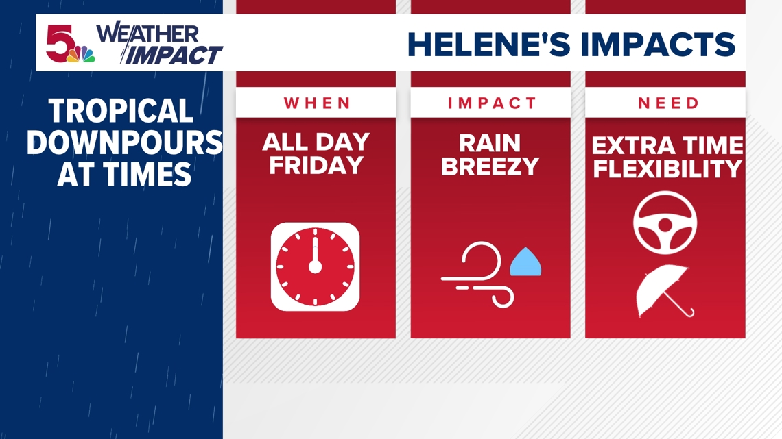
Because Friday will be the most nuisance weather day we see over the next few days, that's a Weather Impact Alert Day. It will be rainy, breezy, and just gloomy all day. Most of the day will have some sort of rain, including morning and evening commute times. While rain is heavy at times, flooding is not expected. I will keep you posted on updates to Helene the rest of the day.
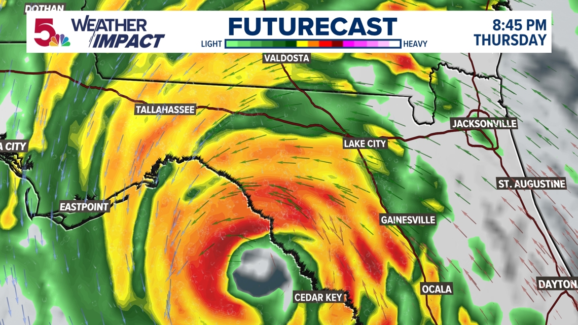
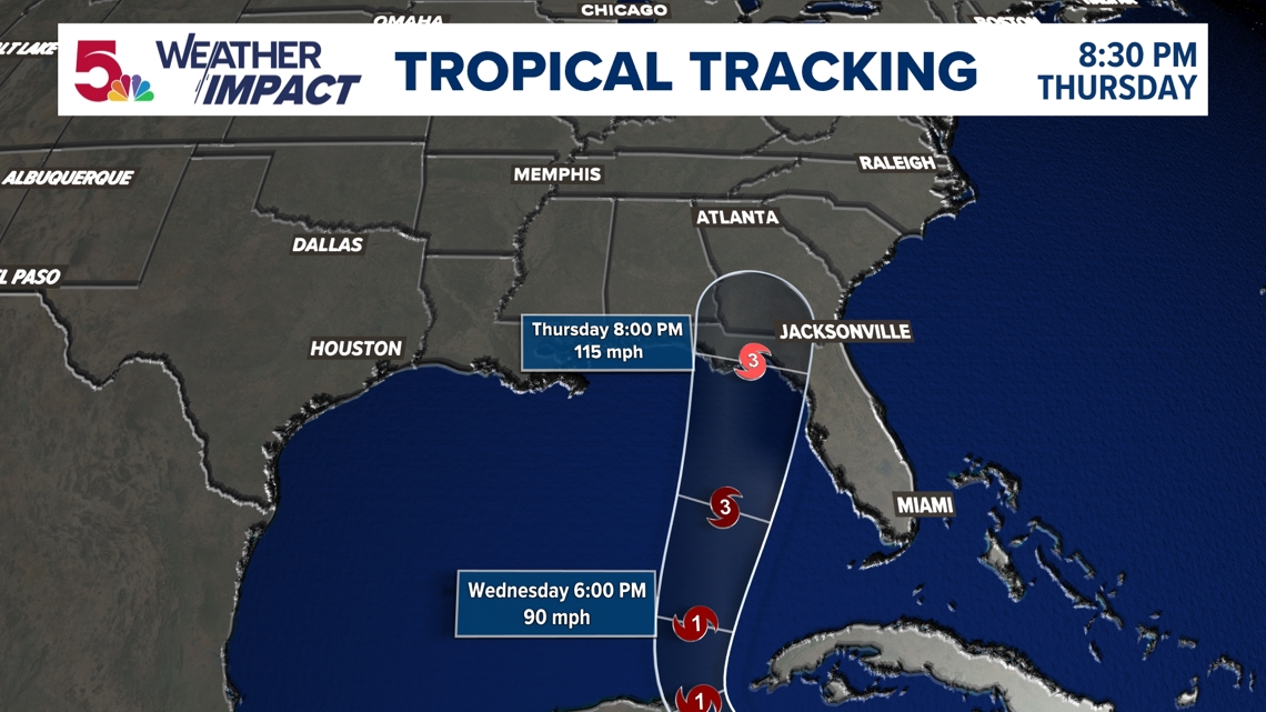
9:15 p.m. Wednesday: This thing is turning into quite the hurricane. While the wind gusts and intensity don't look like much right now in terms of intensity, this thing will have quite the different look by tomorrow morning

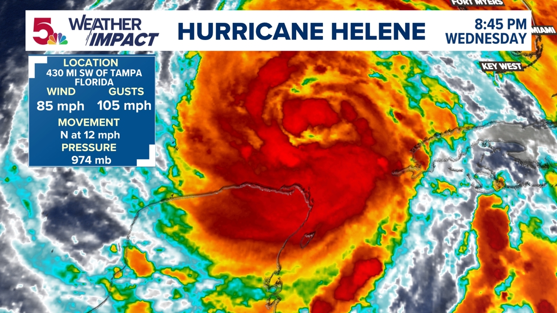
What you see around this now is continued storms forming around the eye wall as this is likely to take more of the "hurricane" shape we would expect by Thursday morning.

Because of the conditions and how it is forecast to rapidly intensify over the next 24 hours, this is now forecast to be a Category 4 storm at landfall tomorrow night.

Friday morning still looks the rainiest period of the entire weekend. As the outer bands of rain start to circle in, heavier bands remain to our southeast.

But the rest of it sort of remains in jeopardy. While we are still going to get rain in some form on Saturday and Sunday, I am not quite sure it's as widespread as it once looked. That's why I said previously this forecast is very complicated, so I didn't want you to fully expect a weekend washout.

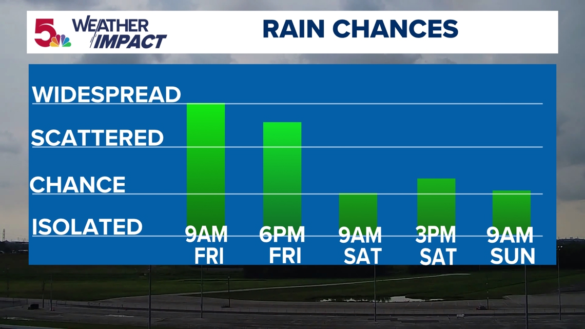
That's why I expect the weekend rain chances to be a little bit more hit and miss. Sure, the further south and east you are, the better chances you will have. But there will be plenty of breaks this weekend, with lots of cloud cover and cooler conditions.

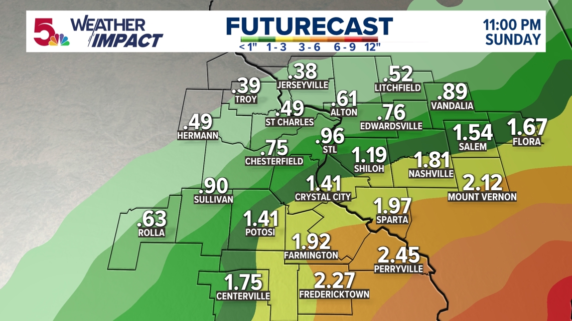
Through Sunday, not much has changed with regard to totals. Soaking to the south, much less to the northwest. We will see if the same trends continue in the morning, and have an update on the hurricane!
10:15 a.m. Wednesday: Hurricane Helene has officially formed in the gulf. After just 24 hours ago, this storm was 45 maximum sustained wind, we have gone all the way up to 80 mph sustained wind with the latest update.

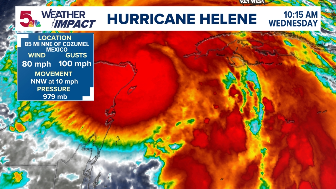
Today will be the main day for intensification as this storm moves to the NNW at around 10 mph.

While the exact track remains in question, this is expected to make landfall sometime on Thursday night, perhaps as a category 3 hurricane.

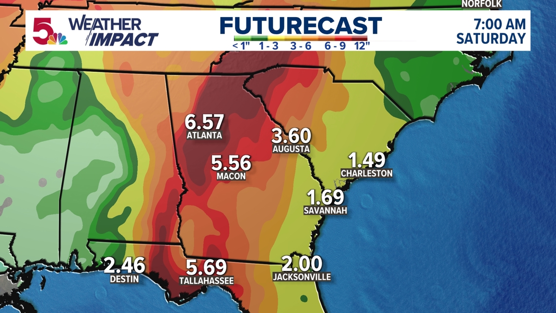
A swath of 6-10" of rain is expected to move through the Florida panhandle and up into Georgia and the Carolinas.

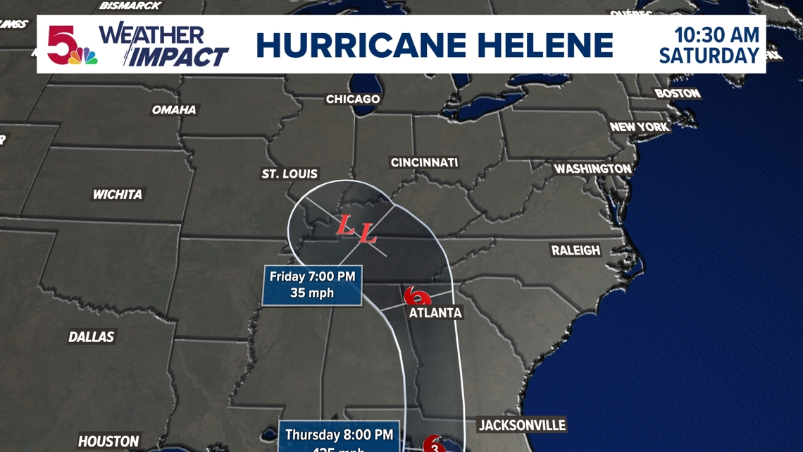
But the track for us hasn't really changed all that much. I think the core of the low pressure center remnants that once were Hurricane Helene are maybe staying a little further south than they were previously forecasted to do so. Showing you these maps with each update is one of the reasons I am writing the article like this. It shows just how much of a dynamic process some of this is when you have some of these impressive storm systems.

As it combines with that upper low that has brought cooler weather and slow moving rain the last two days (Fujiwhara efffect,) we are finally starting to see some symmetry in regards to how this will impact us this weekend.

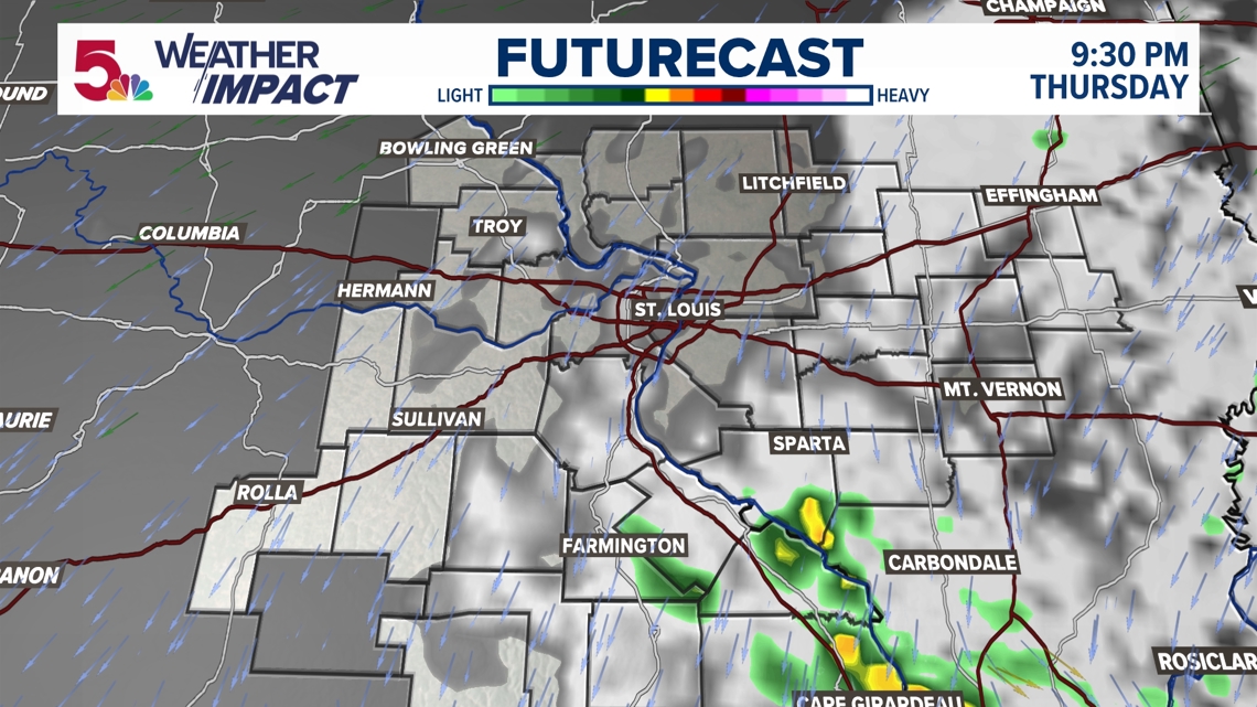
I'm not really sure we have a lot of rain on Thursday. A few showers south, perhaps, but that will be much later in the day.

But Friday morning, we will have a steady wall of rain that settles in through the area. Expect a slow Friday morning commute.

By Friday evening, some of that rain continues to slowly spin in from the east. The heaviest of rain will remain south of I-44 at this point, but there shouldn't be much lightning. Expect a soggy Friday night slate of football games.

But Saturday will be interesting. Right now, it looks like a majority of that rain is to the east. This may be a shift in some of the recent thinking, and my hunch is that will change to some degree once we see a few more model runs as this hurricane nears landfall.

While this will probably change, the gist of it will not. The heaviest of rain will be featured to the south and east of the immediate metro. There will be some impressive totals! But the further north and west you are, the likelihood you have over a half an inch of rain is very low. We will see if trends change as the afternoon updates roll in.
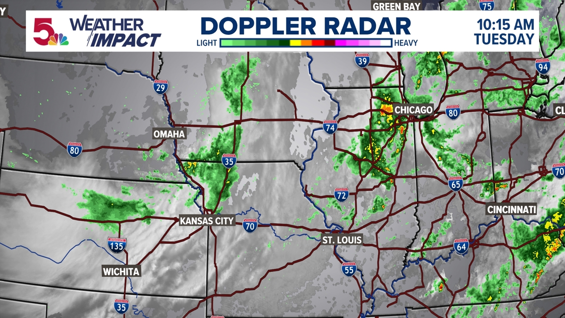
10:00 a.m. Tuesday: We are finally done with our bout of rain in the area. While it is still pretty damp, our rain is basically done for the day. Our next attention turns to the tropical system I mentioned that we are tracking this weekend.

Still, this tropical system near the gulf doesn't quite have the organization just yet that would make it photogenic for a still image. Regardless, this will go rapid intensification the next 24 hours.

Right now, this storm is forecast to go from Tropical Storm Helene, with currently puts it at 45 mph max winds...all the way to a Category 3 storm in a matter of 36 hours!

But as this system enters the contiguous United States and weakens, it will still carry a lot of moisture. That's where its impact for us is really felt as the remnants of Helene move closer to us.

But this upper low that may drag a few showers behind it this afternoon is responsible for what will cause the complicated forecast that I mentioned, this weekend. As this moves south and interacts with the remnants of Helene, there will still be many questions as to how much rain, or what will happen this weekend.

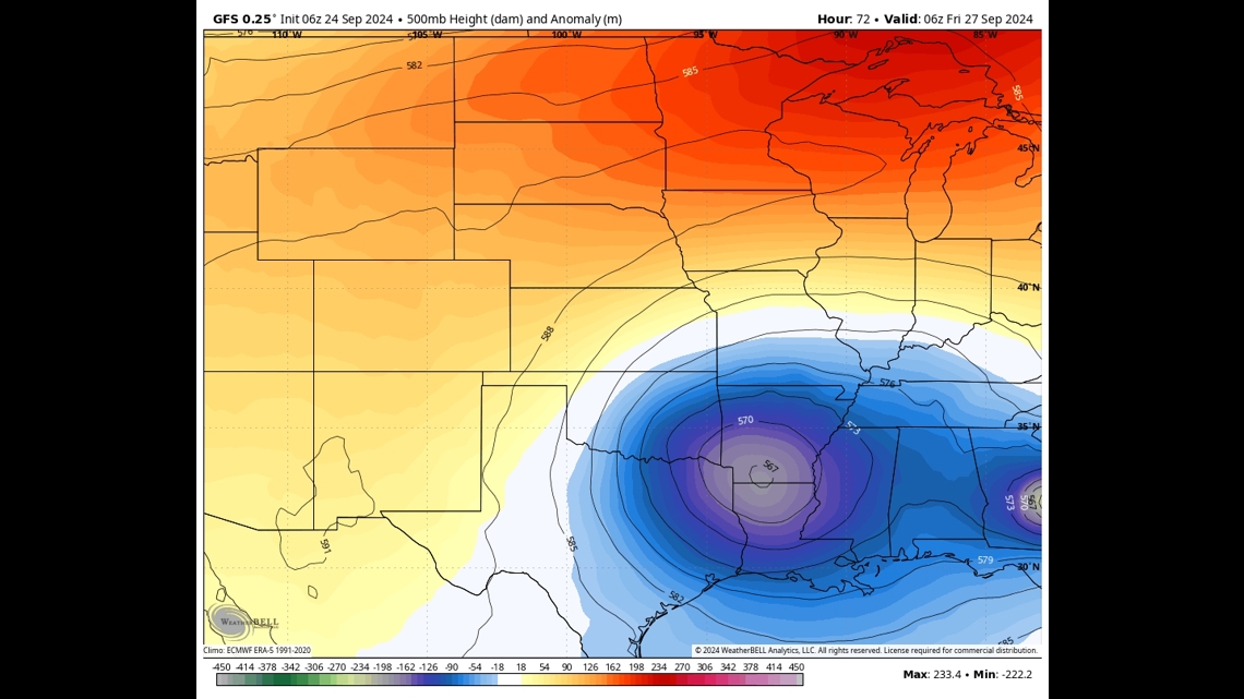

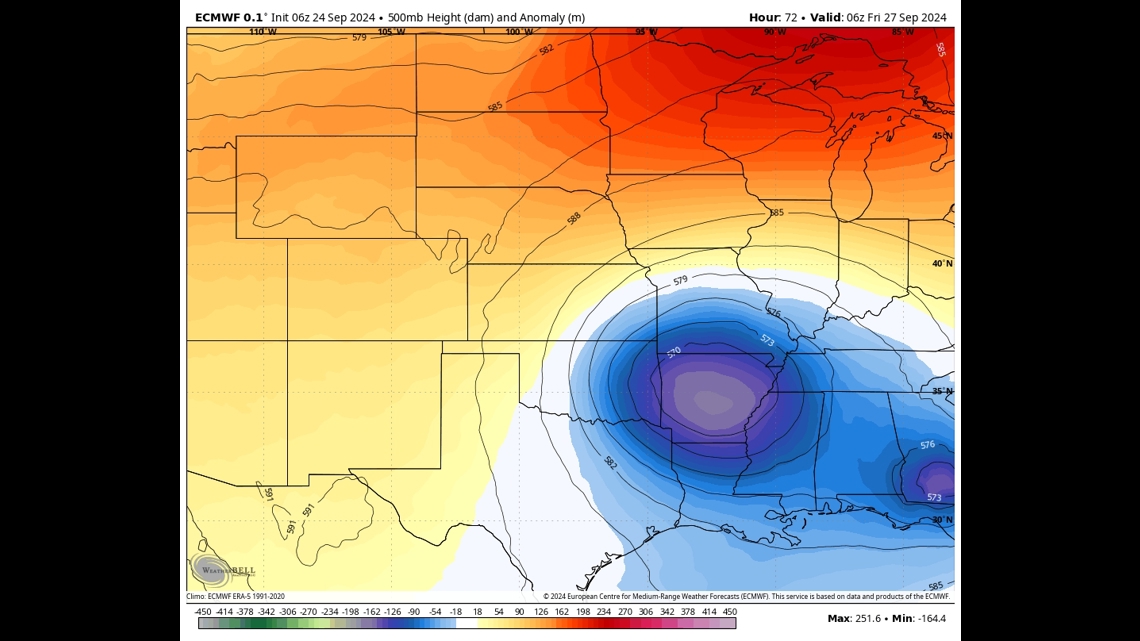

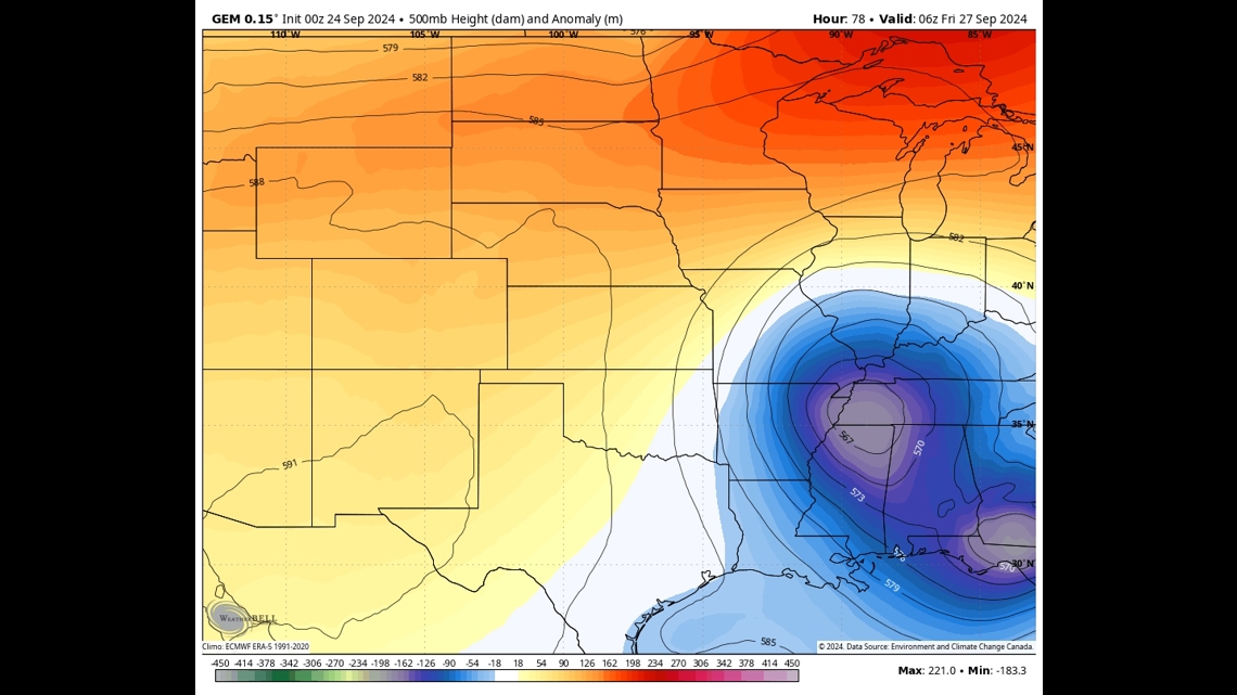
As you look at the three model solutions above, these both have the positions of these upper lows in different spots. It still remains to be seen how far south this upper low will eventually make it. That will have a big impact on how quickly we see the rain Thursday or Friday, and just how long this system sticks around into the weekend. We should still be prepared for changes to the forecast at this moment. While I am quite certain it is going to rain this weekend, the amount and consistency of the rain still remains in the air.
11:18 p.m. Sunday: I'm going to attempt to write this a little differently than some of the other articles you may see on here that I've written in the past. It may give you a little bit of an insight into how the forecast can really change over the course of a week to ten days. I'll try to update it every day in some fashion, so you can get an inside look at how this storm may affect us later in the week.

Right now, there's not much going on. We have seen beneficial rain that we haven't had in more than 50 days in this area. There will be more on Monday as this fills in along the front.

We may really start with some heavy rain in a few areas Monday morning. Pockets of heavy rain will be around through the morning and even most of the day. Expect a rainy and cooler Monday, with another soaking rain. This will not be a deep dive into Monday's rain, but we will use this storm as a guide on what may happen the rest of the week.

But the driving force behind all of this mess is an upper low that will continue to push cooler air in behind for us the next day or two. This is not very unusual in itself, what follows is rather unique.

A tropical system has been slowly churning near the Gulf of Mexico for the last few days. "Invest 97-L," as it is dubbed right now, will eventually have a name over the next few days as it meets favorable conditions. Once again, that is no surprise either. It's September. This is peak hurricane season.

But what is the most intriguing and interesting aspect to me is how they will both interact with each other. That upper low moves south and basically stalls out, aiding the tropical system moving ashore. What happens next? That still remains in question. I am not sure that modeling really may solve this until a day or two away, that's why this forecast is SO fluid and will be interesting to follow for the next few days. There's no doubt it will be cooler and cloudier, but will that be it? Or will we get a steady diet of tropical moisture, and then rain to follow?

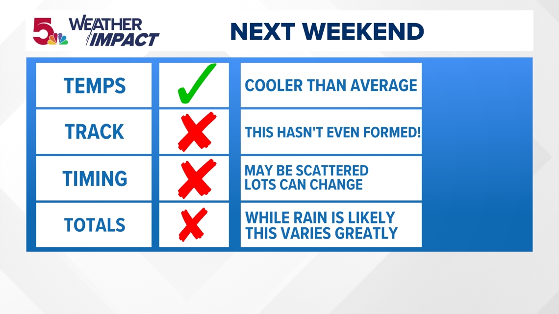
The only thing that I am really certain about is that it will be cooler than average by the end of the week. That won't take too much, but our average high around then is about 78 degrees. The track, timing, and totals....they're all up for grabs! The main thing in my mind: this storm hasn't even formed yet. Recall a recency bias story of Francine. It seemed a certainty we would get SOMETHING...then we got 0.08" of rain (or less!) This system has a long way to go. Remember, I want to keep you posted and I think this is the best way to do it as I have updates on this just about every day, sometimes more than once. It will be interesting to see how long this holds up. The even more interesting thing? If this plays out like the above model solutions? There could be even cooler air that pushes down after that. We could go from hot and dry to cool and wet for about 2 weeks straight.