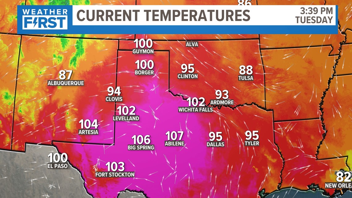
ST. LOUIS — We have avoided temperatures like those below so far this year, but as we get closer to July, we're going to see our hottest stretch of the year so far.
But it's not just this heat we're watching closely over the weekend, it's the severe weather potential as well.
An abnormally strong center of high pressure is centering over the panhandle region of Texas and Oklahoma. As this gets closer to us, we'll of course get much hotter over the next few days.
Download the free 5 On Your Side app to get the latest watches and warnings and track conditions live with our interactive radar. Use the links below to download now.
5 On Your Side news app
iPhone | Google Play

But it's going to essentially block any major storm systems to give us rain chances, with one exception.

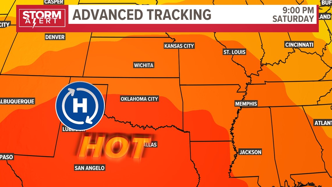
The one storm that will develop and ride the edge of this strong ridge of high pressure is going to have lots of heat and humidity to work with.
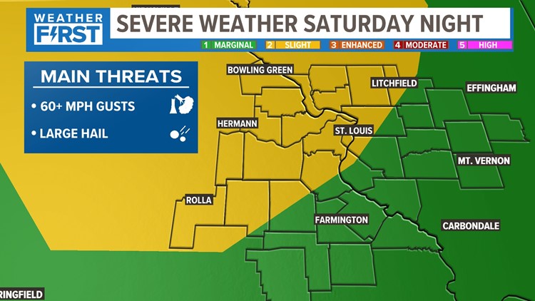
That's why the Storm Prediction Center has already issued a Slight risk of severe weather for Saturday into early Sunday.
This has been expanded to include more of our area as the timing has sped up just a little bit


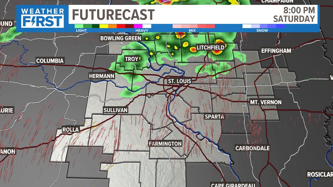
Our first round of storms could start to roll in from the northwest as early as sunset, but more areas will still remain dry by this time.

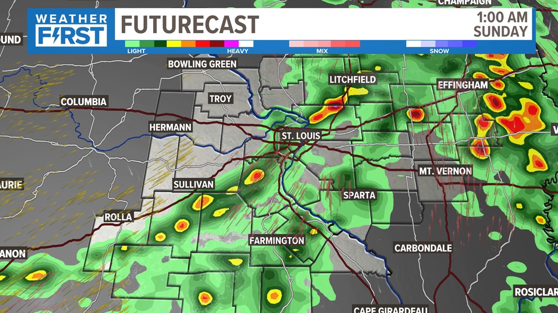
The line continues to spread overnight and gives more areas an opportunity for rain. As with the past few storms, some areas will get a brief burst of rain, but others will not quite get the "drought-busting" rainfall that we are in need of.

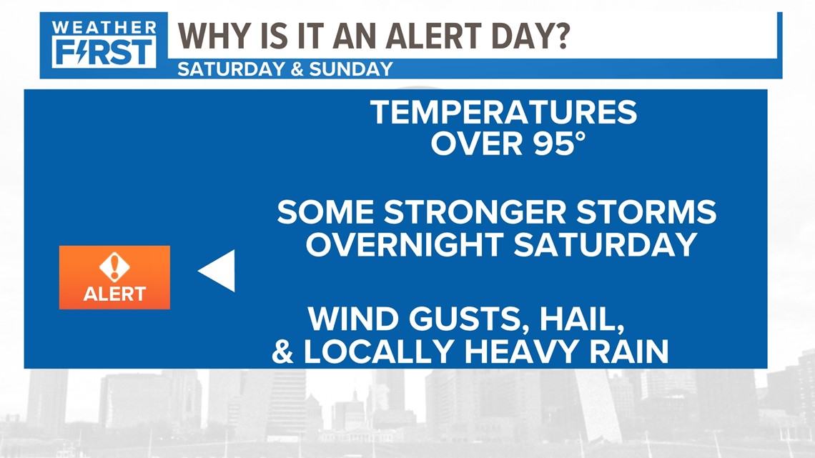
Both days this weekend will be Weather Alert Days. Wind gusts and large hail will be the primary severe weather threats. Otherwise, we have to deal with the dangerous heat all day as well.

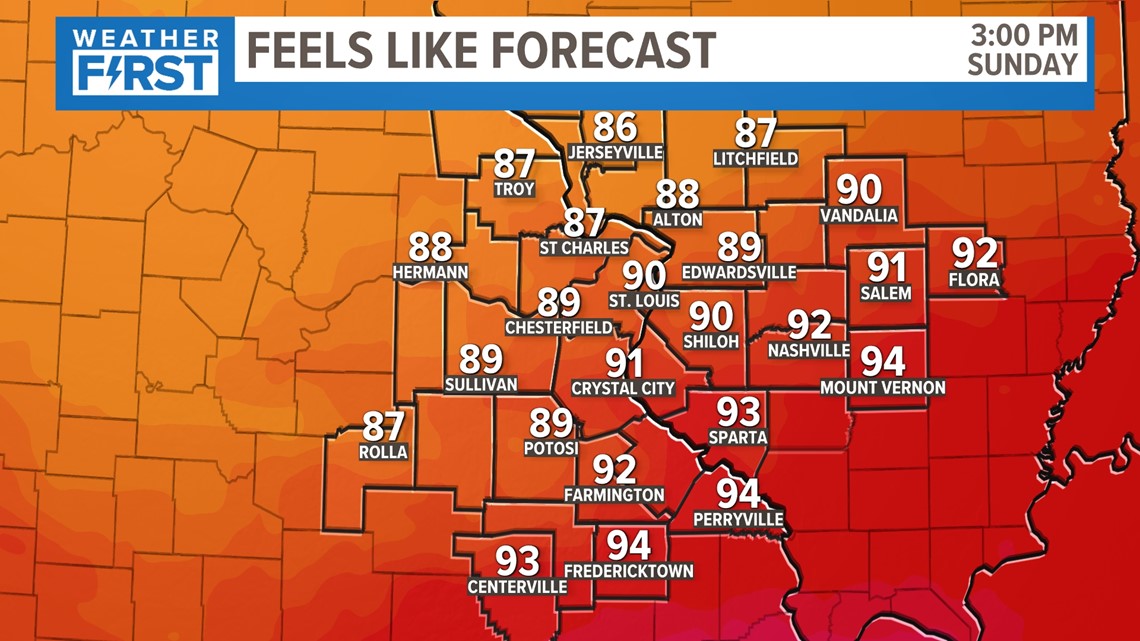
One of the positives of the faster timing of this storm, the humidity this system carries with it will be gone by Sunday afternoon. That keeps us from the 100+ degree heat index.
Stay with the Weather First team for updates on this throughout the week. Click here for the latest forecast.

