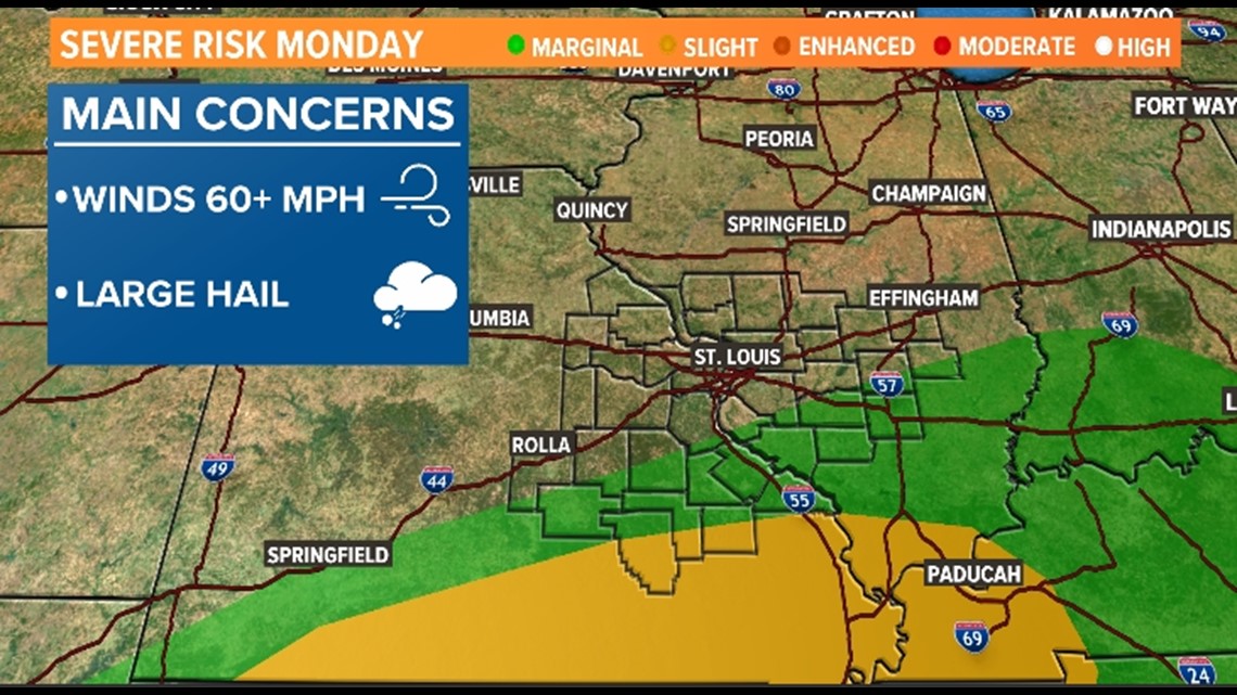
ST. LOUIS — A cold front pushed through our area early Monday morning and brought some thunderstorms to our area and even some small hail. Through much of the day, it's just rain with a few claps of thunder for the immediate St. Louis metro area.
Farther south, the risk for severe weather will remain through the evening hours. The main concerns with that round of storms will be gusty, damaging winds and large hail in excess of 1 inch in diameter. Monday night, the area should dry out and the risk for severe weather will clear away.


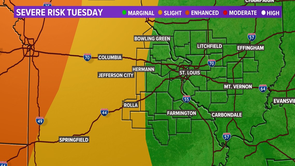
Tuesday, there is a 20-30% chance of storms so most of the area will get through the day dry, but the storms that do form could produce gusty winds and small hail. The worst of the weather will stay across parts of Kansas, western Missouri and Oklahoma on Tuesday.


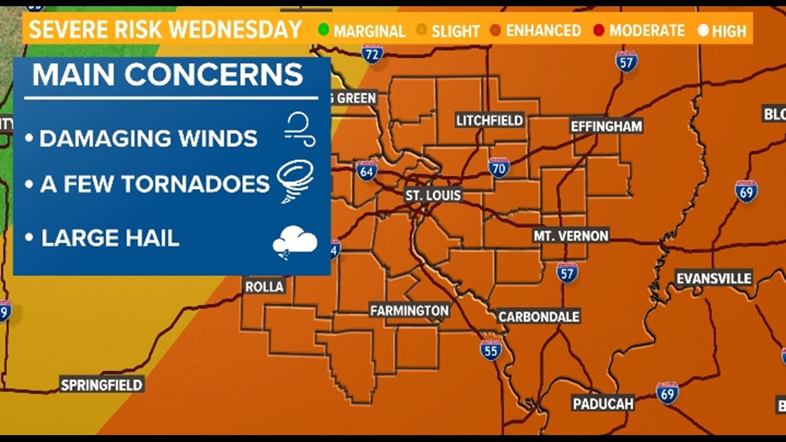
Wednesday will be the best chance for seeing severe weather.
Most of the area is in orange or enhanced area for severe weather. This means more numerous severe thunderstorms are likely for all of us. There will be plenty of fuel for the storms Wednesday, and fuel could mean some big time thunderstorms with the potential of damaging winds, large hail and even a few tornadoes. The timing of the worst weather that day will come in the early afternoon and evening hours.


Ahead of this week's severe weather, make sure to have multiple ways to get weather alerts and have a designated "safe place" in the event of a tornado.
Download the free 5 On Your Side app to get the latest watches and warnings and track conditions live with our interactive radar. Use the links below to download now.
5 On Your Side news app
iPhone | Google Play
Want more breaking news delivered straight to your inbox? Sign up for our 5 On Your Side Breaking News newsletter.


