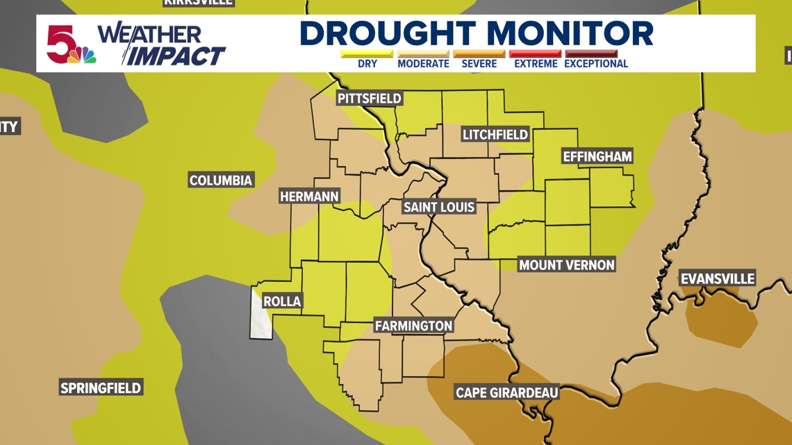
ST. LOUIS — We have started off the first 12 days in September without any rainfall. It's very dry around the area, and some of our area has slipped into a moderate drought, as a result. Just as expected, so far we have only had .08" of rain at St. Louis Lambert International on Friday the 13th.

A strong area of high pressure has been responsible for our dry weather most of this week. Our temperatures topped out at 90 on Wednesday in St. Louis with comfortable humidity levels.
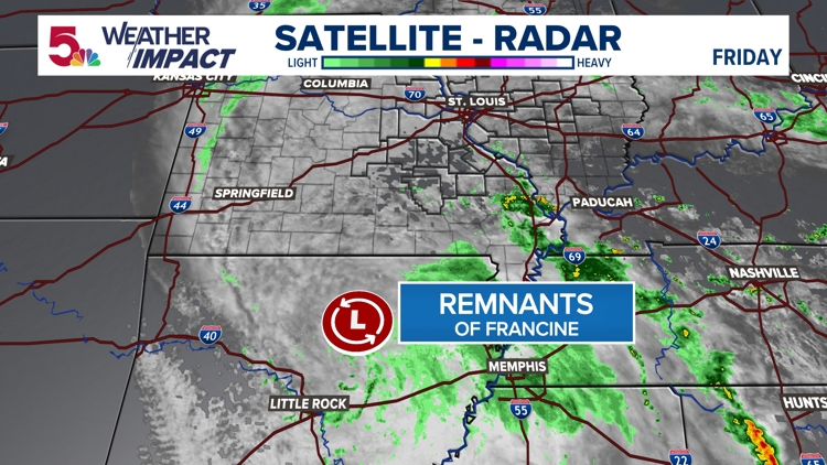
Our only chance for rain, as we continue into the weekend, will come from what is left of Francine. Francine moved over the Louisiana coast late Wednesday afternoon. It strengthened to a category 2 hurricane with sustained winds of 100 m.p.h. and gusts to 120 mph. The storm continues weakening and will dissipate over Arkansas. High pressure over the Northeast will continue to block any eastward movement of the remnants of Francine. We are not expecting any flooding issues or severe thunderstorms. That said, spotty showers and thunderstorms are possible Saturday and Sunday afternoon or evening for some areas, especially south.

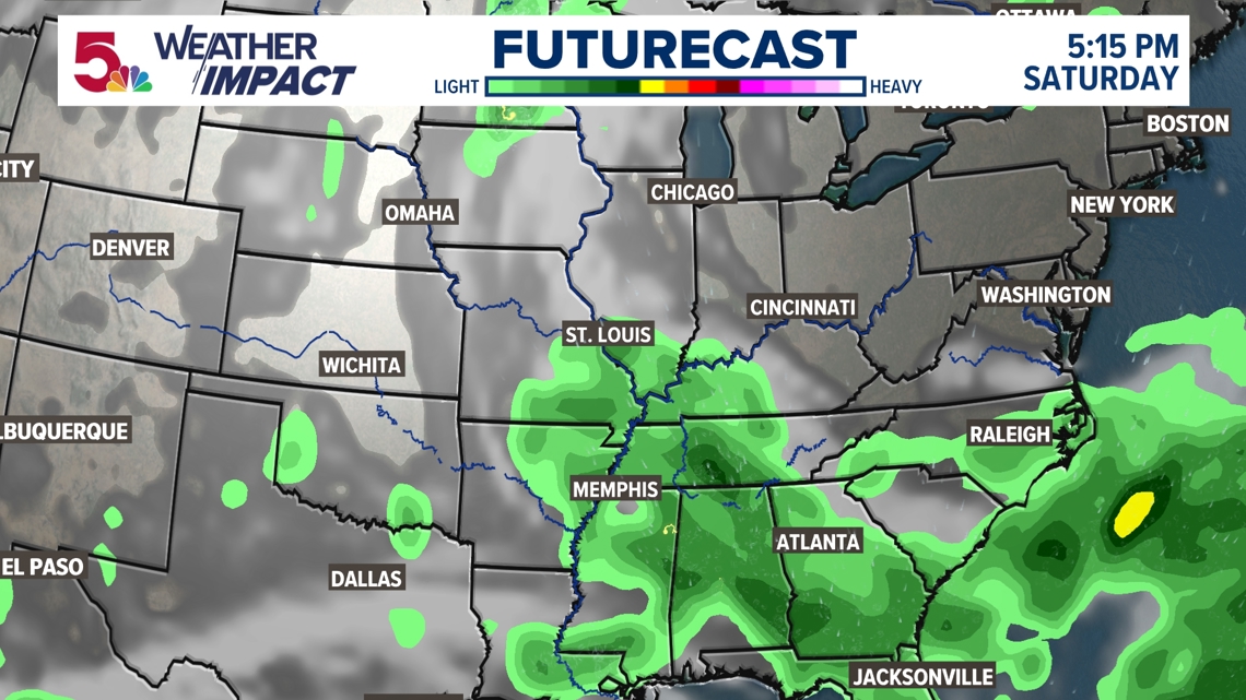
Given the ongoing dry conditions, any rain is welcomed. The best chances of beneficial and substantial rain will stay to the south and southeast of the metro area.

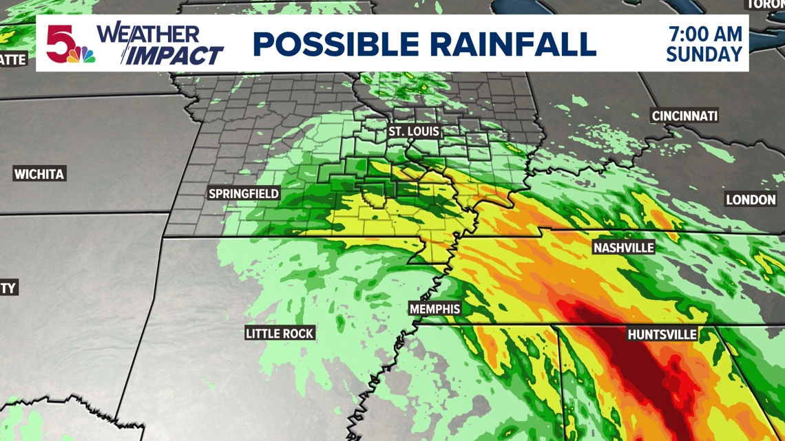
Rain totals by late Sunday, will be higher south and southeast. Most of the area around the metro may only see .25". Right now, it looks like the further northwest you are, the more likely you are to get less rain, with heavier totals well south.