ST. LOUIS — Meteorological summer is underway and it feels like it.
High temperatures Tuesday afternoon soared to near 90°. Humidity levels will continue to increase as south to southwest winds pump in the moisture.
The combination of heat and humidity will create heat indices of 95 to 100° during the afternoon hours Wednesday, which is the highest we have seen since last summer.
Download the free 5 On Your Side app to get the latest watches and warnings and track conditions live with our interactive radar. Use the links below to download now.
5 On Your Side news app
iPhone | Google Play

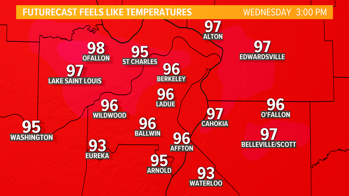
Remember to stay hydrated and out of the sun when possible. Our bodies are not acclimated to the hot, humid weather yet. Taking frequent breaks from intense activity and drinking plenty of water are recommended.
By later Wednesday, a cold front will be pushing into northern Missouri and west-central portions of Illinois.
Thunderstorms are expected to develop along the front. Given the hot and humid conditions, some of the thunderstorms could be intense if not severe.

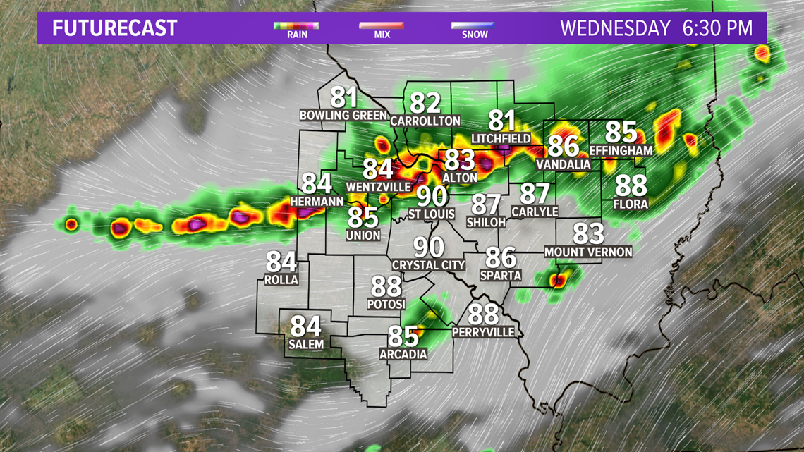
The main severe weather threats are gusty winds and large hail. The storms also could contain frequent cloud-to-ground lightning and downpours.

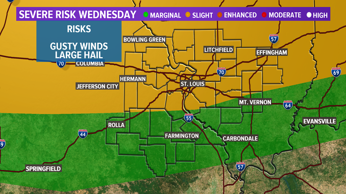
By later Wednesday evening and overnight, any remaining showers and storms are expected to be much more scattered and not nearly as intense.
LATEST HIGH RESOLUTION FUTURECAST: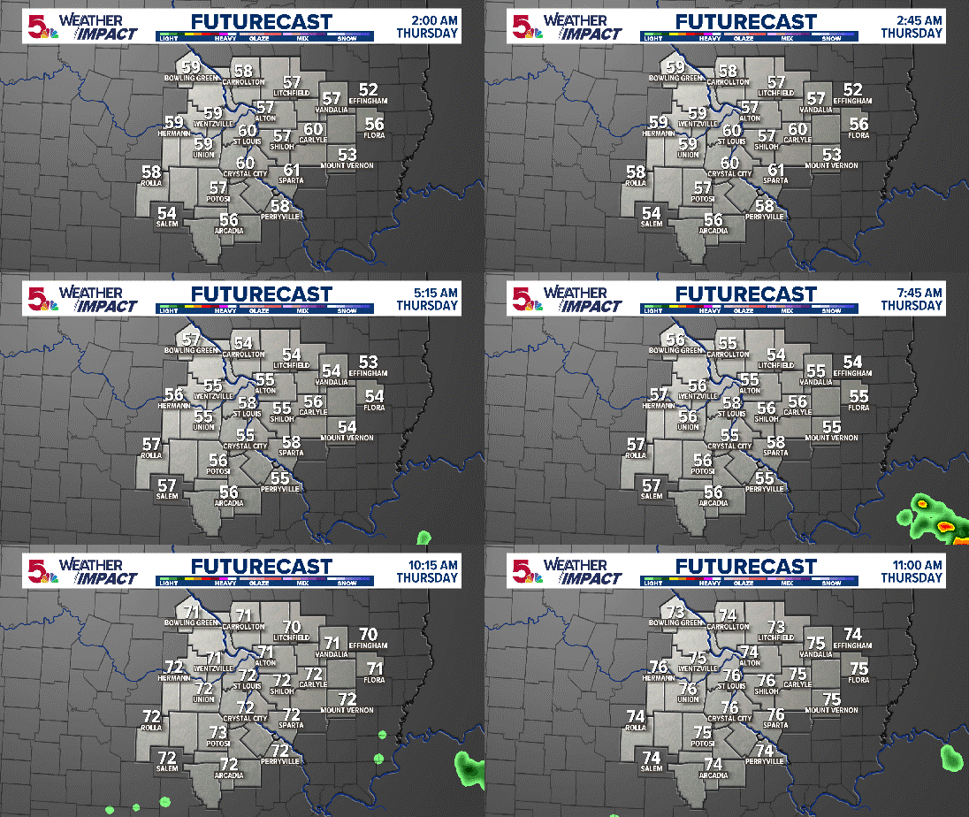
The shower and storm chance will continue into Friday night.
Above average temperatures are expected into early next week.

