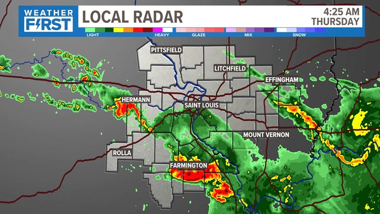
ST. LOUIS — As rain and storms wind down, the flood watch in place for the St. Louis metro area has been lifted. However, a flash flood warning remains for Madison, Ste. Genevieve and St. Francois counties until 1:45 p.m.
Overnight storms brought lightning, damaging winds and heavy rain mainly through southern portions of the 5 On Your Side viewing area. Strong winds in Bonne Terre, Potosi and Farmington downed trees, traffic lights and utility lines.
Download the free 5 On Your Side app to get the latest watches and warnings and track conditions live with our interactive radar. Use the links below to download now.
5 On Your Side news app
iPhone | Google Play
Click here to read the full Weather First forecast.
Follow along here for the latest updates:
10 a.m. - The flood watch in place for the St. Louis metro area has been lifted.
8:53 a.m. - The National Weather Service has issued a flash flood warning until 1:45 p.m. for St. Francois, Madison and Ste. Genevieve counties.
8:47 a.m. - Meteorologist Anthony Slaughter shares updated rain totals.
8 a.m. - The Weather First team has lifted the storm alert that was in place for the St. Louis area.
7:40 a.m. - Ameren Missouri reports 19,416 customers are without power, with outages mainly in:
- St. Francois County - 12,168 customers without power
- Washington County - 2,937
- Scott County - 2,400
- Jefferson County - 231
- Cooper County - 231
- St. Louis County - 199
- Franklin County - 188
7:30 a.m. - Strong storms overnight caused damage in areas south of St. Louis.
In Farmington, winds damaged stoplights and downed trees. In Bonne Terre, a large tree crushed a garage.
At the peak of the storm, winds of up to 70 mph were recorded.
6:40 a.m. - 5 On Your Side viewers are sharing their photos of Thursday's soggy sunrise.
Photos: Thursday's soggy sunrise in the St. Louis region


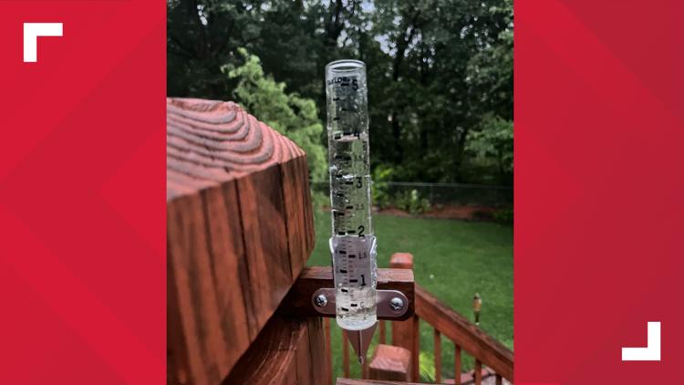


To share your photos, use the Near Me section of the 5 On Your Side mobile app or text them to 314-425-5355.
6:15 a.m. - The National Weather Service has issued a severe thunderstorm warning for Bollinger, Cape Girardeau and Perry counties until 7 a.m. Thursday.
5:20 a.m. - Nearly 16,500 Ameren Missouri customers remain without power Thursday morning, with outages mainly in the following areas:
- St. Francois County - 11,054 customers without power
- Washington County - 2,403
- Scott County - 580
- Cape Girardeau County - 398
- St. Louis County - 368
5 a.m. - A severe thunderstorm warning is in effect for Crawford, Franklin, Jefferson and Washington counties until 5:30 a.m. If this storm threatens you, get inside away from windows and doors.
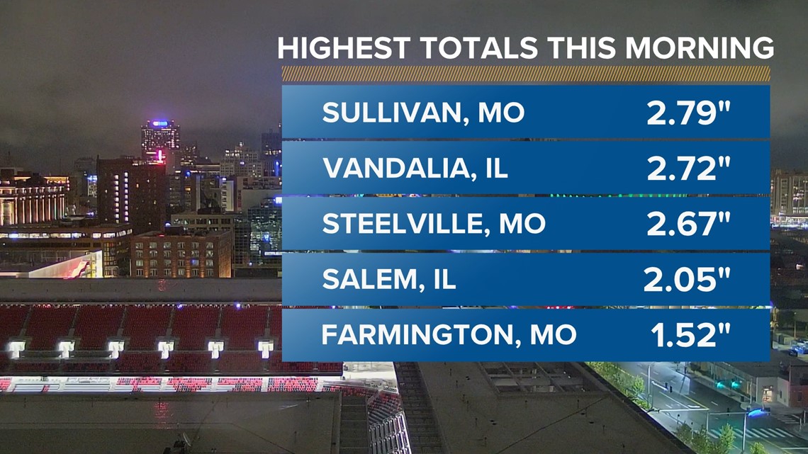
4:40 a.m. - Rain has been falling overnight, but St. Louis didn't see much of it. The highest rainfall totals were recorded in Sullivan, Missouri; Vandalia, Illinois; Steelville, Missouri; Salem, Illinois; and Farmington, Missouri.

1:30 a.m. - The National Weather Service has issued a flash flood warning for Franklin, Boone, Osage, Callaway, Gasconade and Montineau counties until 5:30 a.m. and for Clay and Richland counties until 6:45 a.m.
11:35 p.m. - Severe thunderstorm warning for Rolla will expire at 11:45 p.m. Power outages are extensive across St. Francois (11,000), Washington (3,600) and Crawford (2,000) counties.
10:30 p.m. - Severe Thunderstorm Warning issued for areas including Farmington, Park Hills and Bonne Terre. The warning is set to expire at 11:30 p.m.
10:22 p.m. - Flood Advisory issued for parts of Crawford and Washington counties. Advisory is set to expire at 1:30 a.m.
10:09 p.m. - Severe thunderstorm warning issued for areas including Camden, Maries, Miller, Morgan, Phelps and Pulaski counties. The warning expires at 11 p.m.
10:02 p.m. - Severe thunderstorm warning issued for areas including Cuba, Steelville and Bourbon. The warning is set to expire at 10:45 p.m.
10 p.m. - Severe thunderstorm warning issued for areas including Potosi, Irondale and Mineral Point. The warning is set to expire at 11 p.m.
9:52 p.m. - A flash flood warning was issued for Gasconade and Franklin counties. The warning is set to expire at 12:30 a.m.
9:31 p.m. - Severe thunderstorm warning for part of our area until 10:15 p.m. If this storm threatens you, get inside away from windows and doors.
9:29 p.m. - A flood advisory is now in effect for part of our area. Do not drive into flooded roads.
9:00 p.m. - The amount of lightning with these storms in Mid-Missouri is insane, over 3,600 strikes in just 15 minutes, plus the small hail, gusty winds and torrential rain moving east-southeast, according to Chief Meteorologist Scott Connell.
8:50 p.m. - A severe thunderstorm warning for part of our area until 9:30 p.m. is in effect. Maries, Millers, Phelps and Pulaski counties are affected with a population of more than 3,000 people.
8:44 p.m. - A tornado warning has been issued for High Point, Missouri. The warning is set to expire at 9:15 p.m.
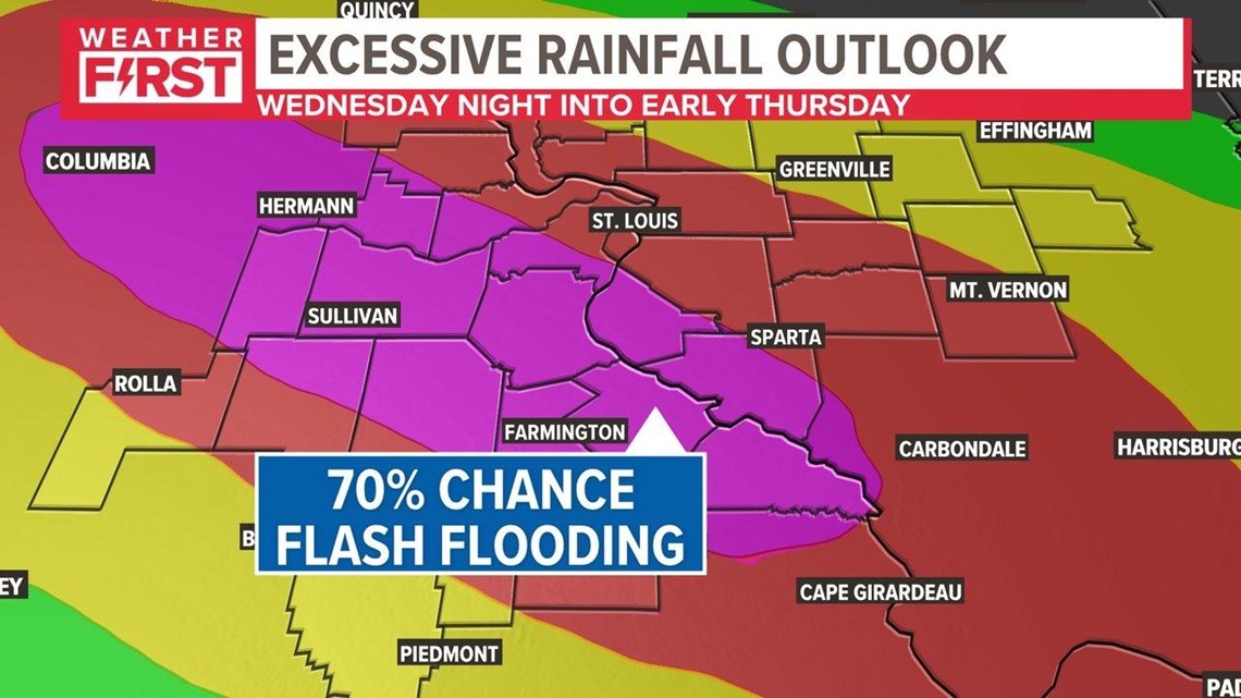
8:06 p.m. - There is a HIGH risk of flash flooding issued from the Weather Prediction Center Wednesday evening. Significant flash flooding risk has increased because of recent trends in the radar and significant heavy rain that fell earlier Wednesday morning, thus saturating the soil.
Download the free 5 On Your Side app to get the latest watches and warnings and track conditions live with our interactive radar. Use the links below to download now.
5 On Your Side news app
iPhone | Google Play
While there will be some adjustment in the rainfall totals shown here, the overall flavor of the set-up is clear with the axis of heavy rain setting up along a northwest-to-southeast trajectory along the Metro St. Louis area.
Potential Rainfall Forecast Comparison

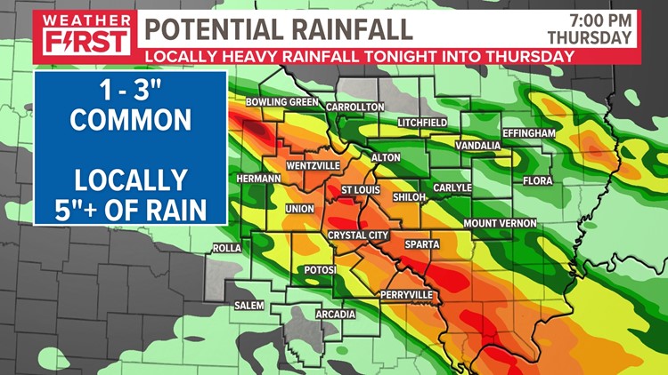

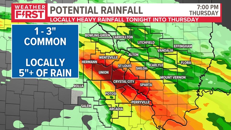
Wednesday night into Thursday morning, there will be additional bands of thunderstorms, but the location in all of these bands may shift a bit. There is also a Severe Weather Threat Wednesday evening into the night. In addition to heavy rain, some storms may produce gusty winds, hail and possibly an isolated tornado.
The Weather Prediction Center has included us under a Moderate risk for flash flooding Thursday morning. That means there is a 70% chance or greater that we'll see flash flooding within 25 miles anywhere in the highlighted zone. We'll monitor those trends and bring you the latest.

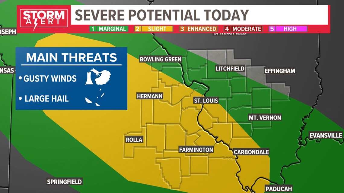
In addition to the risk of flash flooding, a slight risk for severe weather is possible as well later this evening and overnight. This will really depend on how the atmosphere recovers from the storms we've had all morning. Wind gusts over 60 mph and large hail are the main threats, but a brief tornado is not out of the question either.

Make sure your gutters are clear of debris from July's storms and freely flowing away from your home. Also, check to make sure your sump pump is working. If you live in a flood-prone area, keep up with the forecast this week and be prepared to take action should flooding occur. Finally, never drive into or try to drive through flooded roads.
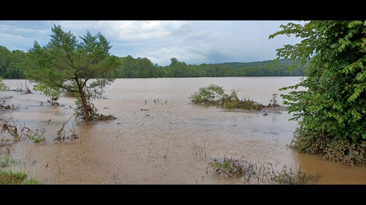
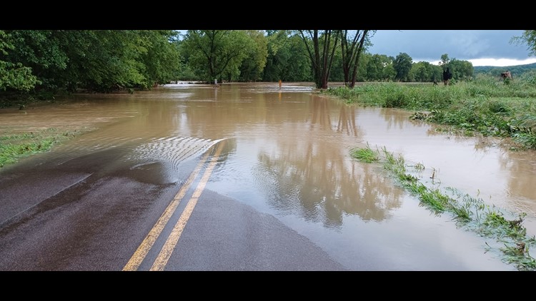
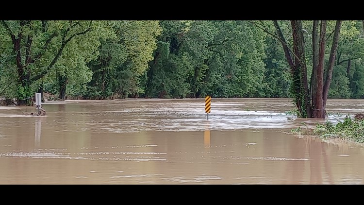
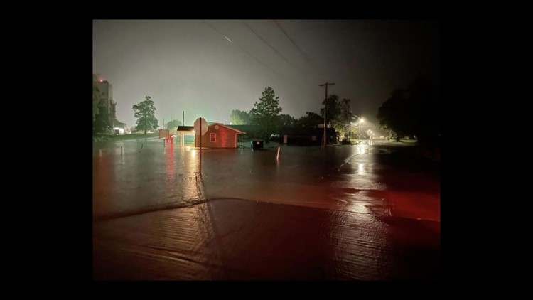
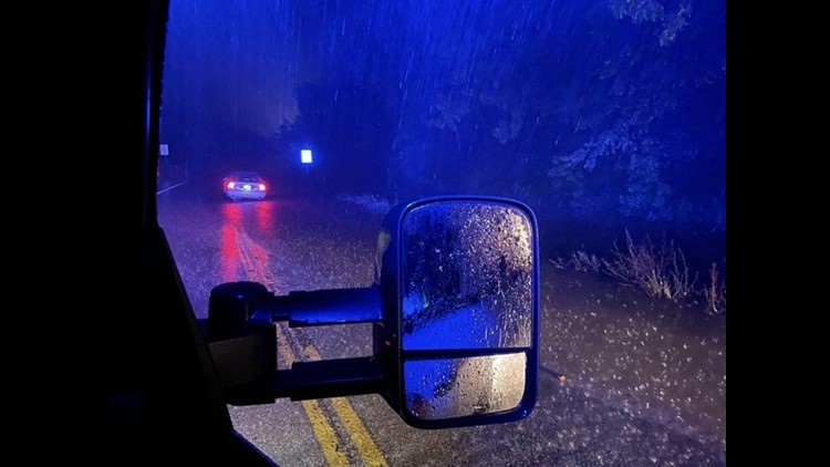
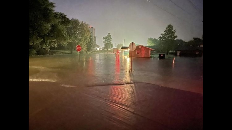
PHOTOS: Flood waters in surrounding St. Louis region


In Missouri, we serve these counties: Crawford County, Franklin County, Gasconade County, Iron County, Jefferson County, Lincoln County, Madison County, Perry County, Phelps County, Pike County, Reynolds County, St. Charles County, St. Francois County, St. Louis City, St. Louis County, Ste. Genevieve County, Warren County and Washington County.
In Illinois, we serve Bond County, Calhoun County, Clay County, Clinton County, Fayette County, Greene County, Jefferson County, Jersey County, Macoupin County, Madison County, Marion County, Monroe County, Montgomery County, Randolph County, St. Clair County and Washington County.