ST. LOUIS — A combination of an unusually strong weather system over the southwest part of the country and active tropical weather in the Gulf of Mexico will make for a soggy scenario to play out into Thursday for portions of the bi-state region.
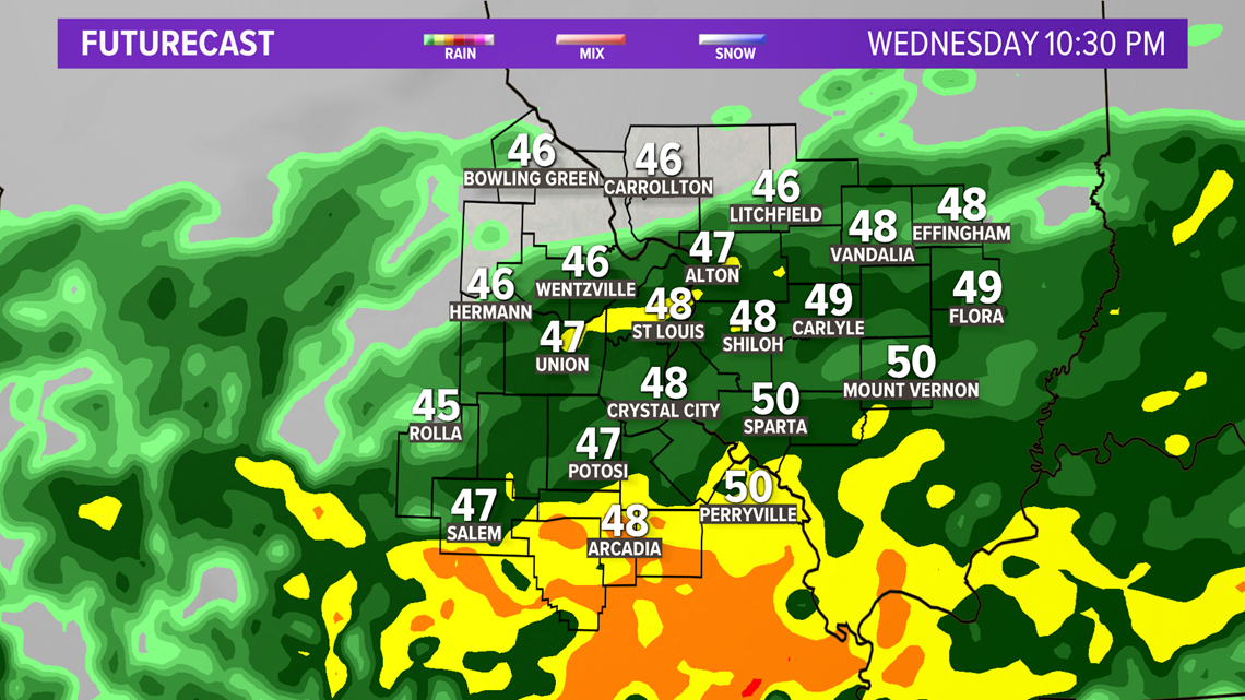
Another surge of rain is pushing across the region Wednesday evening. Locally heavy rain has fallen in Arkansas and southern Missouri and is making its way toward the St. Louis area.
Rain will continue to spread across the area overnight into Thursday. Some thunder is possible with the downpours, especially south and southeast of St. Louis.
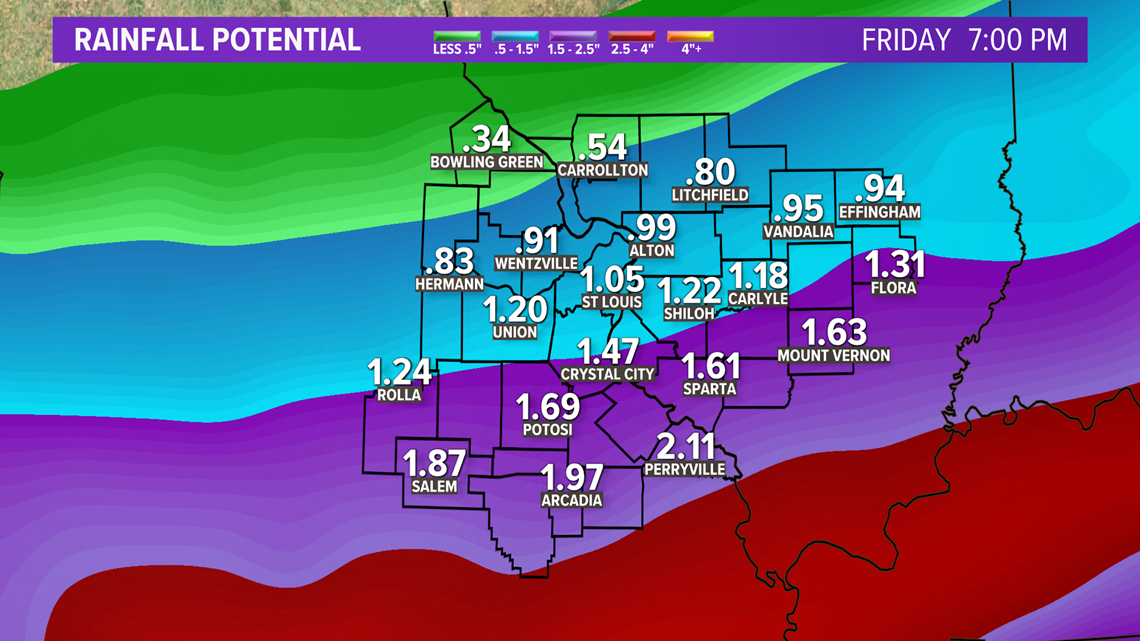
By the time the rain begins to end on Thursday afternoon into Thursday evening, another two to three inches of rain will have drenched southern portions of the 5 On Your Side area.

Download the free 5 On Your Side app to get the latest watches and warnings and track conditions live with our interactive radar. Use the links below to download now.
5 On Your Side news app
iPhone | Google Play


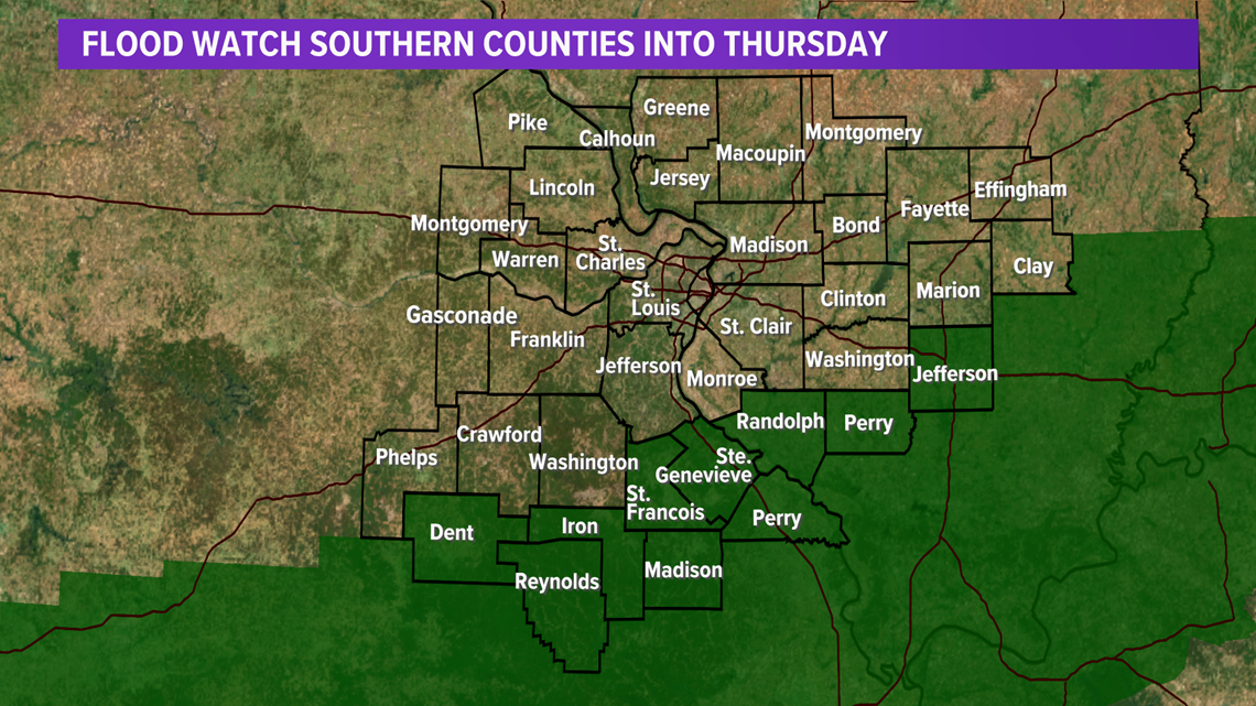
The National Weather Service has issued a flood watch for parts of southern Missouri and southern Illinois. These areas had higher rainfall totals earlier in the week which saturating the ground.
The good news is the sun finally returns Friday into the weekend. Temperatures are a little below average, especially Friday and Sunday. Saturday will be the warmest day of the weekend.