ST. LOUIS — The year 2020 has had its fair share of unique moments, and in the world of weather, it's no exception.
This year, for the first time ever, there could be separate hurricanes making landfall nearly at the same time along the Gulf of Mexico's states.
There have, however, been two hurricanes hit the U.S. mainland and other U.S. islands/territories, but it is rare.
In fact, the last time the U.S. mainland took a direct hit from two hurricanes nearly at the same time was back in September 1933, where one tropical storm slammed into Cedar Key, Florida along the Gulf coast and the other hit Brownsville, Texas, as a Category 3 hurricane with winds near 125 mph.
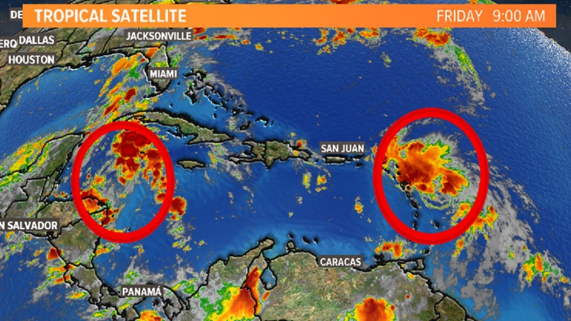
The two areas of concern right now with next week's systems are in the Atlantic Ocean and the Caribbean Sea.
The tropical system in the Atlantic is now a tropical storm with winds at the center whirling at 45 mph. It's been named Laura.
The other system is expected to strengthen from a tropical depression into a tropical storm sometime Friday. It's forecast to move over the Yucatan Peninsula over the weekend. That system will be named Marco.


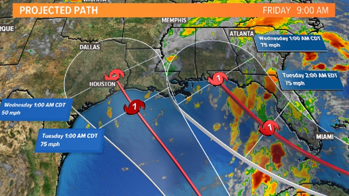
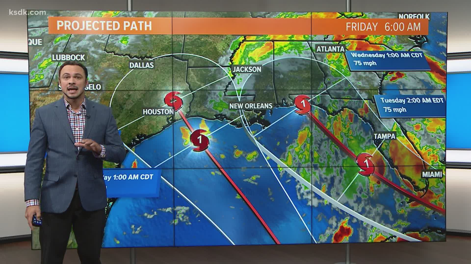
Both Laura and Marco will be moving closer to the mainland over the weekend and the projected path puts both of them in the Gulf of Mexico by Monday.
Sometime late Tuesday into Wednesday morning, those systems are expected to make landfall as Category 1 hurricanes with winds at the center of both near 75 mph.
Areas from Texas to Florida need to be on guard and should prepare now for a direct hit sometime early next week.


