ST. LOUIS — Weather is quiet Monday morning and will stay that way for the next couple of days before our next weather system arrives Thursday. Until then, expect mostly cloudy days.
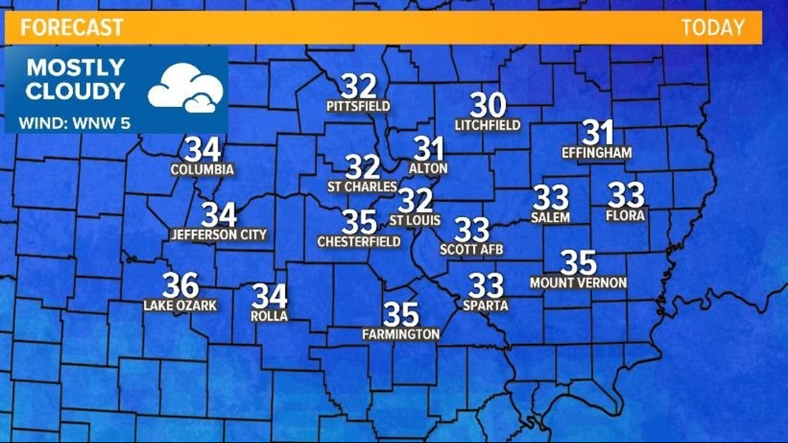
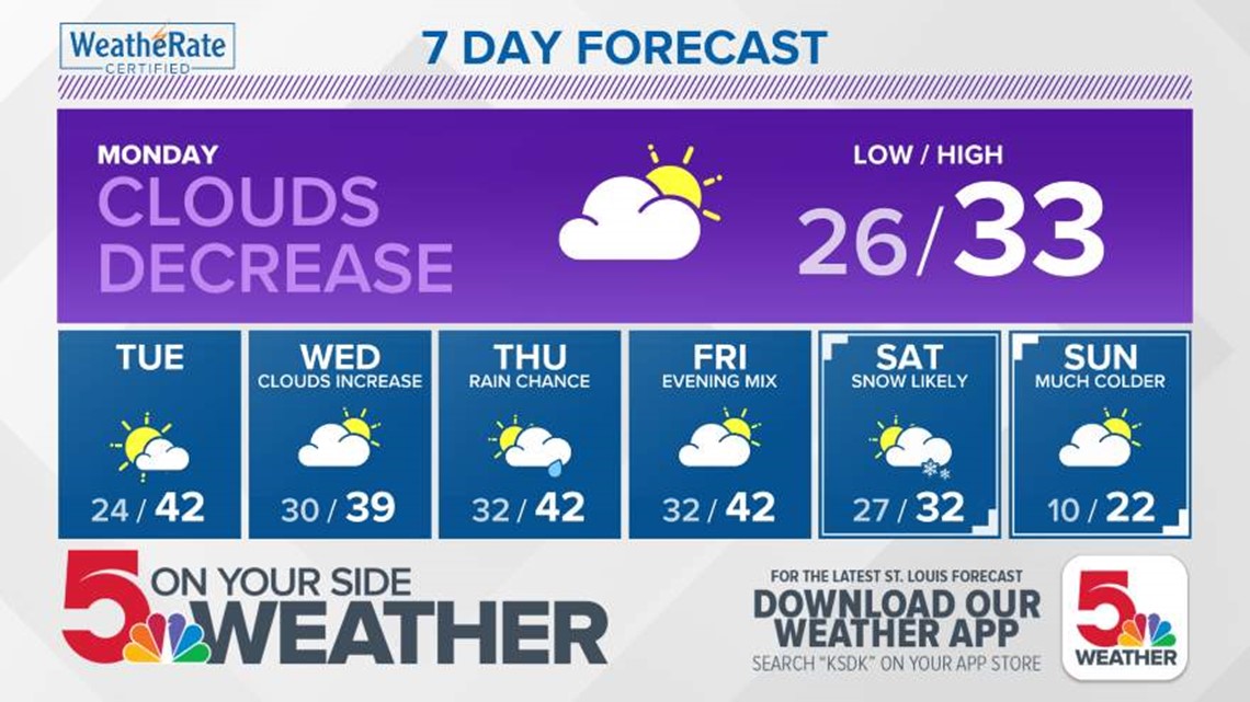
Our temps will start to moderate as well. We can expect 30s for highs Monday and 40s Tuesday. Wednesday is mostly cloudy with highs only reaching 40.
Rain moves into the region Thursday. There are hints that we may have a few snowflakes mixing in, but Thursday's event is mainly rain with temps in the lower 40s. As temps fall Thursday evening, we might see a few snowflakes, but we're not expecting snowfall accumulation that day.
Get Our Weather App!


Here’s where the forecast gets very snowy and then very cold. We're talking single-digit cold.
Saturday another system looks to approach. This time it's snow, not rain.
Right now, it's way too soon to tell how much, but long-range models bring in precipitation starting late Friday night or early morning Saturday, possibly around 1 a.m.
RELATED: Watch Live Radar
One model has snow from start to end Saturday morning into the evening. The European model has rain, then a mix, then snow at the end.
Both are in agreement it will start early Saturday morning and end Saturday evening. It's still unclear what will fall—snow or a mix or rain—or if there will be any at all.
At this point, I can tell you there is a chance of wintry weather this upcoming weekend, as for how much and what—if any—will happen, it's still too soon to say. As always, stay tuned.
We're also tracking very cold temperatures. Saturday night and Sunday night temperatures could dip into the single digits. Saturday night’s low is expected to be 10° and Sunday night is 8°.
After Saturday’s system, our next system moves in Wednesday or Thursday of the following week, which—again—could be snow or a mix.


