ST. LOUIS — We haven't seen much in the way of snow throughout the region over the course of this winter, but that should change (to some degree) over the next few days.
While this doesn't look like too much right now, this slow-moving system has been responsible for our rain on Christmas Day and will be responsible for our rain and snow mix over the next couple of days.
Download the free 5 On Your Side app to get the latest watches and warnings and track conditions live with our interactive radar. Use the links below to download now.
5 On Your Side news app
iPhone | Google Play

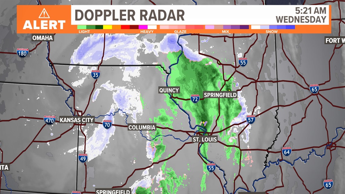

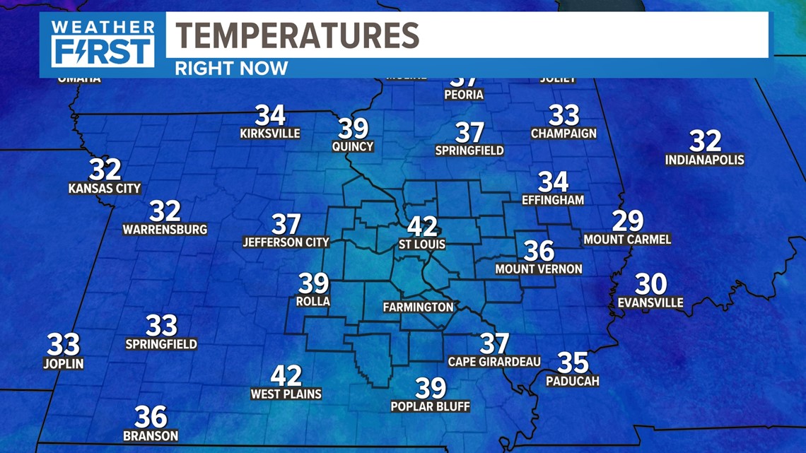
One of the biggest reasons we haven't seen any snow this season is not just our lack of moisture, it's our lack of cold air. That's why I don't want snow lovers to get *too* excited this time around.
But take a look at all of the areas that are above-freezing right now and getting snow. Many of you have questions about that, and I'll do my best to explain them here.

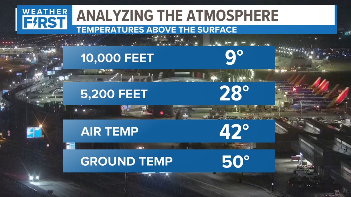
Let's start by going up to around 10,000 feet above the surface. We know the air is always colder as we go higher up. We've seen mountain peaks and flown on airplanes. But it's very important for situations like this. Temperatures go from the low 20s about a mile high up, to the mid-40s locally.
The ground is even warmer!
Soil temperatures are near 50 degrees after our recent warm weather. That means we either need a drastic change of air mass or a local change. In this case, snowfall rates need to overcome that warm ground temperature to cause issues.

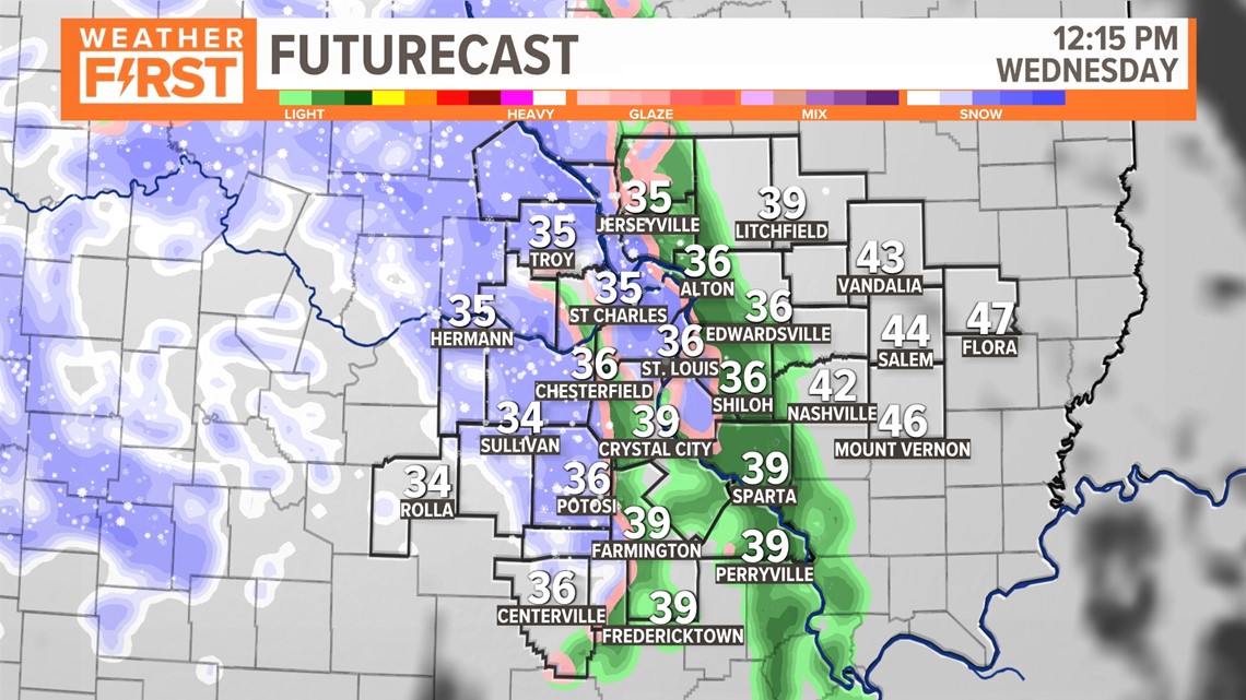
We should continue to see light rain most of the morning, but things will change from rain to snow in a few spots by mid-morning. This is when things may become slick in a few spots as we start to encounter snow over the same spots for several hours.

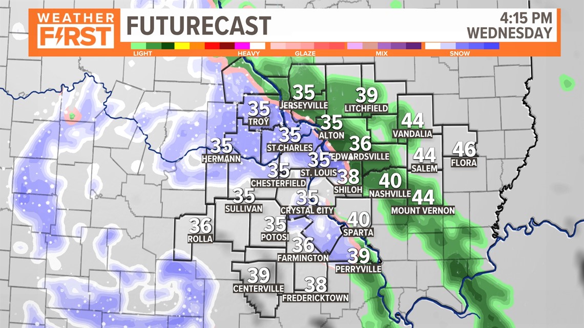
But the second half of the day may be a bit more interesting. Because of the track of this low pressure in central Missouri, we may see some of these heavier bands become relatively stationary for a while. Sometimes, this allows snowfall rates over 1" per hour, and that may make the pavement surface much colder. If this were to occur, there may be some issues for a brief period.

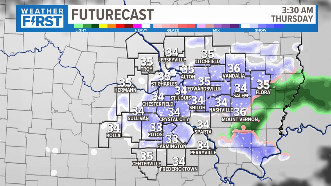
Early Thursday morning, depending on how quickly this system moves, we may see enough cold air for another light burst of this to impact areas around the city and further south.

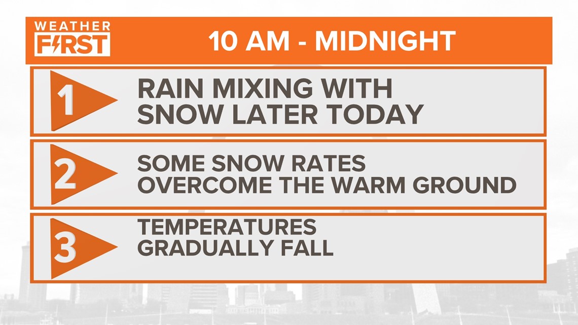
While it seems odd that there is this much uncertainty this close to the system's arrival, it's a matter of temperatures and the track of this low with a "mind of its own."
At this point, I am not expecting a widespread accumulation. But IF those criteria I mentioned earlier will allow for a localized heavy band of snow, this could rapidly cool the pavement. Be prepared for this potential late Wednesday into early Thursday. We will keep you posted with any updates.

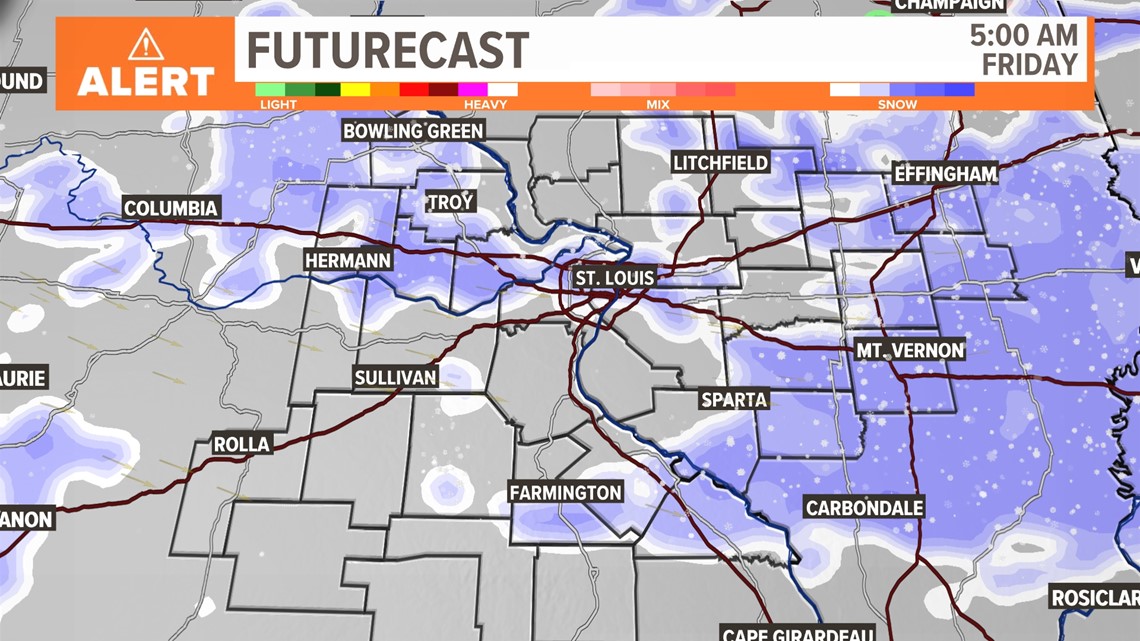
Interestingly enough, as things have changed over the last 24 hours, I expect this system to hang around enough for another light burst of snow late Thursday into early Friday as well. This could provide some issues for travelers Friday morning as light snow falls with temperatures a bit colder to start the day.
Want more breaking news delivered straight to your inbox? Sign up for our 5 On Your Side Breaking News newsletter.


