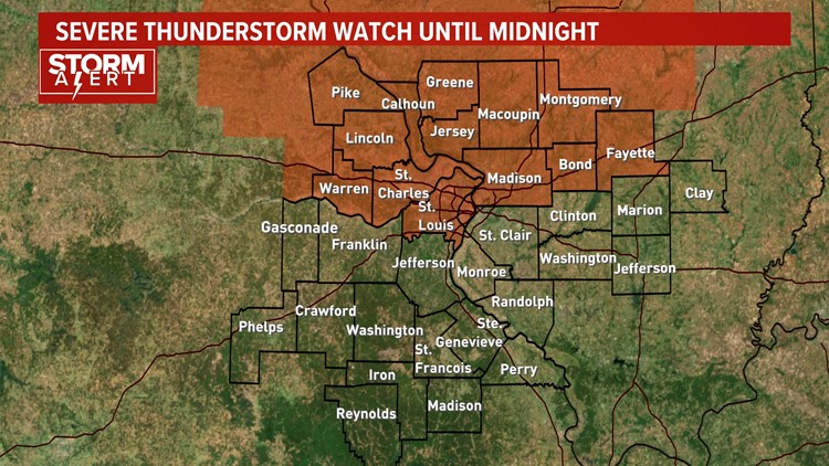
ST. LOUIS — A Severe Thunderstorm Watch has been issued until midnight Saturday from St. Louis City and St. Louis County northward.
A cold front will be slamming into the high heat and humidity of Saturday. Storms are developing around the area tonight.


Some severe cells are possible from St. Louis northward to Springfield, Illinois until midnight tonight. The main threats from these storms are severe wind gusts over 60 miles per hour, and large hail is also possible.
A Severe Thunderstorm Watch means conditions are favorable for severe thunderstorms in and close to the watch area. Persons in these areas should stay weather aware if threatening weather conditions move into your area. Stay with 5 On Your Side this evening, as we will be running our crawl with any warnings as they are issued and we will break into regularly scheduled programming as needed.
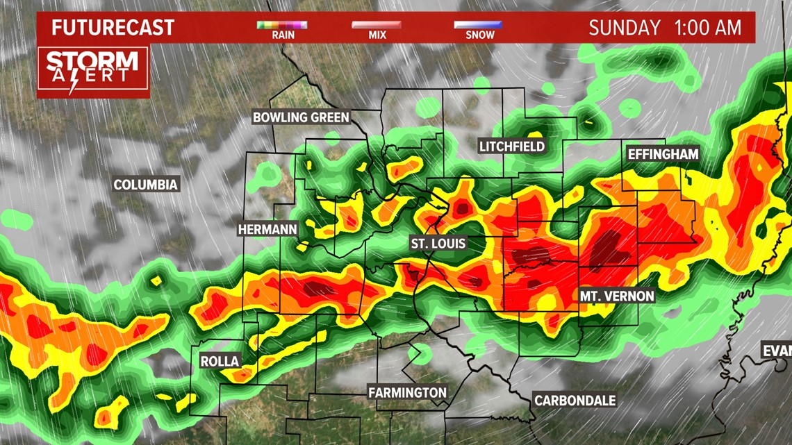
Below is the future satellite and radar at 1 a.m. So, even after the severe thunderstorm watch ends, we are still expecting showers and storms to be in the area with the potential for frequent lightning and heavy rain.


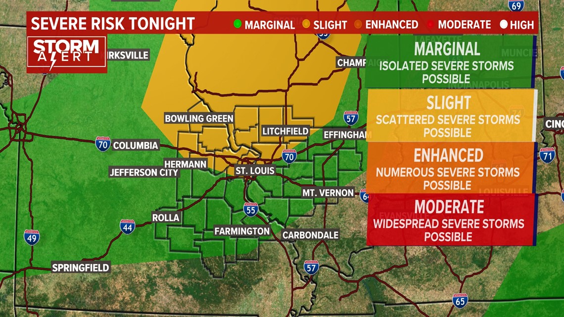
Below, the Severe Storm Prediction center has scattered severe thunderstorm potential in the yellow area. This includes St. Louis. The rest of the area is in green, or a marginal risk for isolated severe thunderstorms.


