ST. LOUIS — Significant power outages, downed trees, and even some hail damage have been highlighted throughout the region from Friday and Saturday's storms.
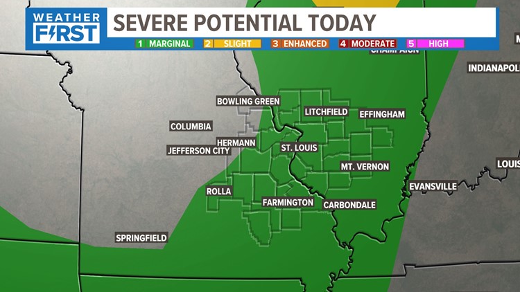
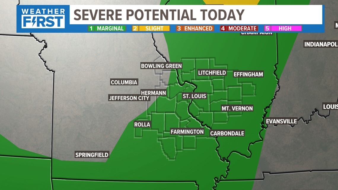
Another chance for severe weather is not exactly what we want to hear about right now, but that seems possible south and east of St. Louis Wednesday. The Storm Prediction Center has downgraded us to a level 1 out of 5 risk.
Download the free 5 On Your Side app to get the latest watches and warnings and track conditions live with our interactive radar. Use the links below to download now.
5 On Your Side news app
iPhone | Google Play

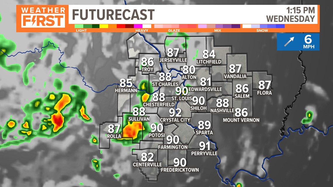
As the storms approach from western Missouri, the line of storms will fall apart some on the Missouri side of the river. As the heating of the day occurs, these storms will re-energize some as they march east into Illinois.

As that boundary moves in from the west and interacts with the heating of the day, scattered strong storms are expected to develop.

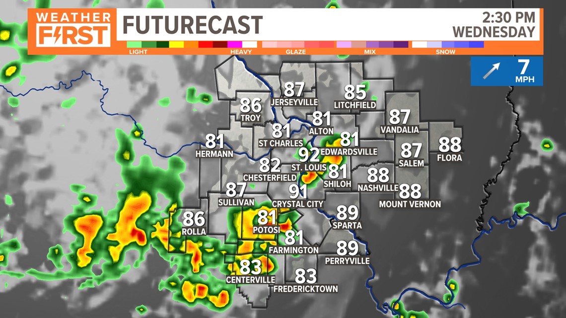
The worst of the weather may occur south and east of St. Louis this go-round with the futurecast showing intense storm development by 2 p.m - 4 p.m. across our southern and eastern counties.

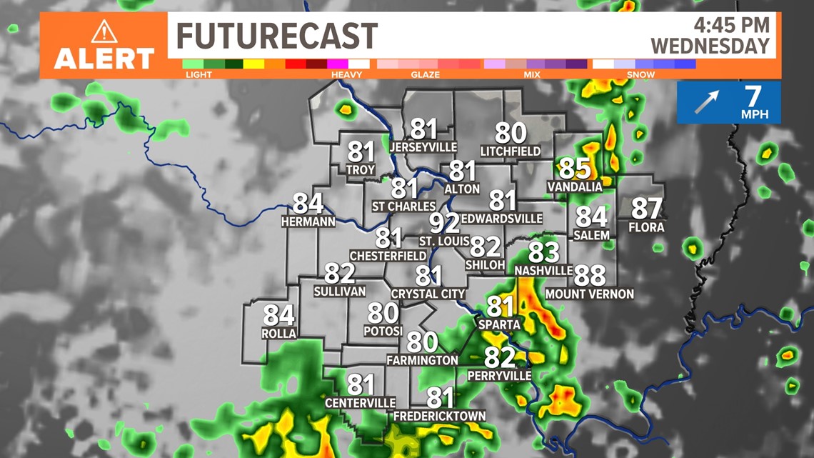
Storm chances move east very quickly, with most of the storms out of our area well before sunset.
Wednesday will be a "weather alert" day and damaging winds seem to be the main threat. Storms should clear away Wednesday night.
Most of our storms chances will be this afternoon and early evening. Not everyone is expected to get severe weather this time around. While the setup is slightly different than the last time, there is still a wind potential over 60 mph. Not expected to have as many widespread issues, but there will still be isolated wind gusts over 60 mph and some larger hail. We will keep you posted as any watches/warnings are issued later today, but stay alert this afternoon.
Click here to read the full Weather First forecast.