ST. LOUIS — National Weather Service (NWS) survey crews spent much of Thursday assessing the damage caused by a severe storm system that rolled over the entire St. Louis region Thursday evening.
Numerous counties in the 5 On Your Side coverage area were hunkered down after multiple tornado warnings were issued by the NWS, with the last county under a warning being Marion, Illinois. The survey crews traveled to areas where damage was reported to confirm whether suspected tornadoes touched down.
So far, NWS has officially confirmed nine St. Louis area tornadoes. They include:
- A tornado with gusts up to 100 mph started south of Eureka, Missouri, near Twin Rivers Road and lowered in intensity as it traveled east near High Ridge.
- A tornado with gusts up to 95 mph near Standard City, Illinois.
- A tornado with gusts up to 90 mph southeast of Dorsey, Illinois.
- A tornado with gusts up to 80 mph east of Granite City, Illinois, near Arlington Greens Golf Course.
- A tornado with gusts up to 80 mph went north of Marine, Illinois.
- A tornado with gusts up to 74 mph southeast of Cahokia Heights, Illinois.
- A tornado with gusts up to 60 mph northwest of Troy, Illinois.
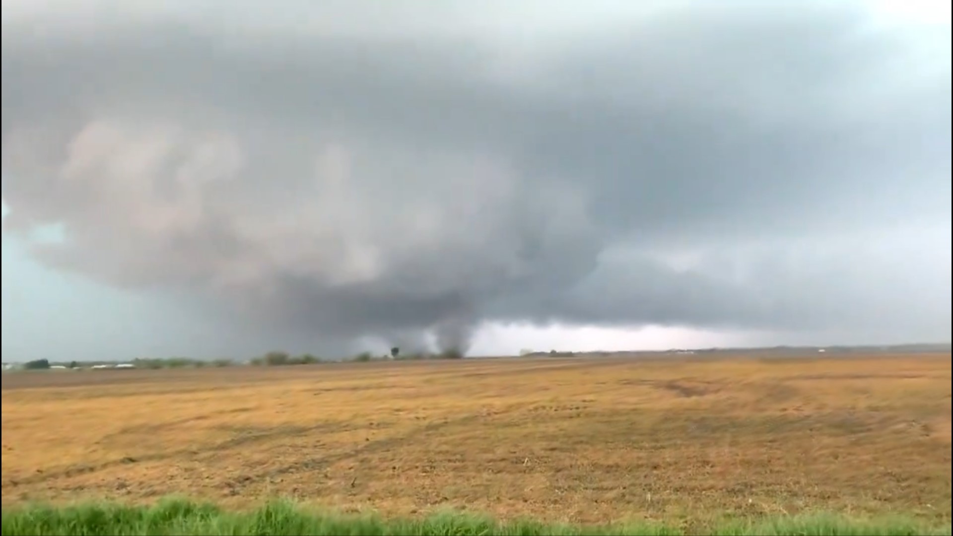
One other tornado was captured on video touching down in Greene and Macoupin counties in Illinois to the far north of St. Louis. NWS informally reported that tornado on Thursday during the storms. The storm survey crew could not find any damage in Greenfield. Video of the tornado and storm spotter reports do confirm the tornado and an estimated track was determined. Spotters also confirmed a brief tornado near Kemper, Illinois. These two tornadoes are rated EF-Unknown. Since the tornadoes remained over open fields. there was no identifiable damage, thus the EF-U rating.
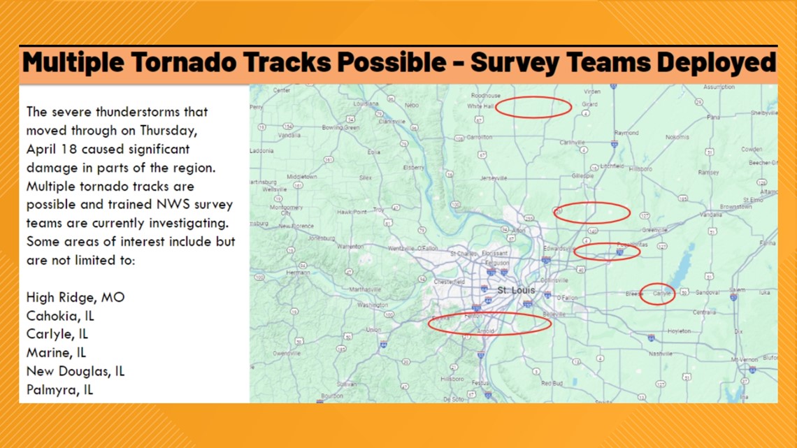
NWS said survey teams worked through the day Thursday at numerous locations around the area, including, but not limited to:
- High Ridge, Missouri
- Cahokia, Illinois
- Carlyle, Illinois
- Marine, Illinois
- New Douglas, Illinois
- Palmyra, Illinois


How do meteorologists figure out whether a tornado happened or not? Radars and electronics can only tell NWS meteorologists so much. To figure out whether a tornado happened, the service has to head out into the field. Less than 24 hours after the storms, the agency sent out multiple survey teams to assess damage and figure out whether a legitimate tornado touchdown occurred.
"The pattern of damage determines if it was a tornado. NOT how much damage was caused," NWS said on its website. "We conduct surveys to find out exactly what happened. This helps us to improve our warnings for the future. This is also important for historical reference."
Tornado damage can often be confused with damage from a microburst, so meteorologists look at the type of damage rather than how much damage occurred.
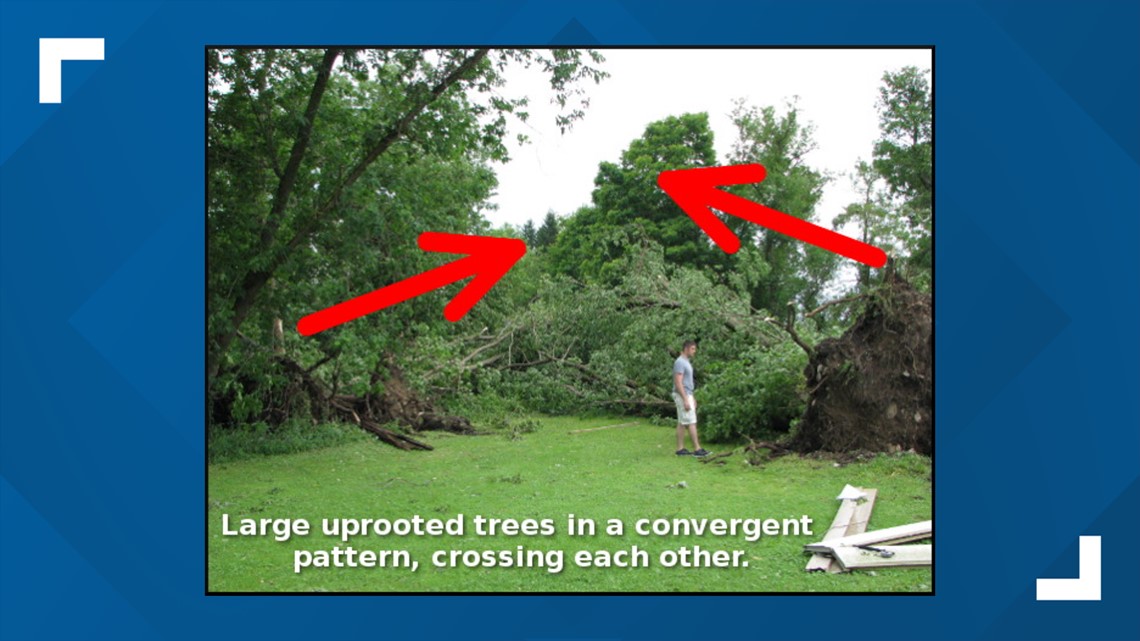
Damage from a tornado often looks chaotic and leaves large trees uprooted and often crossing each other on the ground, the service said. Smaller snapped branches or trees aren't usually helpful, since those don't convey the true severity of winds.
For example, NWS originally said in a tweet on March 14 that a tornado was confirmed near Maeystown, Illinois. However, around half a dozen surveyors went to the area the next day and couldn't find any damage indicating a tornado was in the area.


Top St. Louis headlines
Get the latest news and details throughout the St. Louis area from 5 On Your Side broadcasts here.

