ST. LOUIS — 9:00 p.m. Monday UPDATE: The threat of severe weather has ended for the St. Louis area for the remainder of the night. More intense storms are possible Tuesday into Tuesday night.
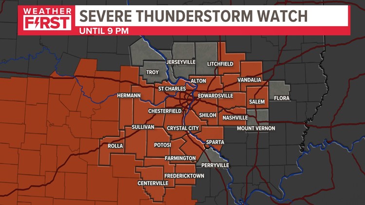
Another active weather afternoon is developing across the St. Louis area Monday afternoon. A severe thunderstorm watch is in effect throughout most of the St. Louis area until 9 p.m. Some thunderstorms may produce large hail and strong wind gusts.
The watches were initially issued for Franklin, Gasconade, Clinton, Washington, Iron, Reynolds and Phelps counties until 9 p.m. Monday. Those watches were expanded to St. Louis, St. Louis County and St. Charles County in Missouri and multiple counties in the Metro East.
Click here to view all active weather alerts.
Outside and away from thunderstorms, temperatures have climbed into the 80s close to 90 degrees. With the humidity, the fuel is in place for the storms. Earlier thunderstorm complexes to our north and also farther southwest have put down boundaries for additional storms to develop.
The severe threat will be highest during peak heating through the afternoon hours.
Video showed small hail and heavy rain falling in Bellefontaine Neighbors.

As of 8:30 p.m., Ameren reported the following number of customers without power:
Ameren Illinois: 2, 194
- Madison County: 1,814
Ameren Missouri: 5,726
- Jefferson County: 1,251
- St. Louis County: 474
- St. Louis City: 354
- Cape Girardeau: 2,499
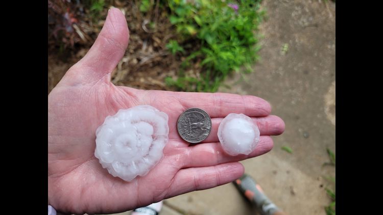
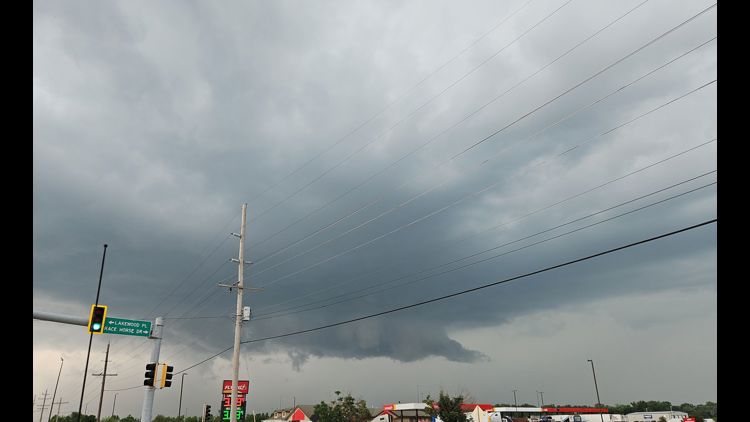
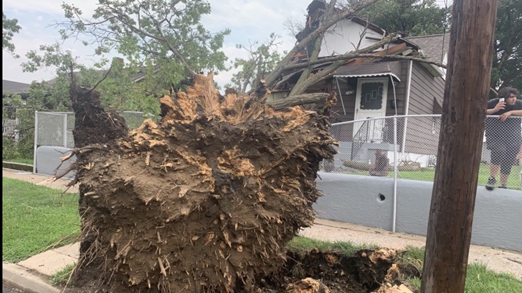
Photos: Damaging hail, heavy rain in north St. Louis County and Metro East


Download the free 5 On Your Side app to get the latest watches and warnings and track conditions live with our interactive radar. Use the links below to download now.
5 On Your Side news app
iPhone | Google Play