ST. LOUIS — UPDATE:
The severe threat has ended for our southern Illinois counties as of midnight. A mix of sleet, rain and graupel is possible from scattered thunderstorms as the cold air surges in behind that front.
PREVIOUS STORY:
The National Weather Service issued a tornado watch Tuesday evening for several counties in Illinois.
The watch includes most Illinois counties in the St. Louis area until 5 a.m. Wednesday.

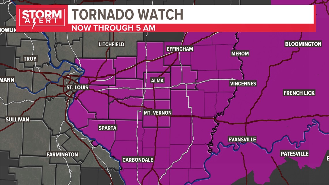
A tornado watch means there are favorable conditions for a tornado to develop. A tornado warning means a tornado has been spotted or indicated by the radar.
The St. Louis-area broke records today, with our warmest Feb. 27 on record, and our warmest day in February on record as well. Things will change significantly overnight as a strong front moves through and drops our temperatures fall nearly 60 degrees by Wednesday morning.
Download the free 5 On Your Side app to get the latest watches and warnings and track conditions live with our interactive radar. Use the links below to download now.
5 On Your Side news app
iPhone | Google Play