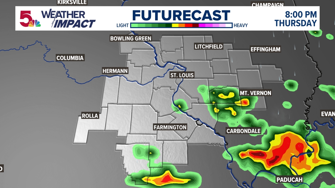
ST. LOUIS — A few thunderstorms moved through early Thursday, but those have cleared the area. More storms are expected to form Thursday evening along a cold front with damaging wind gusts the main risk. Along with heavy rainfall, frequent lightning and thunder are possible and this may cause you to put outdoor plans on pause.

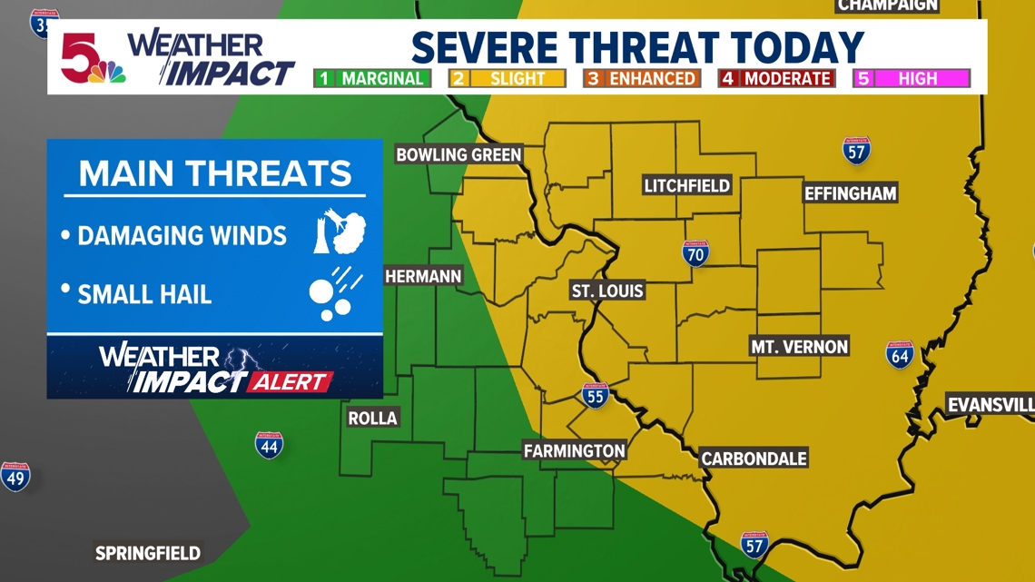
The best time frame for more storms to form later today would come after 6 p.m. and mainly southeast of St. Louis. The storms should clear the area by midnight with dry weather returning into the weekend.

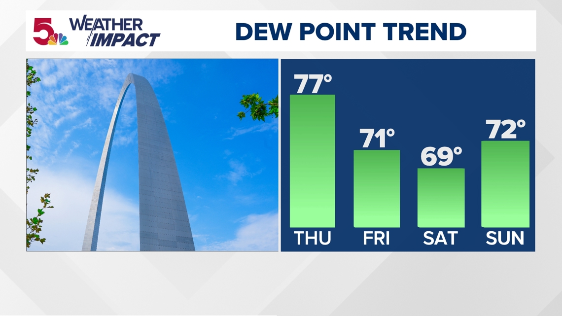
While the cold front will drop our temperatures only slightly, it will drop our dew point temperatures making it feel less oppressive outside. Temperatures will be coolest on Friday with mid to upper 80s for highs, but by Saturday and Sunday highs will climb back to near 90.

For the full Weather Impact forecast, click here.