ST. LOUIS — It has been increasingly wetter over the last few weeks, with some rivers swelling, localized flash flooding and plenty of nuisance rain. While some of this has been an issue, it has been largely beneficial in ending our drought region-wide.
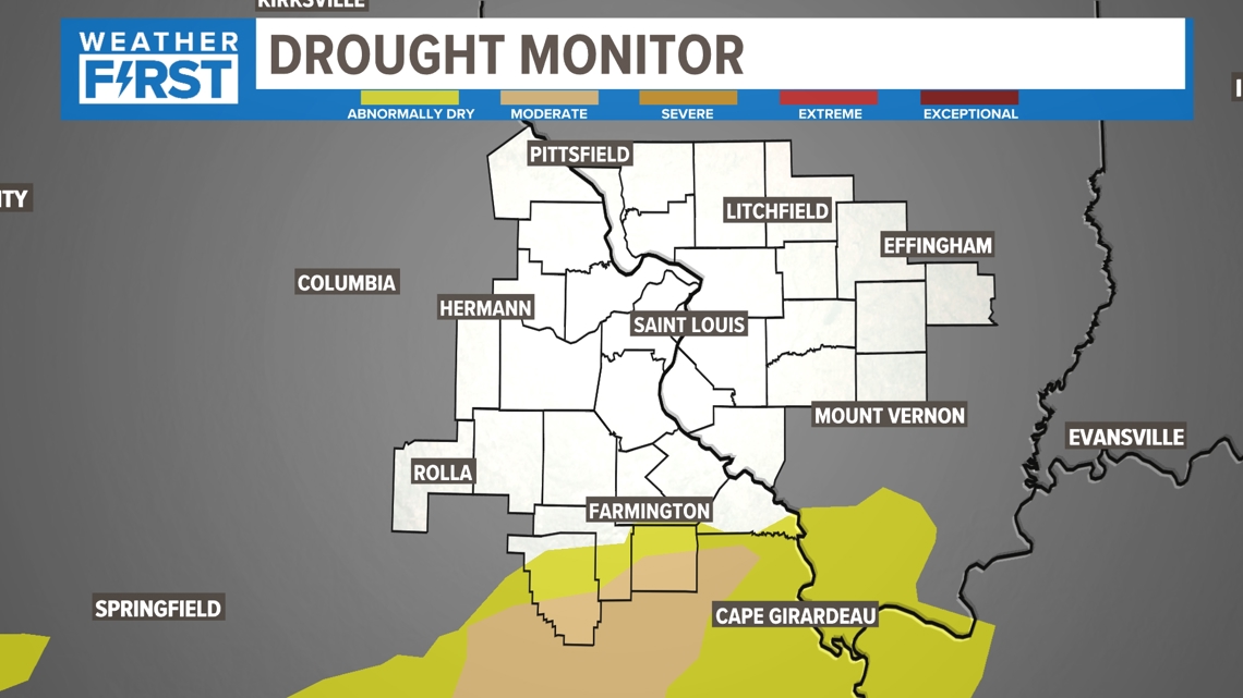
To no one's surprise, we have virtually eliminated drought in almost every county in our coverage area. This is really important moving into the hot, summer months that can evaporate the water very quickly. But this map looked a LOT different last summer and fall. Extreme and exceptional drought was a common occurrence in many cases.
Download the free 5 On Your Side app to get the latest watches and warnings and track conditions live with our interactive radar. Use the links below to download now.
5 On Your Side news app
iPhone | Google Play


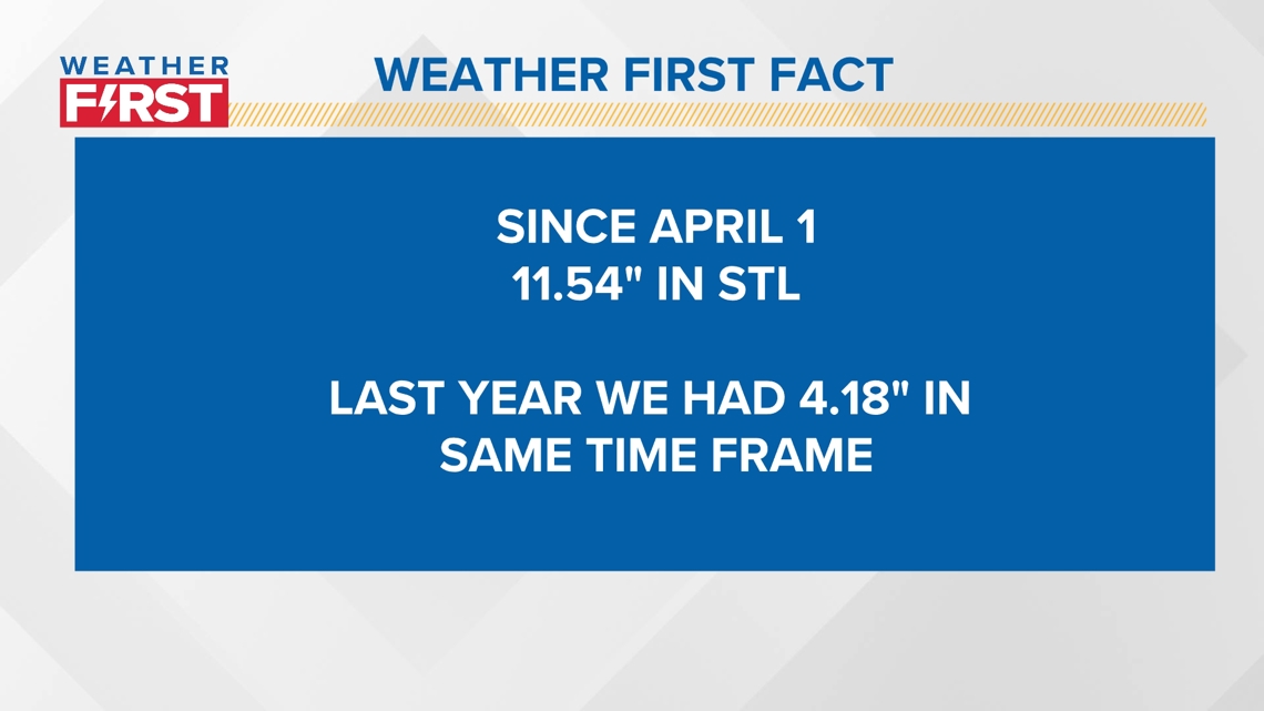
The staggering statistic as we got into the month of April this year and entered this very wet pattern, is when you compare it to last year, we are almost 7.5" ahead of where we were last year. We are also in the top 30 wettest starts to the year in St. Louis.

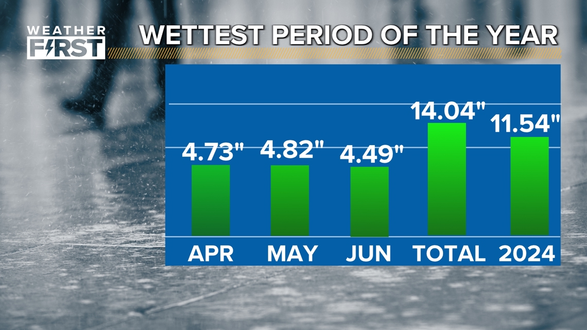
Now these are supposed to be wet months, but they weren't last year. This stretch of months we are in, are actually our statistical wettest months of the year! In fact, we are already 2.5" away from our average of the 3 months combined, with another 6 weeks to go.

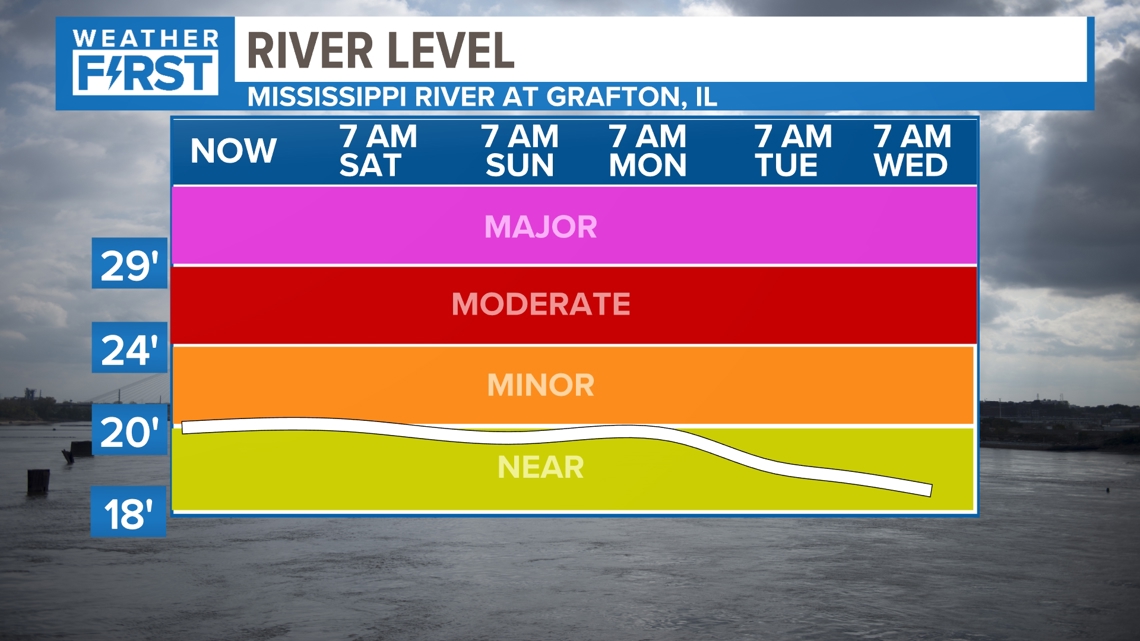


After historically low river levels last year, we are starting to see them come up quite a bit. The next hurdle we have to deal with due to the increased rain chances would be some localized flooding. Some of these rivers are in minor flood stage, but are forecasted to come down by the middle of next week.

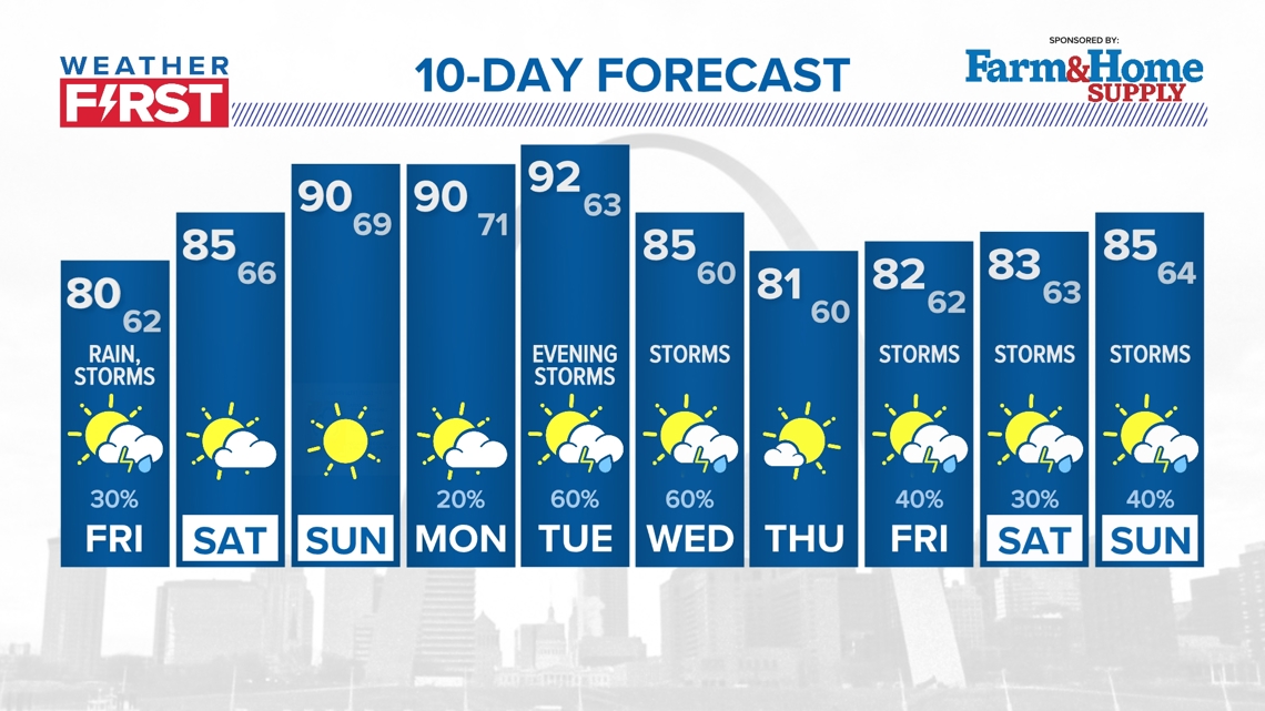
Fortunately, any rain chances this afternoon should be brief, and really won't contribute to the rainfall. Our next chance of rain looks to be late Tuesday into Wednesday. Thankfully, we will have a nice period of dry weather to catch up and settle down just a bit.


