ST. LOUIS — 5 On Your Side news app
iPhone | Google Play
To watch 5 On Your Side broadcasts or reports 24/7, 5 On Your Side is always streaming on 5+. Download for free on Roku or Amazon Fire TV.
I posted this a few days ago from my desktop computer. Many of you sent me similar things from your mobile and desktop devices. 5 days out...9 inches of snow! Case closed, right?

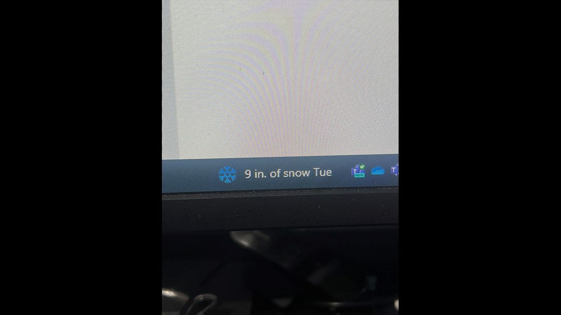

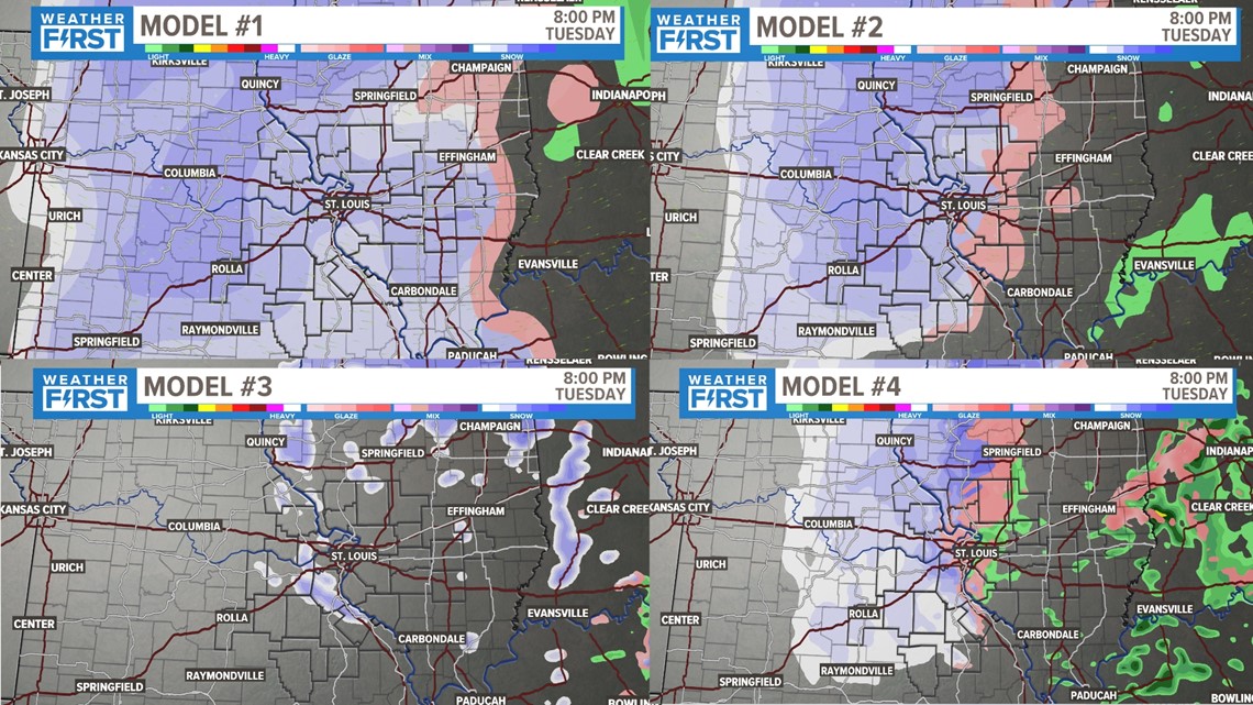
Of course, that is wrong. You would have heard about it by now if we were actually going to 9 inches of snow. But what gives, and what are we going to expect? Just as an example of how much things can vary between models even 24 hours out, you can see a small sample of them above. There lies the difficulty of winter weather forecasting (and forecasting in general.

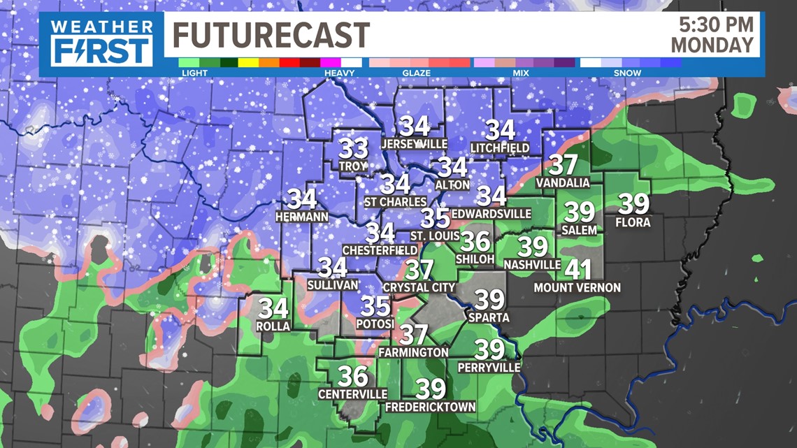
So what is going to occur to start the week? I think it will rain and snow without question. We've discussed how important the track is so far, but once it is here, what can we expect? Let's think back to Friday evening briefly. While it wasn't quite as widespread or strong as this system will be, this will be the first part of the storm that is bit similar to something we've experienced recently. As temperatures remain above freezing, snowfall rates may overcome temperatures above freezing as we track a razor thin rain and snow line.

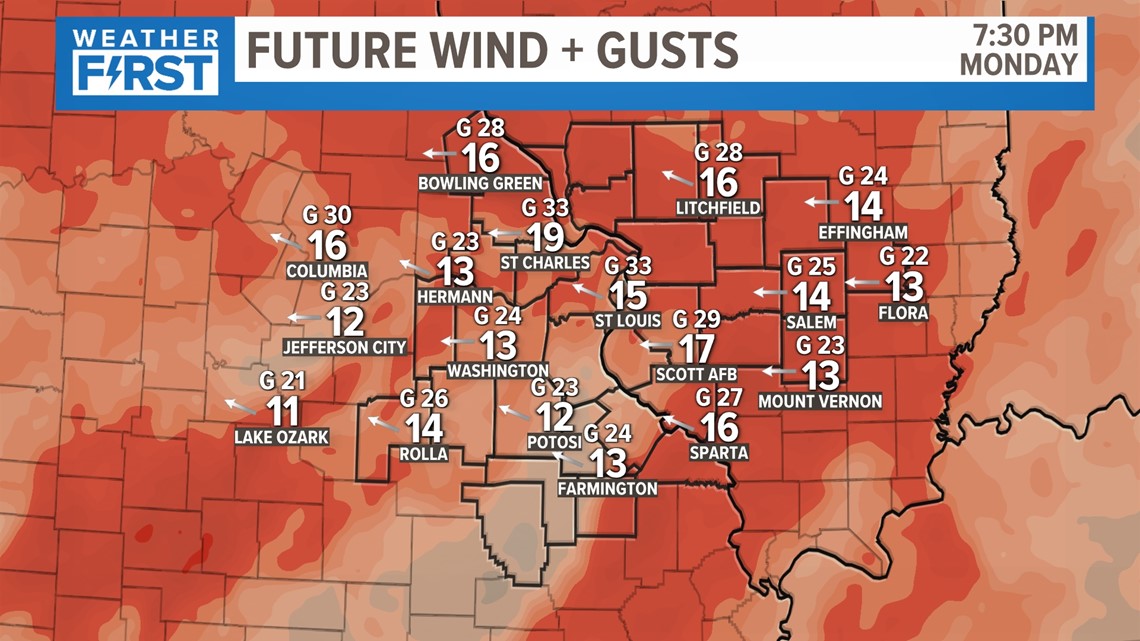
The other thing that is maybe falling as a back burner: wind gusts over 30 and 40 mph. This will cause visibility to fall very quickly as heavy, wet snow falls. Power outages may be something to watch out for as well, as this snow should stick to the trees and make them heavier as the wind blows.

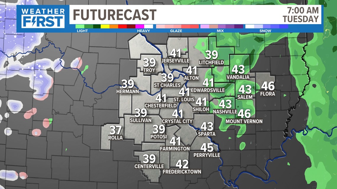
Tuesday morning looks to find a dry slot of air settling into the area. Not only are our temperatures above freezing, but we shouldn't see much more than a few areas of light rain or drizzle.

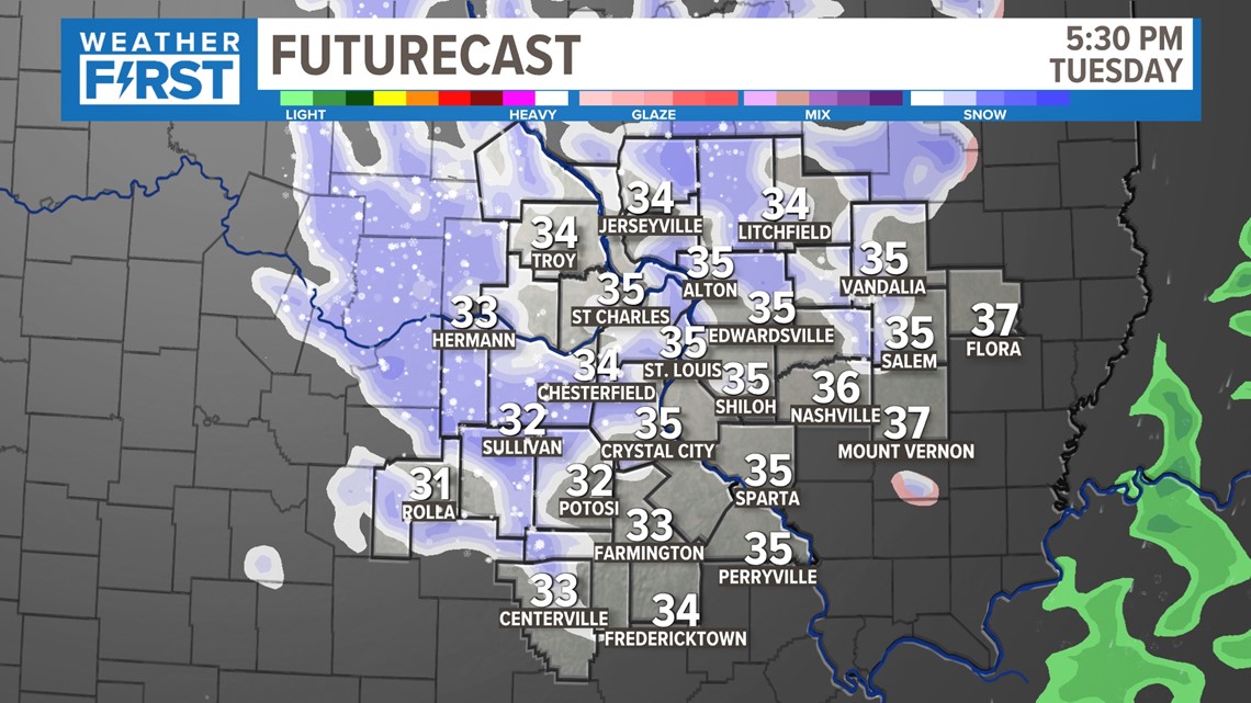
This is the second period of the next 48 hours that looks to cause some issues as temperatures fall. This is when the visibility may drop again, and things may get slick as well. As temperatures fall below freezing, more areas will get accumulating snow.

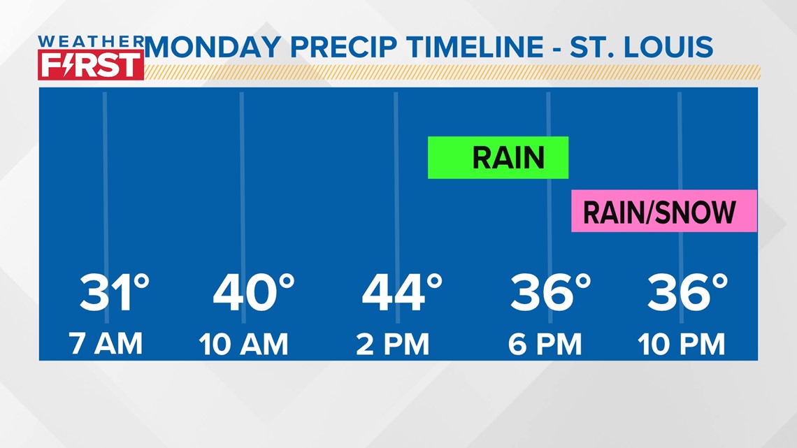

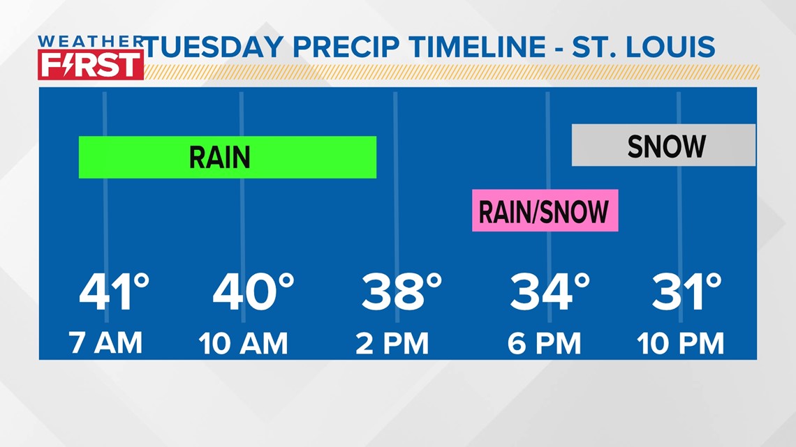
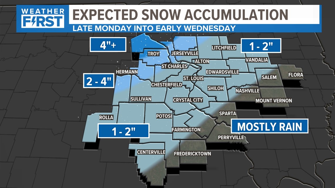
Areas in St. Louis can expect a majority rain to start on Monday, before transitioning to rain and snow later in the day on Monday. The key factor on Tuesday will be how quickly temperatures fall below freezing. Right now, that looks like it won't be until about 8 PM

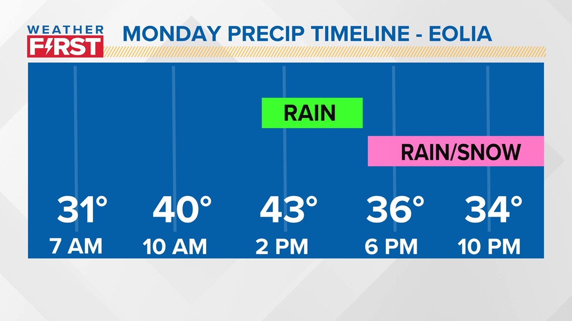

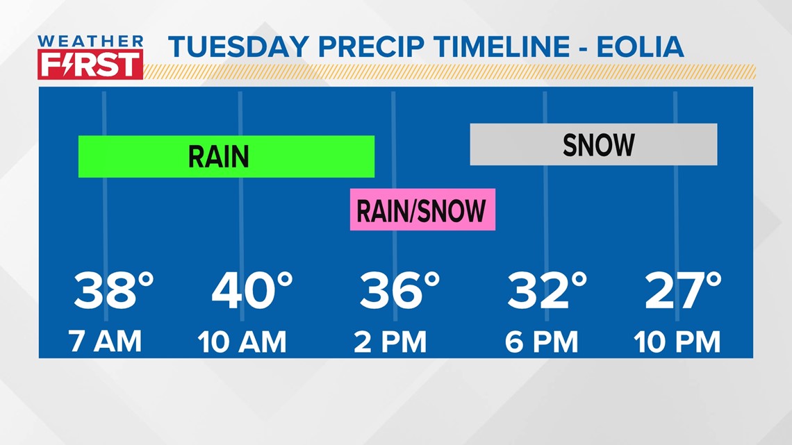
Further north, in the winter storm watch, we may see a quicker transition to snow, and colder air overall. That's why I expect snowfall totals a bit higher there anyway.

