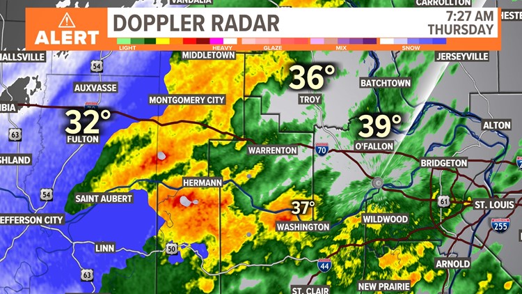
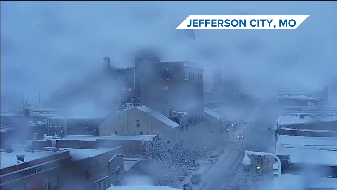
ST. LOUIS — Thursday has started off rainy for most of us and that rain is beginning to transition to snow. It is really coming down in central Missouri.
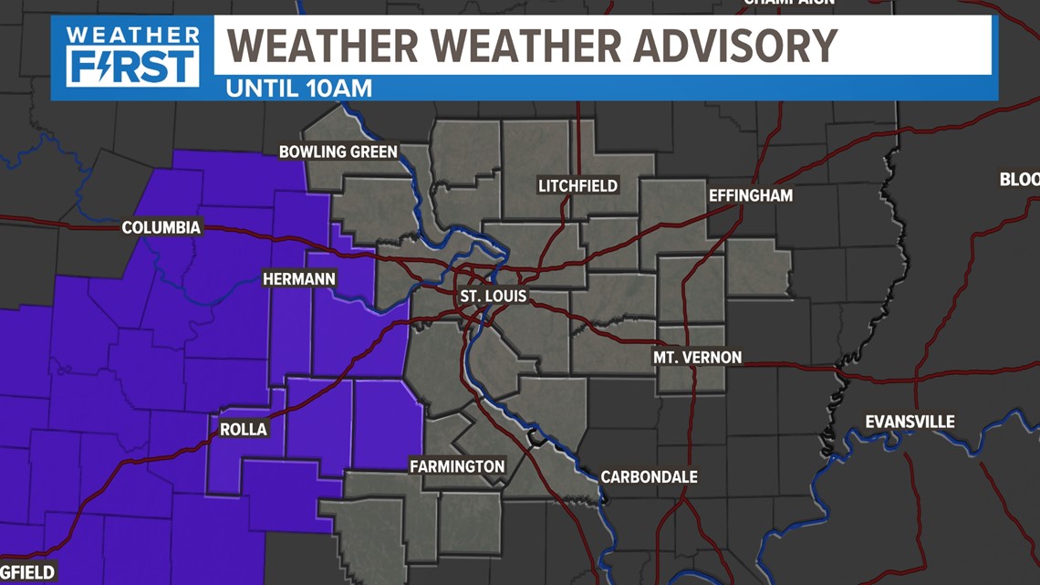
A winter weather advisory was in place until 10 a.m. While you'll notice most of our area isn't impacted by this, there are some very heavy bands of snow that are developing to our west.
Between 2-3 inches of heavy, wet snow has fallen as temperatures have hovered around 34 degrees. This is the reason for the winter weather advisory. We do not anticipate this will be an issue for any locations in the bi-state Thursday morning.


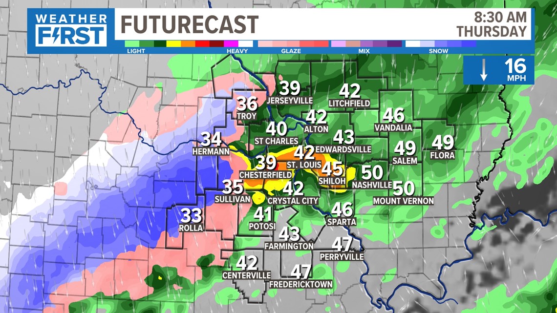
While temperatures are mostly above freezing in the St. Louis area, slightly colder air is already starting to move in, and there will be a possibility of some quick accumulations in the grass here.

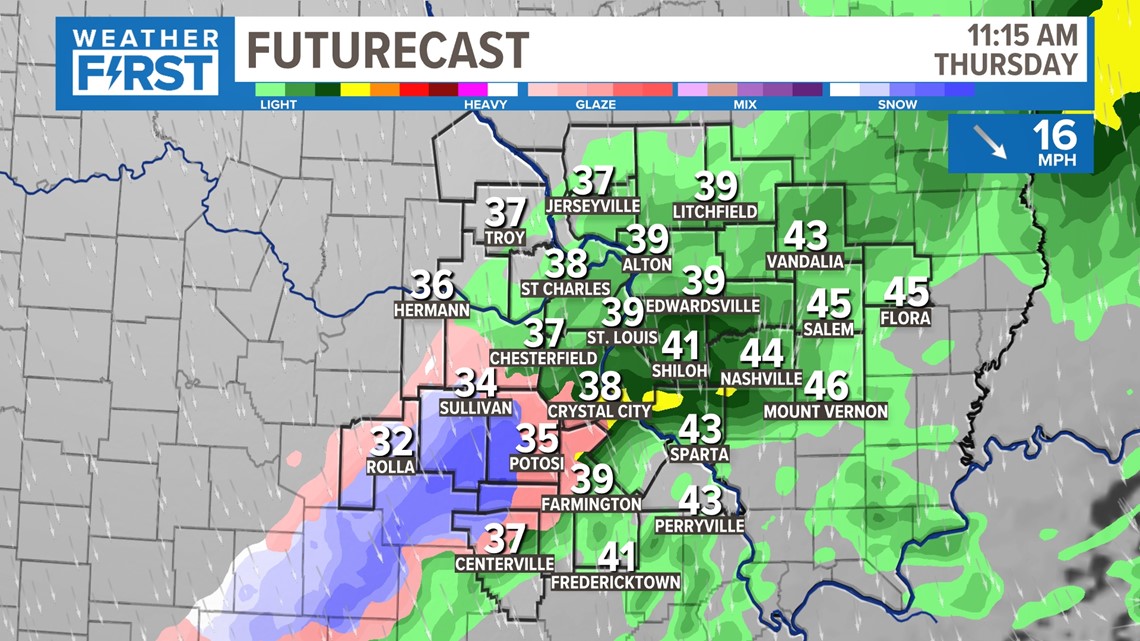
Colder air continues to move in before noon. Notice how a lot of this is still showing up as rain? It's likely flakes of snow will be mixed to some degree at this time. Areas southwest have the greatest likelihood of any accumulation in the grass or minor impacts, though.

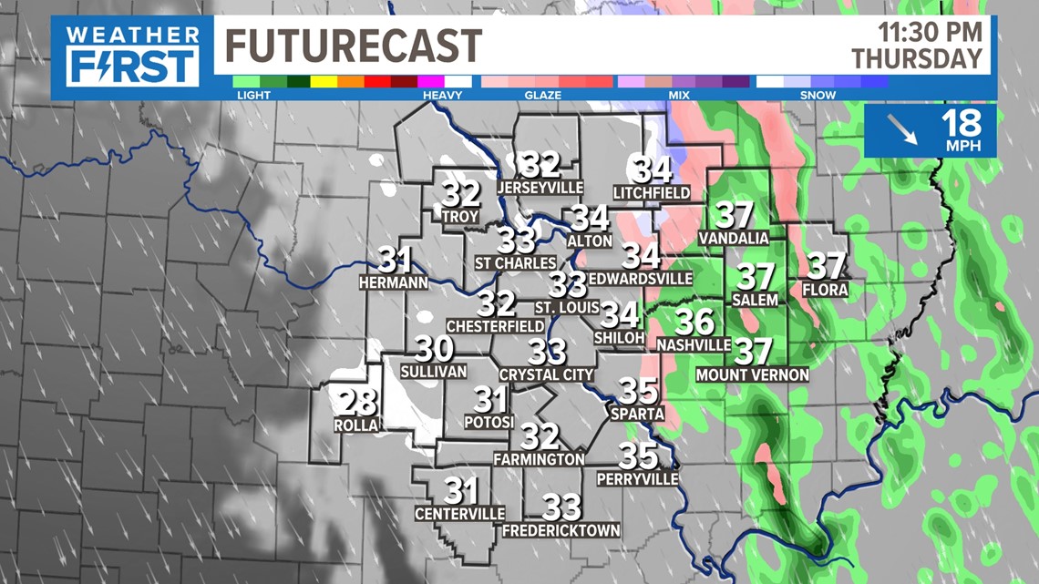
Later tonight, we may see a few light snow showers and flurries, but impacts will be minimal. Little to no accumulation is expected. Even areas that had it in the grass during the day can expect that to melt later in the day. Ground temperatures are still pretty warm.
To watch 5 On Your Side broadcasts or reports 24/7, 5 On Your Side is always streaming on 5+. Download for free on Roku or Amazon Fire TV.