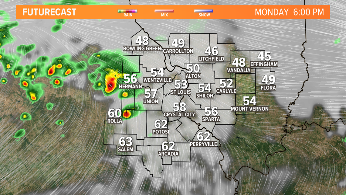
ST. LOUIS — The unsettled weather pattern continues across the middle part of the country this week. The mammoth storm system that has been impacting a huge swath of real estate from the Rockies to our area is trudging eastward Monday afternoon.
As the upper-level system moves in during the evening hours, a few showers and perhaps a strong storm or two will be possible. The favored area appears to be along and north of the Missouri River and along Interstate 70 heading east of the metro through the evening hours. The main severe threat appears to be hail, but the ingredients are available for some strong winds if the storms can tap into them.

While there will be a break in the weather traffic over us on Tuesday, clouds will be slow to leave and sunshine somewhat limited. However, Tuesday is expected to be dry.
Download the free 5 On Your Side app to get the latest watches and warnings and track conditions live with our interactive radar. Use the links below to download now.
5 On Your Side news app
iPhone | Google Play
It doesn't stay that way for long. Another impressive system will be pulling out of the Plains on Wednesday bringing with it more rain for our area.

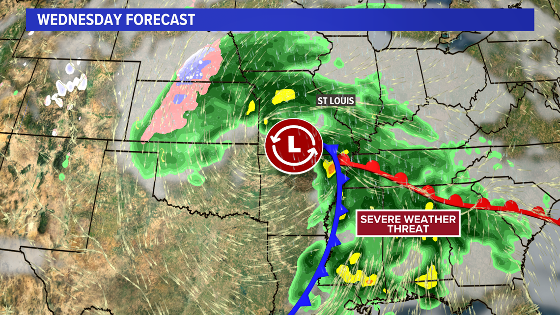
There is a threat of severe weather with this system, mainly along the Gulf Coast states.
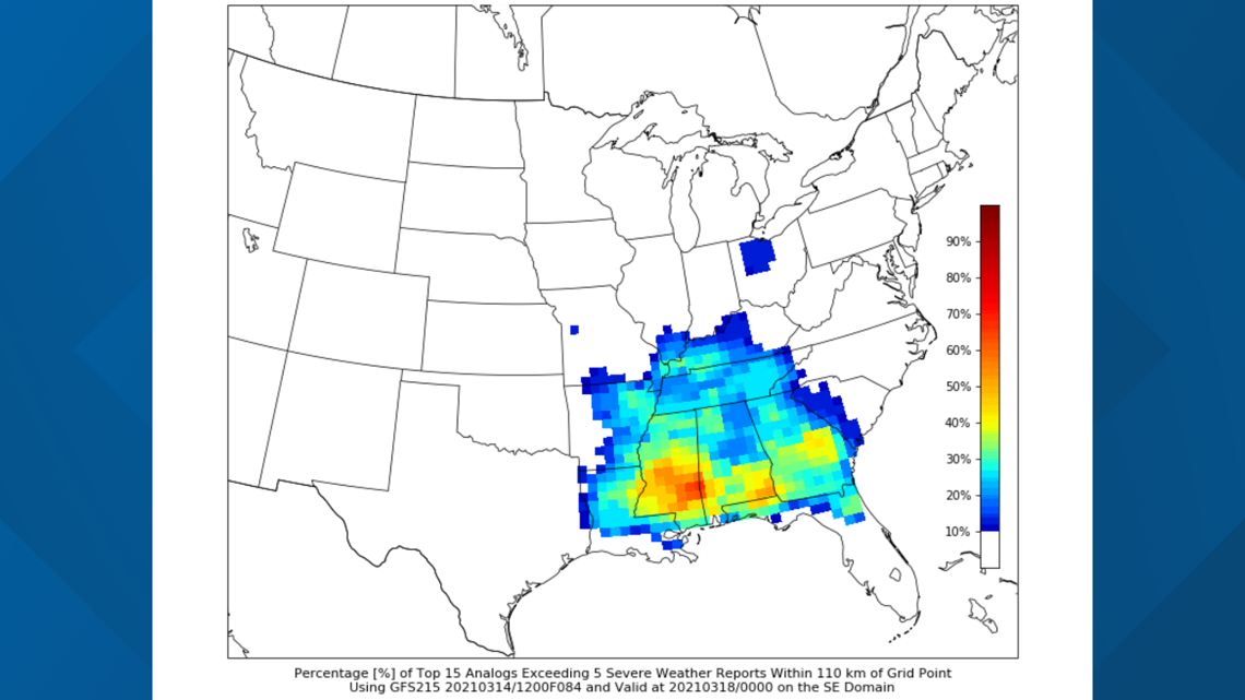
Analog guidance from Saint Louis University's Cooperative Institute for Precipitation Systems (CIPS) looks at similar weather patterns from the past and the impacts produced. The CIPS guidance indicates the greatest severe threat well to the south of St. Louis where the warmer, more humid air is expected to be.

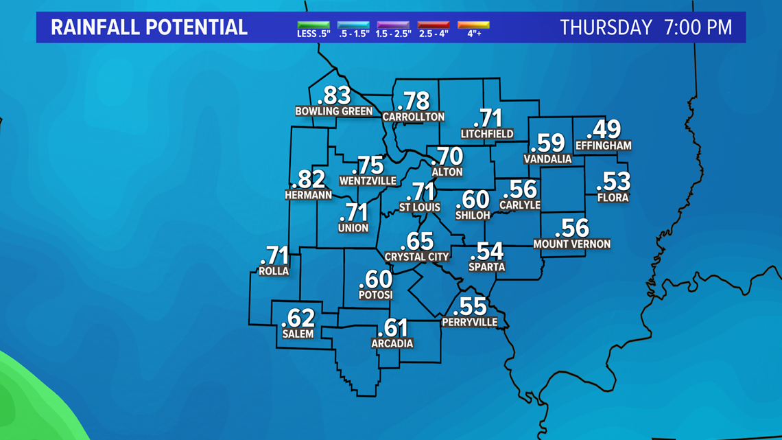
Areas of showers and embedded thunderstorms are expected to continue from later Wednesday into Thursday bringing an additional half-an-inch of rain or more to the area.

By Friday into the weekend, we should have an opportunity to dry out across the area. While temperatures will be at or perhaps a little below average by Thursday and Friday, a warming trend is expected by the end of the weekend.