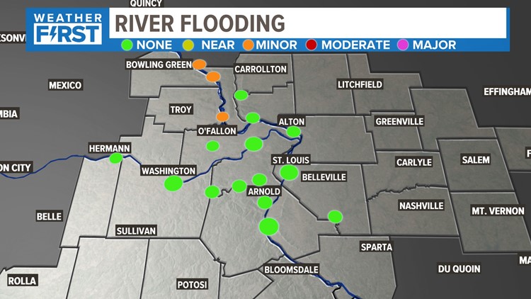
ST. LOUIS — It hasn't been particularly wet in the St. Louis area, especially for April standards. But we're starting to see a few of our major rivers upstream rise a little bit into minor flood stage, and climbing.
So, what gives? The northern snowpack is starting to melt and work its way into the tributaries.
This is nothing particularly new in this area, but it's perhaps magnified a bit because we didn't really have this problem last year. The upper Midwest was in a pretty significant drought, and if you'll remember, some of our river levels were at historically low levels. But several major snowstorms and rain events have brought those levels back up, and our flooding concerns are increasing in the major rivers.

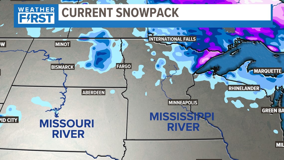
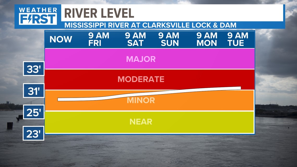
Most of the river levels that have been impacted so far are the areas north along the Mississippi River. As you'll note in the charts below, every specific area has it's own flood stage corresponding with a certain level in feet. All of these areas are currently in "minor" flood stage and only projected to rise over the next few days into "major" flood stage.


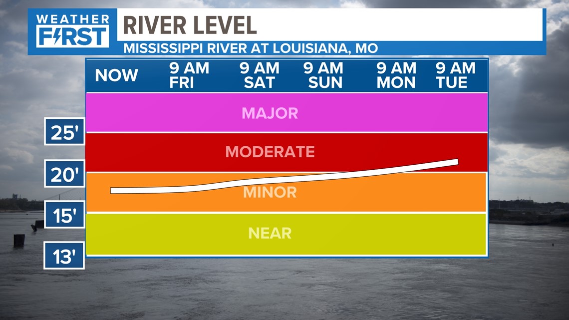

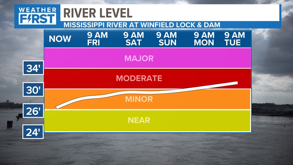
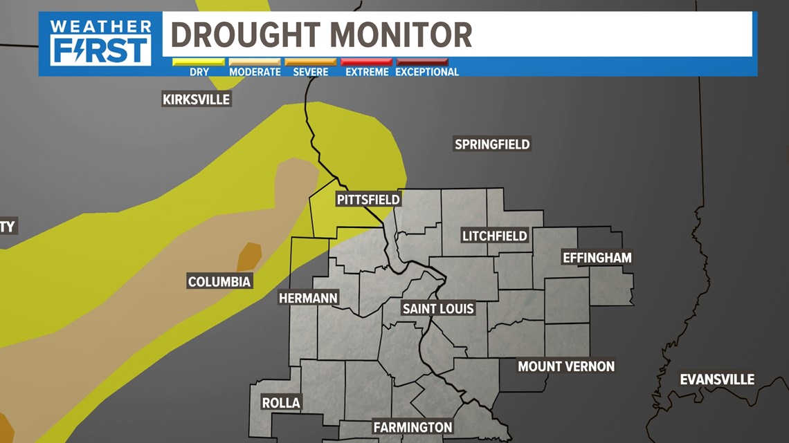
In a slight touch of irony, those same areas are actually under the first category of drought in the most recent update of the National Drought Monitor.
There have been many areas of rain locally of recent, but as we've often mentioned before, think about the higher sun angle and warmer temperatures.
Flash drought can occur very quickly in our area. We will continue to monitor this trend and the last from each of the rivers.

