ST. LOUIS — We started off the month of October on the chillier side! A well timed cold front has brought us some relief from the humidity and brief heat that we had for a few days to close out the month of September.
We started off this morning in the 30s and 40s throughout the entire area. Does this mean we have fully moved into fall? Well...to some degree.
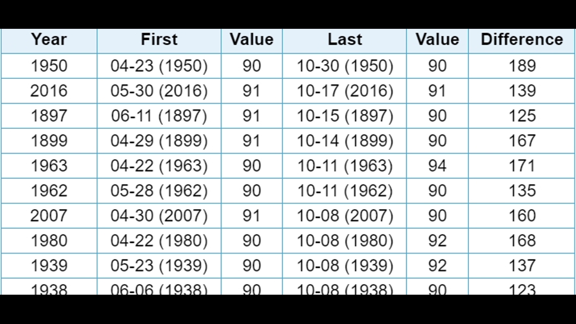
We are getting into the month where we don't see a TON of 90 degree temperatures. They obviously still happen, but the latest one we've ever had was the day before Halloween. Overall, we only have 15 days we 90 degrees or higher is a record high for the date. So if you're fed up with some of the more extreme heat, we are heading in a good direction for that this month.


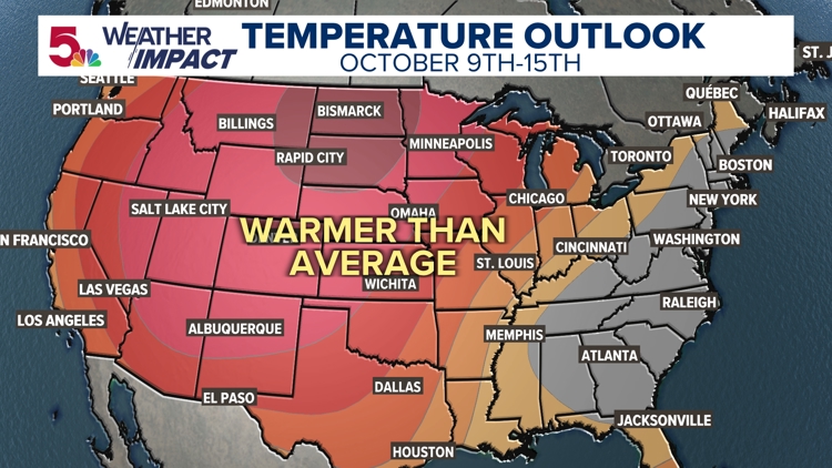
While I think we are likely done with 90 degrees for the year, I don't think that fully shuts the door on warm temperatures the rest of the year. We are going to see plenty of above average readings the next 2 weeks. Temperatures are still going to be in the mid 80s for a few days, I am just not expecting the extreme 90 degree temperatures.


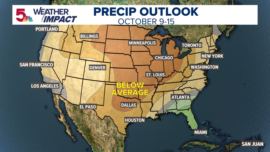
We are also going to be thankful that we actually got some rain the last few days, because there is no rain in sight over the next 10-14 days. Dry weather will continue to settle back in, with warmer than normal temperatures expected during this time frame as well.


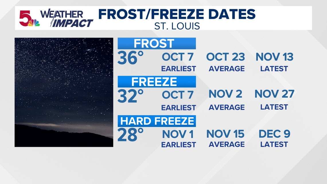
As far as turning the corner to fall when it comes to frost and freeze dates, this doesn't seem particularly likely to be an early frost or freeze, either. You can learn more about your area's particular frost and freeze dates in the Weather Impact Fall Outlook.


