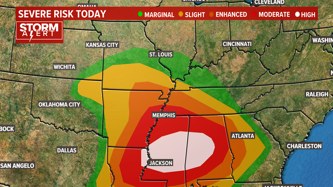
ST. LOUIS — A springtime pattern is leading to the threat of severe weather across parts of the Bi-state region into the deep south for St. Patrick's Day. Warm, humid air will be drawn to the north from the Gulf of Mexico as this system moves the Plains into the southeastern U.S.
The energy for this system was located over Oklahoma Wednesday evening and will move to eastern Tennessee by Wednesday evening.
The combination of the energy, strong winds aloft and the warm, humid air is expected to initiate strong to severe storms during the day Wednesday across parts of Missouri into Arkansas and Louisiana.
The storms will then move into Mississippi, Alabama and western Tennessee into the overnight hours. Nighttime tornadoes are among the most dangerous since many are sleeping while the storms approach.

Across the 5 On Your Side area, the first wave of rain has moved on after dropping around a half an inch of rain in the metro area and providing a few of us with some small hail.
Download the free 5 On Your Side app to get the latest watches and warnings and track conditions live with our interactive radar. Use the links below to download now.
5 On Your Side news app
iPhone | Google Play
Later this evening, another round of stronger thunderstorms is expected to develop and move northeast through the area. These storms will also have a wind threat along with the hail chances for our far southern counties.
Latest High-Resolution Forecast:
It appears the threat for isolated tornadoes will be across far southern Missouri where the warmer, more humid air will be found. Locally, the area of greatest concern will stretch from a line just south of Farmington to Rolla, Missouri. The threat increases as you move farther south toward the Arkansas state line.
During the late evening and overnight Wednesday, the threat area will shift more into Alabama, Mississippi and Tennessee where intense storms will likely continue to produce tornadoes, damaging winds and some hail.
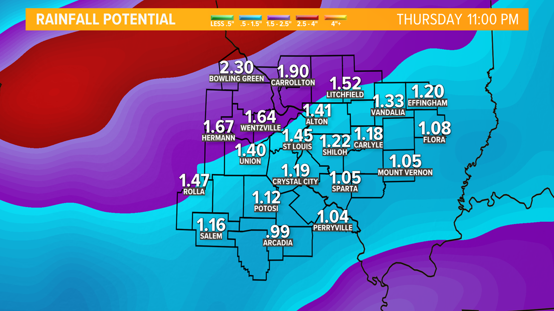
Thursday will bring cooler temperatures in the 40s during the afternoon and periods of rain and showers and gusty winds as the severe threat shifts to the southeastern U.S. As the rain finally comes to an end Thursday evening, another 1-2 inches of rain will have fallen across the area.

Finally, dry weather will return for Friday into the weekend.