
ST. LOUIS — Despite a warmer and drier than average autumn, the fall color around St. Louis did not disappoint. Now that the leaves are falling, it’s time to look ahead with the Weather First winter weather outlook.
Even with a brief cold snap arriving before Halloween, the cold didn't last. That is likely an indicator of how this winter plays out.
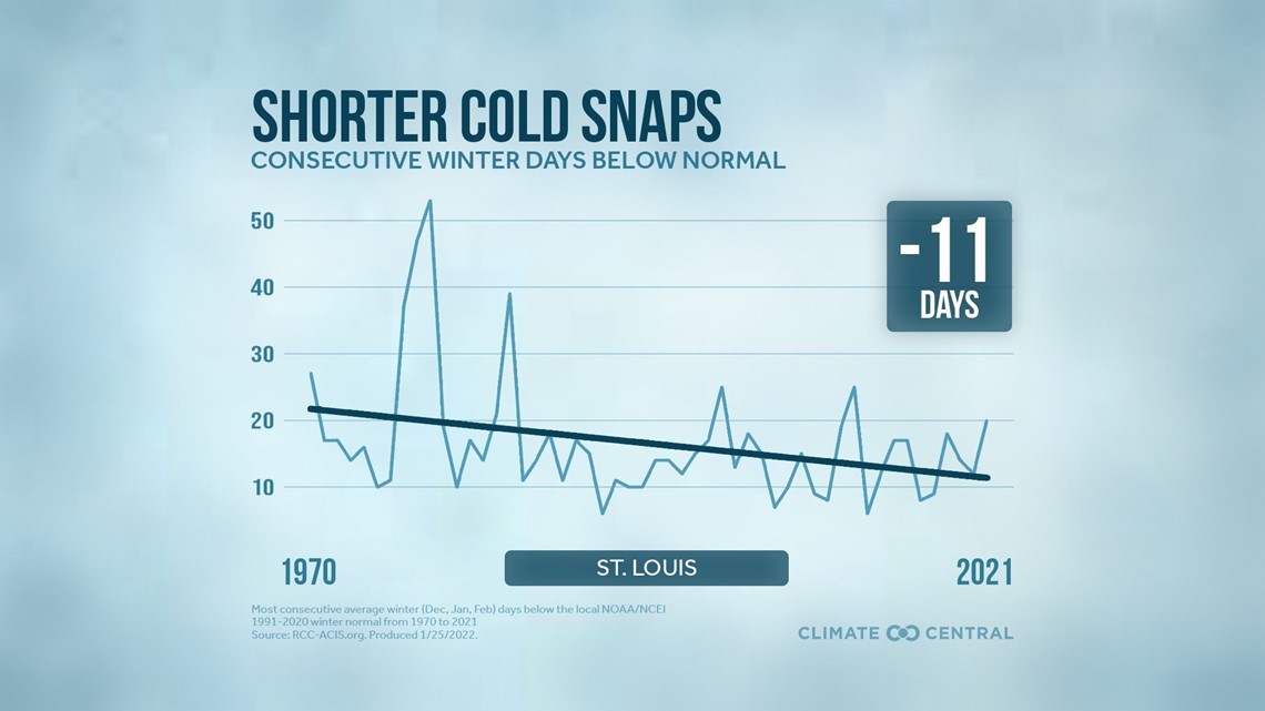
The tendency for lengthy cold snaps has been decreasing over the last 50 years, according to Climate Central Chief Meteorologist Bernadette Woods Placky. We still get an arctic blast from time to time, but the frigid air tends not to linger.
"We're still going to get winter. It's just changing as things warm around the globe, and the way we're seeing that play out in Saint Louis is sort of shrinking our winter season" Woods Placky said.

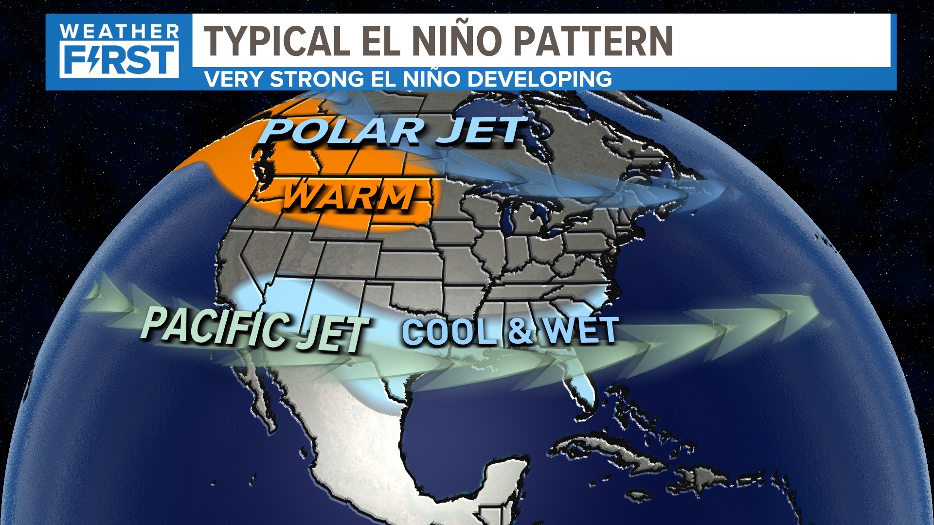
After three winters with a La Niña pattern in the Equatorial Pacific Ocean, the water there has now warmed. El Niño has developed and it's getting stronger. The Pacific Ocean holds clues to the larger climate patterns that drive seasonal weather.
El Niño patterns don't show a trend locally, according to University of Missouri atmospheric scientist Dr. Tony Lupo.
"When you have these very strong, what we call 'classic El Niños,' that tends to have a very strong signal in the northern tier of states where things are well above normal temperature-wise and well below normal precipitation-wise," Lupo said. "And then in the southern tier of states, you get the opposite pattern. A little bit below normal temperatures and wetter conditions."
There have been eleven strong or very strong El Niño patterns since 1950. In St. Louis, some have been wetter than average while some were dryer. Some were warmer than average, others, not so much. In most of those eleven years, snowfall was a little off the average.
"I-70, Columbia and St. Louis are right in that middle ground between the 2 strong signals, so depending on the shape of the El Niño in the Pacific itself and the jet stream's ultimate pattern or how it settles," Lupo said. "And in the United States, that's going to govern whether we get more snow or less snow."
One wild card this year in addition to El Niño in the Pacific was sea surface temperatures elsewhere around the world warming to levels never observed this summer in many areas. This could be a bit of a wild card in the winter ahead.

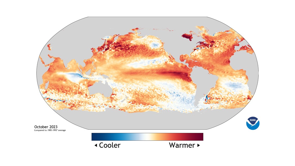
"We're an ocean planet and, so, when we see our weather patterns move around the world, they're really affected by what's happening in the ocean," Woods Placky said. "So, as we had all of that extra heat that drives our weather patterns in some new ways. Now, how that's going to play out exactly for St. Louis this year I'm not quite sure, but we know that it does supercharge a lot of our weather patterns." She also said this in an area of research that is ongoing.
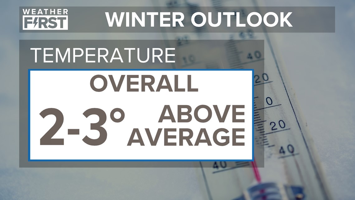
With all that unusually warm water, temperatures will be warmer than average in St. Louis. Cold air will depend on the polar vortex delivering the cold air to our area. When it does, it probably doesn't last for any length of time.
Odds favor the coldest weather this year during January into February, but still warmer than average overall.

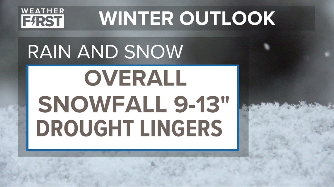
We must have the cold air available and a favorable storm track for us to get snow or ice in St. Louis. We'll likely see more snow than last winter since only around five inches was measured last winter. Overall though, near-average or a bit below-average precipitation can be expected.
The best chance to see improvement in the drought conditions across the bi-state area would be in southern Missouri and southern Illinois, Lupo said. Those areas are closer to the regions that tend to see above-average precipitation.
Our winter forecast gives a hat tip to next year’s Muny schedule: Anything Goes.
Don’t discount the possibility of an impactful winter storm, especially during January into February. But our snow chances look limited again this winter. The 30-year average snowfall for the season, November through April, is 16.6 inches.

As always, we have to keep a severe weather eye out for any volatile weather patterns. Any abnormally warm and humid weather could take advantage of seasonably strong winds aloft to create intense thunderstorms.
Top St. Louis headlines
Get the latest news and details throughout the St. Louis area from 5 On Your Side broadcasts here.