

ST. LOUIS — When it comes to forecasting what sort of weather this winter will bring, there's science, and then there's folklore.
Scientific forecasting
One of the patterns meteorologists look for is driven by water temperatures in the central Pacific Ocean along the equator.
If the sea surface is cooler than normal, it's referred to as La Nina. Warmer than normal sea surface temperatures lead to El Nino. These changes in the water temperature usually last several months and can drive the weather patterns that impact us.
In typical El Nino years, extreme cold weather is limited with the polar jet stream spending much of its time farther north and an active Pacific jet stream keeping the deep south cooler and wetter than average.
If cold air happens to be over us, that southern storm track can spread a wintry mess into the region, but we often miss the storms as they slip by to our south.
In La Nina years, the Pacific jet is much farther north and doesn't come into play for us as much. That can limit the amount of true arctic air that can get to us and we may be a little wetter than average.

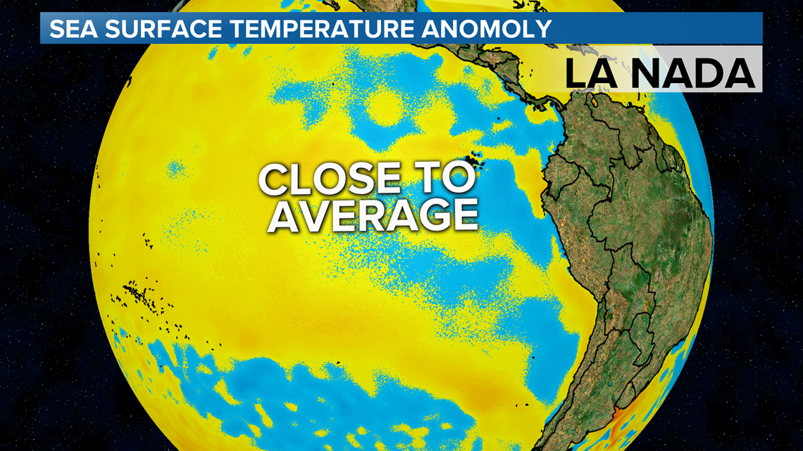
So back to the tropical Pacific to look at the water temperatures, there was a weak El Nino signal late this summer but that appears to have faded --- so it's basically neutral. Or, as some say, La Nada.
Jim Sieveking with the National Weather Service in St. Louis says “there isn't anything that's really driving the weather patterns" for this winter.
And that usually leads to big swings on the thermometer and only if we can get the cold air in place will we have big snows-and odds are we aren't going to know too far in advance this year.
Sieveking said one of the things we will look to for cold air is the Arctic Oscillation. "The arctic oscillation can determine, maybe one to two weeks in advance, if we're going to get a really cold spell in St. Louis".
That's what happened on Veterans Day as we've already seen an active southern jet stream create problems with the cold air in place. With the cold start to November, temperatures are well below average, but even with the colder than average November, that's not a clear sign for the next three months.
"There really doesn't show any type of pattern when you have a cold November," he said.
Sieveking looked at the 20 coldest Novembers on record and it was about a 50/50 split on both temperature and snowfall.

Folklore predictions
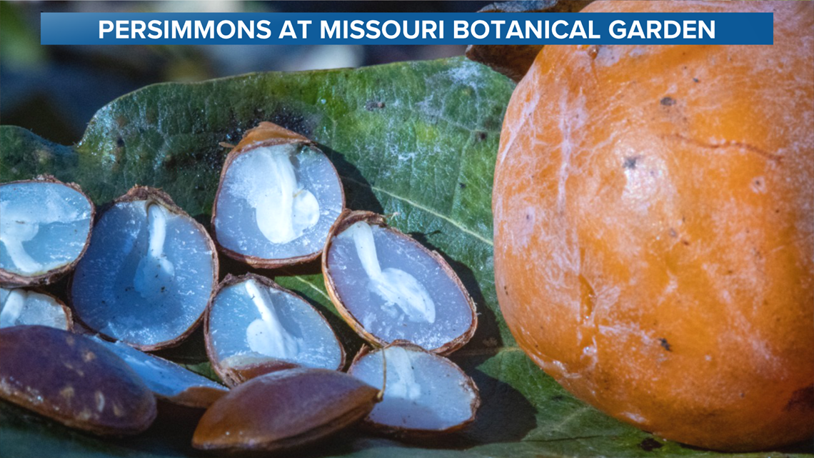
A photo of the persimmon seeds from the Missouri Botanical Garden on Facebook shows all spoons, and most of you said you had spoons too. Legend has it that means a snowy winter.
I'd say the persimmons are best in pudding, not prediction.
Finally, the woolly worms are snuggling into their winter hideouts. Listen, woolly worms are tough. They can survive temperatures down to 90 below zero and still develop into a tiger moth in the spring. Legend has it that the thickness of the band of orange might give insight into the winter ahead. Entomologists have studied this and yes, the more orange, the earlier it started chowing down. But that tells us about the previous winter!
The bottom line
Veterans Day was a good example of the active southern jet stream creating problems when cold air is available. Since the southern storm track is already active, there's a good chance we will have at least one decent snow of more than six inches this winter. Overall snowfall will likely be near average.
We will have our cold times too, but a prolonged period of extreme cold doesn't seem likely. Our bet is that temperatures will end up close to average by the time the leaves start budding out on the trees.