ST. LOUIS — The complex upper-level pattern will continue to evolve over the next 24 hours. Colder air will work into the backside of the system providing an opportunity for accumulating snow for portions of Missouri, Illinois, Iowa, Indiana, Michigan and Ohio.
As the snow showers become more widespread into early Wednesday, accumulation is expected to begin, especially on grassy areas.
The snow will mainly come this morning until around 10 a.m. for the St. Louis metro area and could linger as late as noon or early afternoon. The heaviest, steady snow will come until 9 a.m., and after that things will start to lighten up and snow ends by the afternoon for most of the area. On the Illinois side this evening, snow will stick mainly to grassy and elevated surfaces.
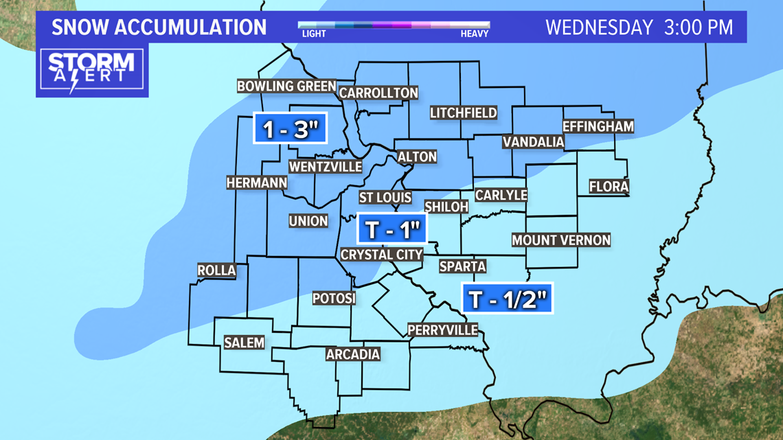
Totals on grass will range from trace amounts to 2 inches.
It will be cold Wednesday and Thursday, in the 30s. Thursday night into Friday there will be another round of light snow and/or sprinkles, which should amount to just a dusting for some.
The weekend looks bright and warm again -- in the 50s Saturday and a few 60s for Sunday.
RELATED: Live interactive radar
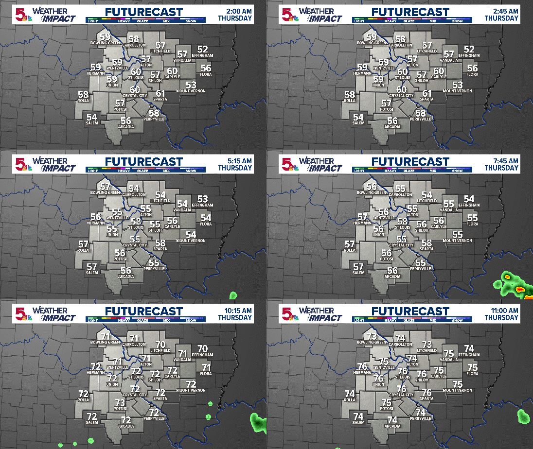
High Resolution Futurecast for the next 12 hours:

Download the 5 On Your Side app to track the wintry weather with radar and get the latest updates for your area:
5 On Your Side news app
iPhone | Google Play
Even as the snow falls, the ground remains relatively warm, from 40° to 45° which could eat into the amount of snow that can accumulate. With the cold air generally lacking and the warm ground, accumulations should be limited to mostly grassy or elevated areas. The exception to that may be farther north and northwest of St. Louis where temperatures drop just below freezing by early Wednesday.
A winter weather advisory is in effect for a good portion of the area, including the metro St. Louis area, overnight into midday Wednesday. The biggest impacts will likely occur during the morning rush hour Wednesday.


Accumulations will range from nearly nothing southeast of the metro to perhaps 2 or 3 inches near Bowling Green, Missouri.
Gusty winds will drive wind chills into the teens and 20s Wednesday afternoon as the snow showers pull away from the area.

