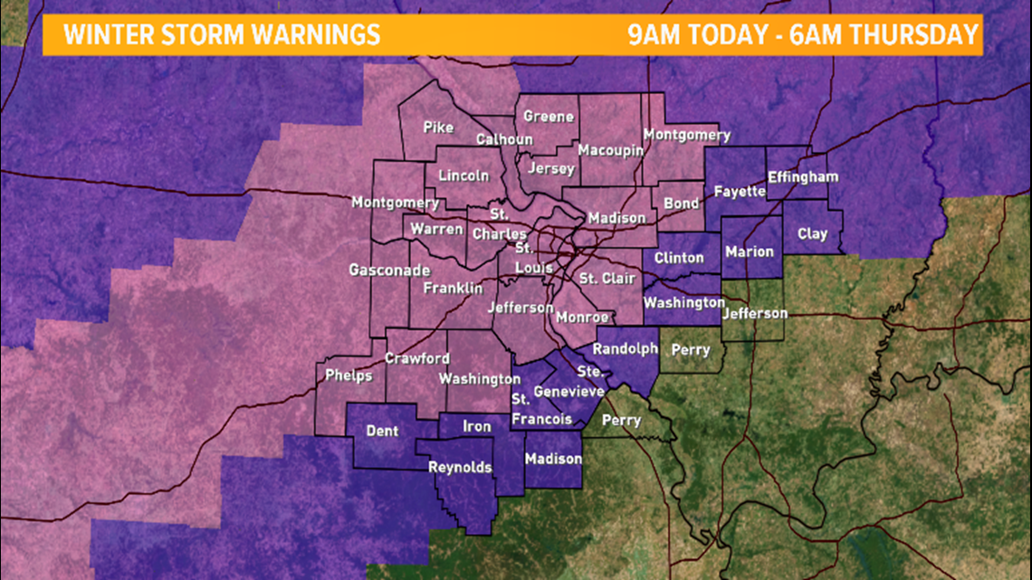
ST. LOUIS — A winter storm warning goes into effect Wednesday morning at 9 a.m. and will stay in effect until Thursday at 6 a.m.
Overnight we had some rain, but elevated surfaces may have frozen over this morning as our temperatures are right near freezing.
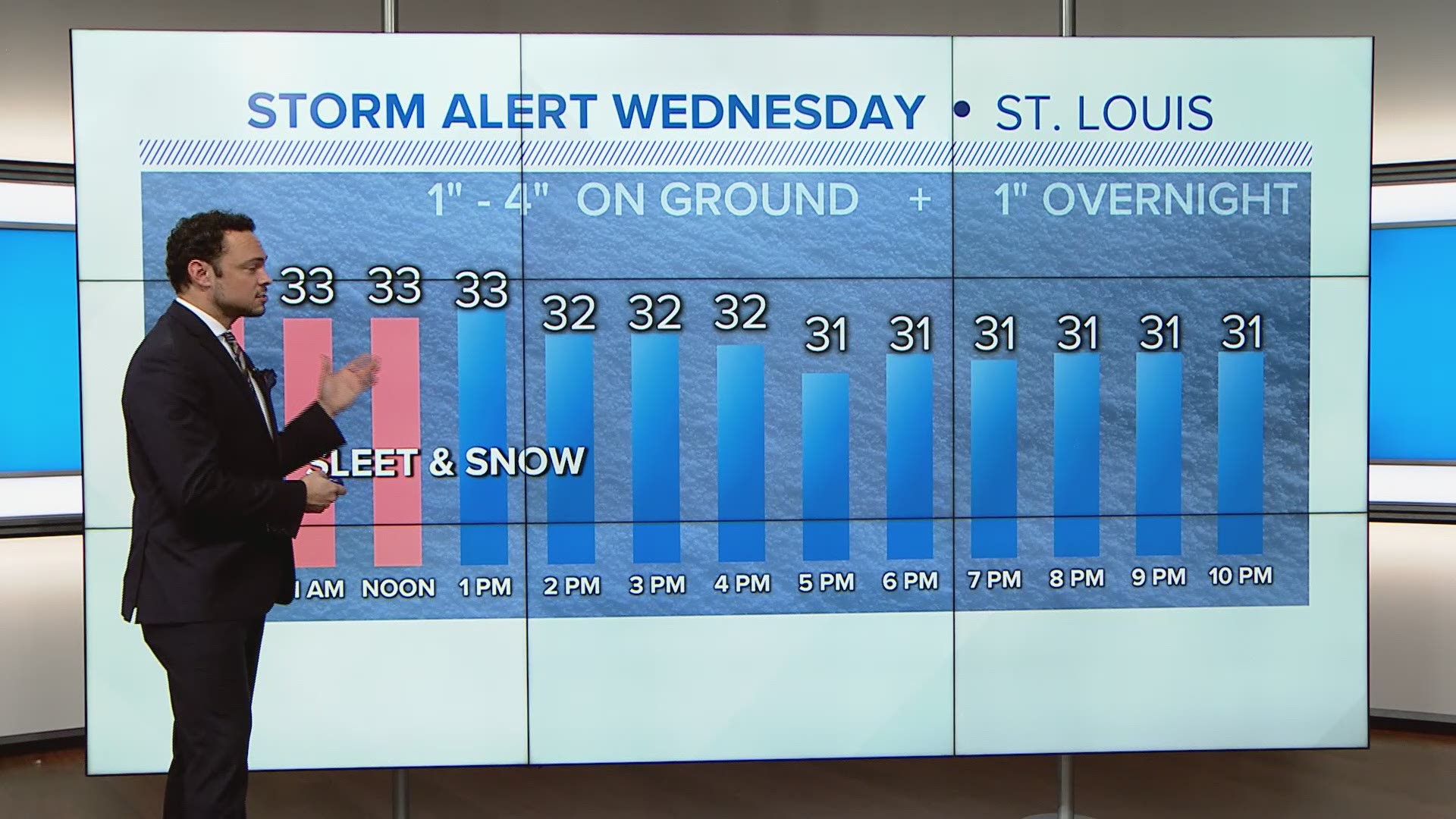
Snow and sleet will begin to fall just after 9 a.m. and continue through the day with the largest impact on the Wednesday evening rush hour.

Snowfall rates could top 1 inch per hour at times today, especially around or just after lunchtime. Snow totals will vary greatly with this system with some places picking upwards of 4-6 inches of snow west of St. Louis.

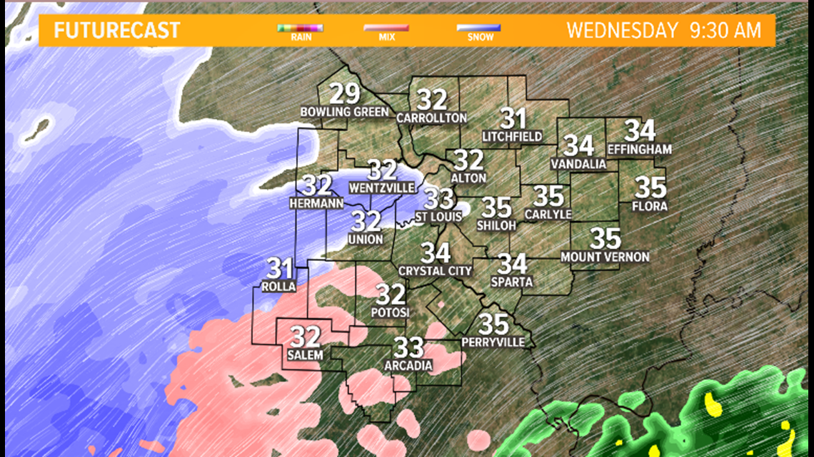
In the St. Louis metro, places in north county could see upwards of 2-4 inches while areas in south county only get 1-2 inches.

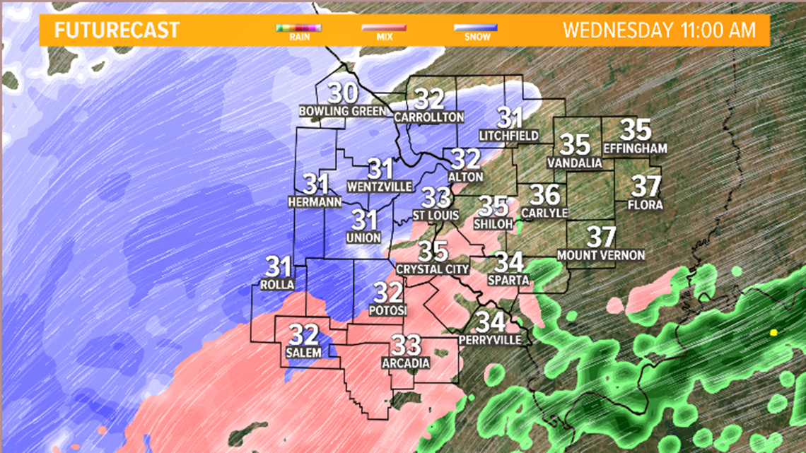
There will also be a great deal of sleet with the snow today. In fact, some locations could see up to 1 inch of sleet along with the expected snow. East and south of the St. Louis metro area, snowfall will be minor with only a dusting to 1 inch expected. These locations will see more a wintry mix with lesser impacts.

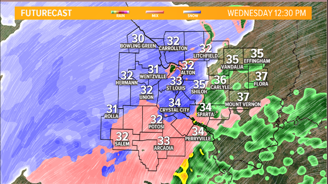
Temperatures will hold steady near freezing all day as the snow and sleet fall, so icing and slick spots are a concern. Winds will also gust from time to time, up to 20-30 mph, reducing visibility.

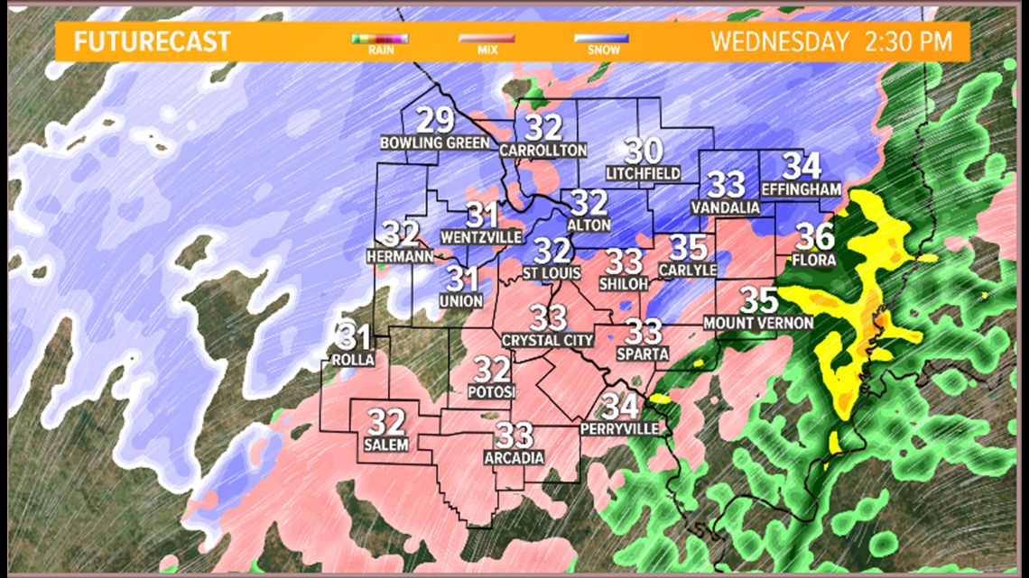
Snow should come to an end Thursday morning with snow totals for the St. Louis metro ranging from 1–4 inches. West of St. Louis there is potential to see upwards of 4–6 inches. Travel during the afternoon today is highly discouraged.
Bookmark these links to get the latest updates during the winter weather:
Download the 5 On Your Side app to track the wintry weather with radar and get the latest updates for your area:
iPhone | Google Play

