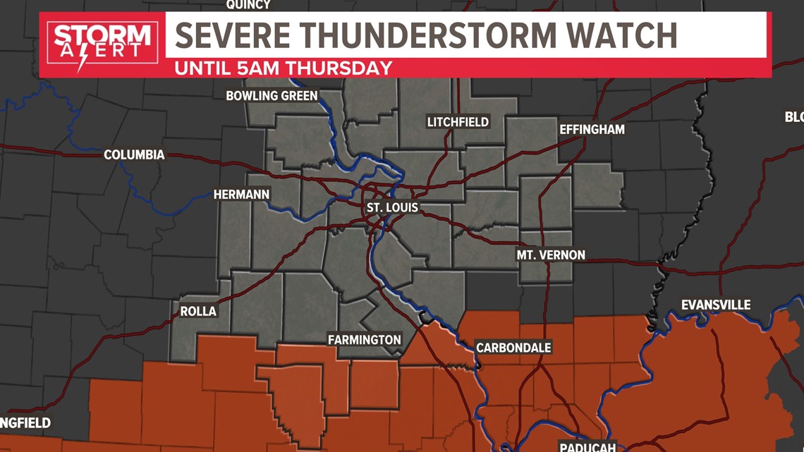
ST. LOUIS — A severe thunderstorm watch is in effect for southern Missouri and southern Illinois until 5 a.m. Thursday morning. This includes Iron, Madison, Perry and Reynolds counties in Missouri. Some storms closer to the Arkansas border may have gusty winds and hail up to the size of quarters.


A frontal boundary moved just south of the St. Louis area Tuesday creating the large contrast in afternoon temperatures. Areas north of St. Louis saw highs in the 50s and areas south warmed near 70. That boundary has sagged ever farther south late this evening. Warm, more humid air to our south is being lifted north over the boundary creating showers and some thunder.


The greater chance of seeing strong winds or large hail is to the south of the boundary. This includes the Arcadia Valley.


Elsewhere scattered showers and some thunderstorms are expected to continue moving northeast through our area. The timing of the best rain chances is through daybreak.


On the northern side of this system, winter weather is a concern. The cold air has moved into northern Missouri and northern Illinois. Here, a wintry mix of freezing rain, sleet and snow will transition to mostly snow by Thursday morning.
Download the free 5 On Your Side app to get the latest watches and warnings and track conditions live with our interactive radar. Use the links below to download now.
5 On Your Side news app
iPhone | Google Play


To watch 5 On Your Side broadcasts or reports 24/7, 5 On Your Side is always streaming on 5+. Download for free on Roku or Amazon Fire TV.
Winter storm warnings stretch from Kansas and Nebraska into northern Missouri and Iowa through southern Wisconsin and northern Illinois. Travel will be problematic in these areas. For St. Louis, as the colder air filters in during the day Thursday, a few flurries are possible during the afternoon. Any accumulating snow will be out of the 5 On Your Side area.


