

ST. LOUIS — The Storm Prediction Center has our area outlined for a marginal and slight risk for severe weather Tuesday night until 6 a.m. Wednesday morning. Most storms will just produce rain, lightning and thunder and move on, but there is a risk of one or two of those storms producing gusty winds. Storms should clear around or just before sunrise Wednesday morning with dry weather returning and lower humidity levels.

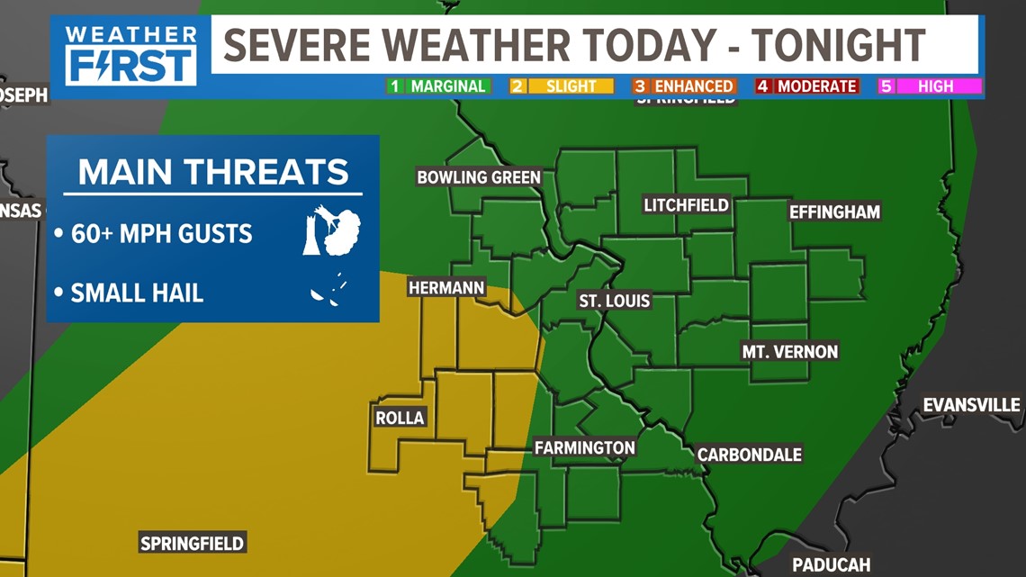
The main severe weather threat looks to be south of the immediate metro area.

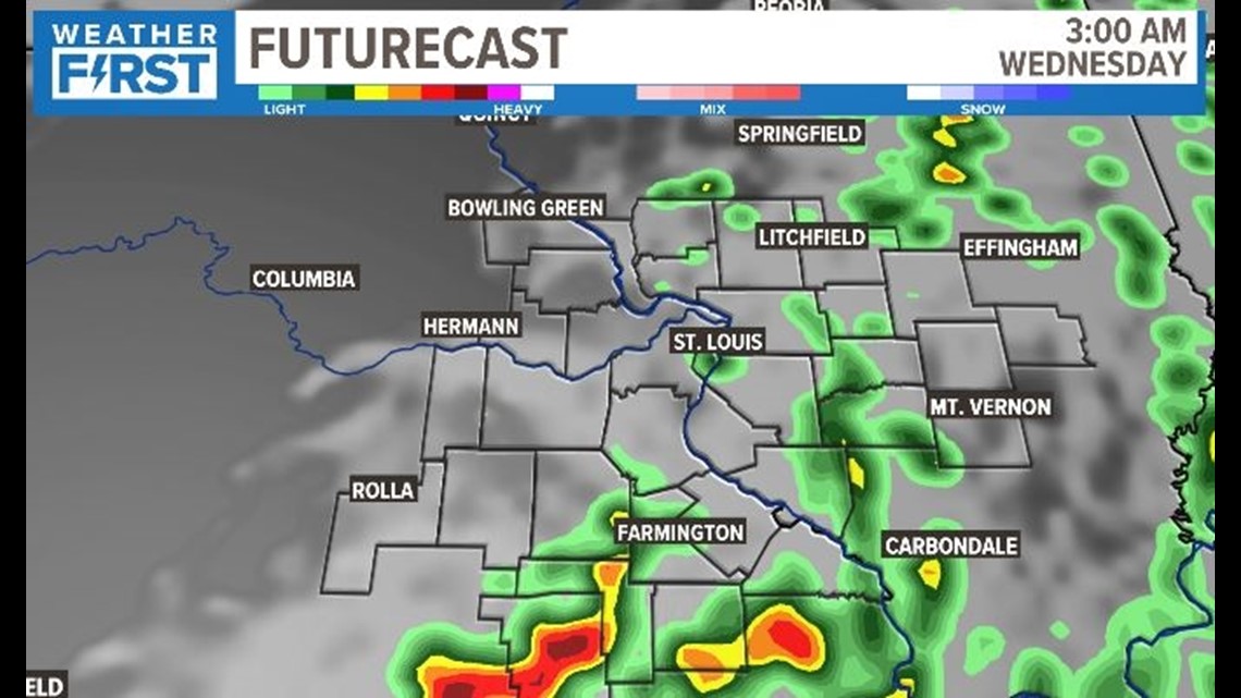
As the storms push east into Illinois, they are expected to weaken and fall apart. Severe weather is not anticipated east of St. Louis.

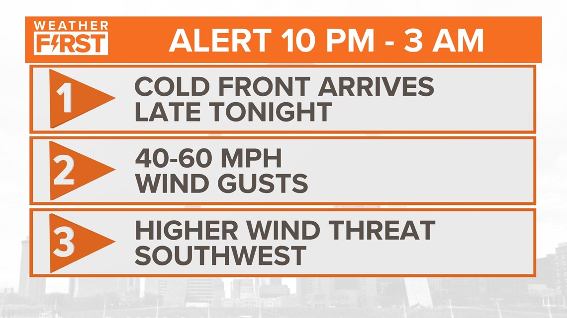
The remainder of tonight is an Weather Alert for 40-60 mph wind gusts possible overnight. As that cold front arrives, we will expect a few loud storms overnight, even if they aren't severe. Wind gusts could create some isolated damage or power outages, depending on storm development. The better chance for this to occur is southwest of our area.
Quiet weather awaits us for the rest of the week with high temperatures in the mid-80s with comfortable humidity levels.