ST. LOUIS — After pockets of heavy rain moved through the Bi-State region on Tuesday, we finally had a chance to dry out on Wednesday. The break in the rain is short-lived though, as more showers and storms chances return on Thursday.
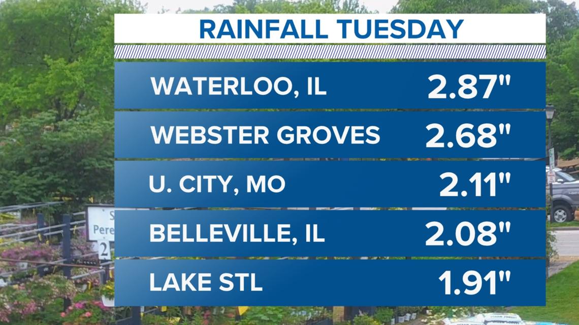
After weeks of rainfall and severe weather, our pattern continues to remain damp. In fact, just yesterday alone some of the storms that formed put down more than two inches of rain in just a few hours causing some urban flooding, especially in the flood prone areas in the metro east.
Download the free 5 On Your Side app to get the latest watches and warnings and track conditions live with our interactive radar. Use the links below to download now.
5 On Your Side news app
iPhone | Google Play

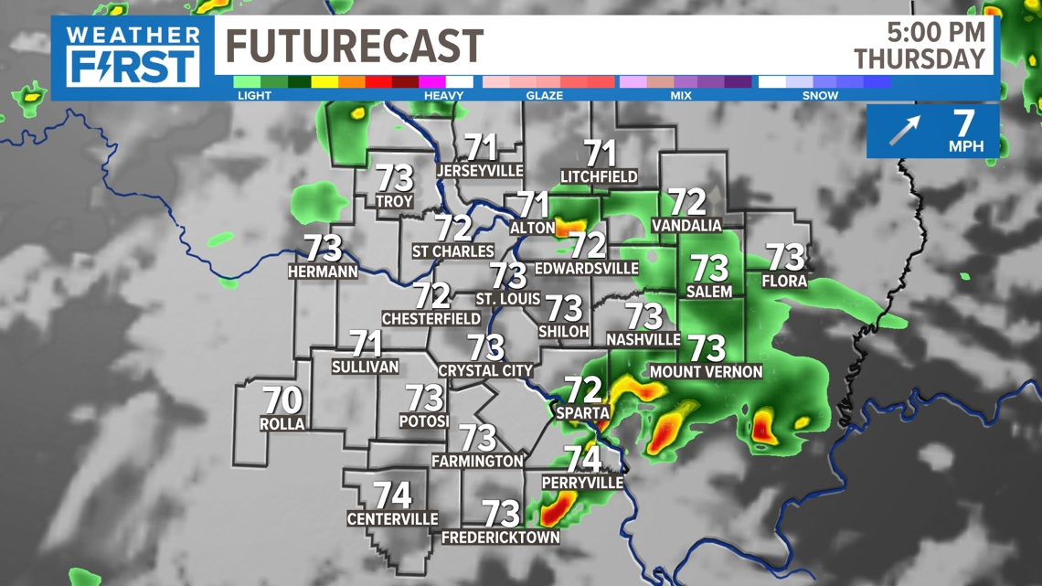
Thursday, additional showers and storms are forecast to move through the area with a few pockets of heavy rain embedded again. While the severe weather risk is low, it's not zero. Right now, the Storm Prediction Center has the 5 On Your Side viewing area outlooked for a level 1 risk (marginal).

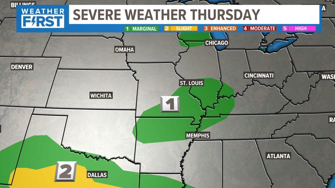
Widespread severe weather will not happen anywhere near St. Louis. However, one or two storms could reach severe criteria during the afternoon on Thursday.

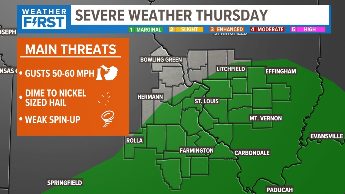
Hail up to the size of a nickels and perhaps a quarter size. gusty winds of 50-60 m.p.h. and a brief spin-up tornado are all possible.

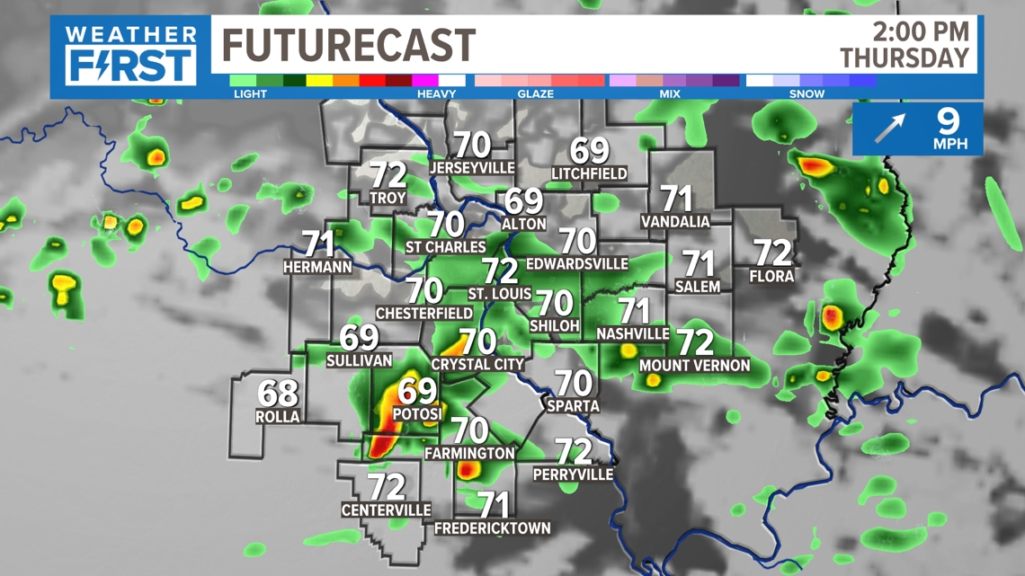
Scattered showers are forecast to begin in the morning. As that areas fades, isolated, heavier and potentially stronger storms are expected to develop during the afternoon. While not everyone will experience stormy weather on Thursday, we'll all feel the added humidity through the weekend.

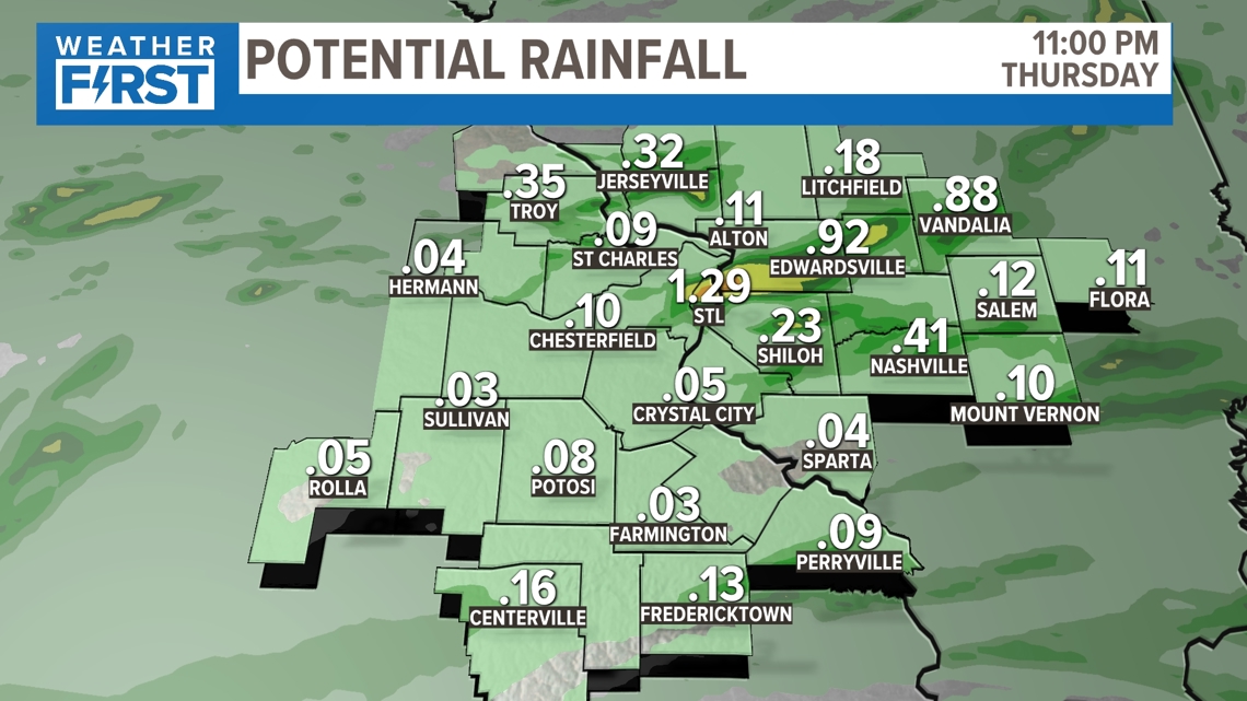
Along with the limited severe weather risk, there is a localized risk of flash flooding because the storms will put down some very heavy rain in a short amount of time and our ground is now saturated from weeks worth of rain. Forecast models are generally showing .25" - .75" of rain in most spots, but where storms form models are showing over 1" of rain coming.

Make sure you alert to any changing weather conditions through the day on Thursday. The storms shift southeast of St. Louis on Friday and the weekend turns hotter and dry with mid to upper 80s expected.
The Weather First Team will use "Storm Alert" to refer to life-threatening or major-impact weather conditions in our region. "Weather Alert" refers to nuisance or disruptive weather and is indicated by orange icons and bars in our weather graphics on TV and online.