ST. LOUIS — 11:05 p.m. - The severe thunderstorm watch over southern portions of Missouri and Illinois is canceled early. Noisy storms continue to move east-northeast, but they remain below severe limits.
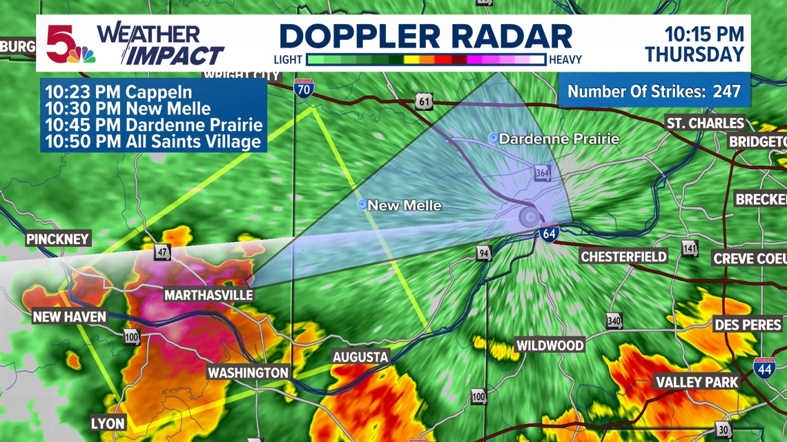
10:15 p.m. - Our first severe thunderstorm warning in a while comes from Franklin, St. Charles, and Warren County until 11 p.m. mainly for up to quarter-size hail, but perhaps we are getting some 40-plus mph wind gusts.

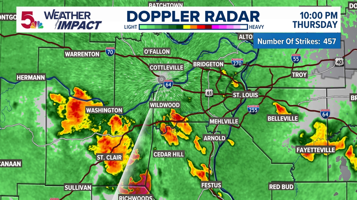
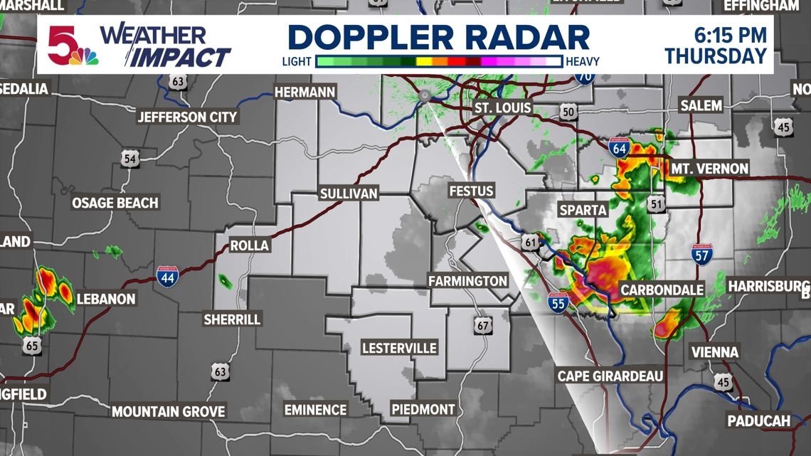
10:08 p.m. - While none of these storms are severe, they are still producing some heavy rain and frequent lightning. Wind gusts between 40-50 mph are possible right now, but that would be on the higher end for the most part. You're likely seeing lightning in the distance in many cases, but not hearing any thunder.

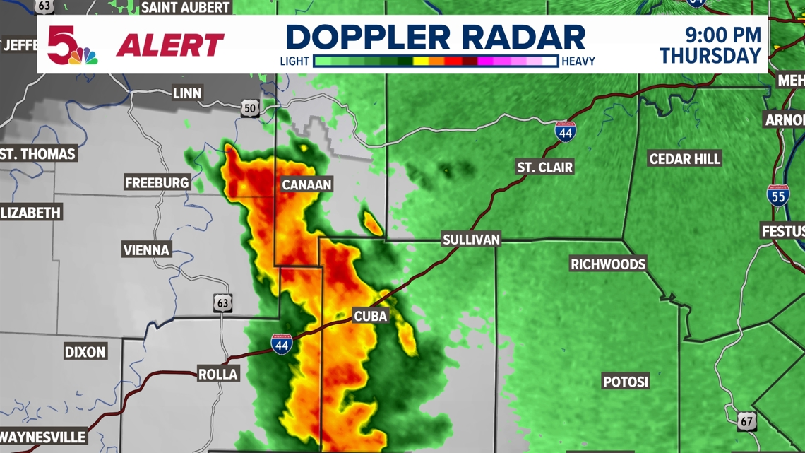
9:09 p.m. - This particular storm that's moving through Cuba right now has produced 43 mph wind gusts, but that's still a ways away from being severe. We will still monitor this as it continues to move northeast.

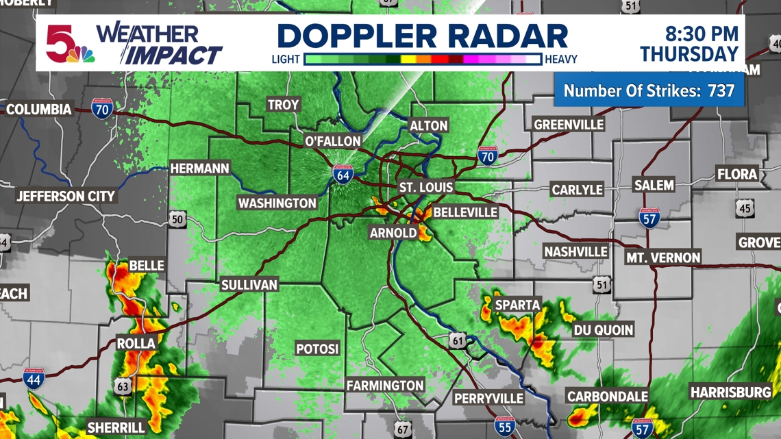
8:41 p.m. - A few storms are starting to pop up in the immediate metro area. Nothing severe just yet, but there is a line to the southwest that is moving to the northeast. This will impact more areas the rest of the night. We will see how the severe weather threat plays out. This is looking lower at the moment.


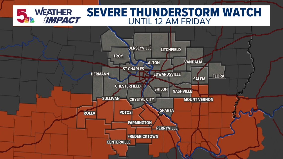
6:10 p.m. A severe thunderstorm watch is in place for our southern counties until midnight. This is due to a boundary that is south of I-44 that is going to be (and is currently) the source of thunderstorm development.

Storms are firing along this boundary from west to east. This is the primary location where large hail, damaging wind gusts and even a brief tornado are possible.

But the second round of storms, which may be the source for additional storms later tonight, as a cold front moves into the area. The same threats may be realized as we head into the overnight hours. This threat isn't likely to begin until after 10 p.m. for most of our area.


But the second wave is the more likely wave for severe weather development, especially depending on how we see the sun come out by the afternoon and have the atmosphere become more unstable. Right now that looks like a likely scenario, and as a result, storms may become strong/severe in the afternoon for some spots, also by late evening into the overnight.

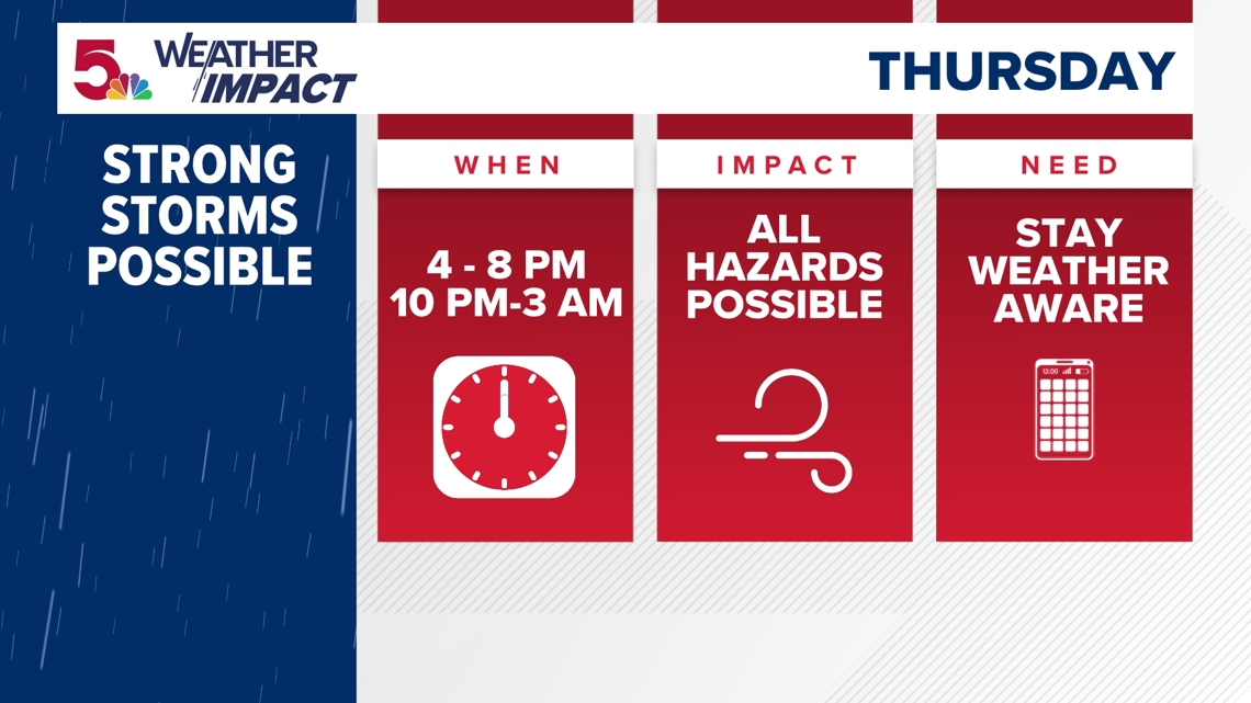
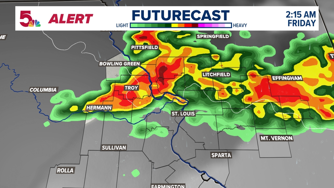
The main risk for Thursday night will be damaging winds over 60 mph, large hail and even a low risk of tornadoes. Make sure to check the forecast between now and then for any updates on the exact timing and threats for Thursday. Storms are expected to move through Thursday evening into early Friday morning before sunrise.
By Saturday and Sunday, sunshine returns and temperatures will go back into the 80s.