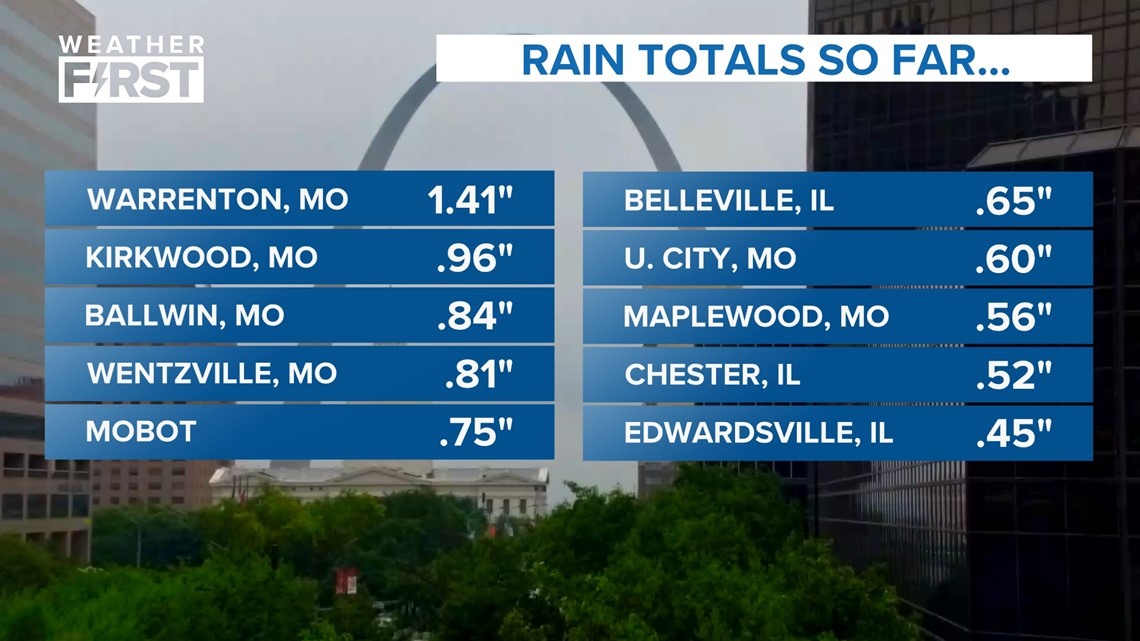
ST. LOUIS — Another round of showers and thunderstorms moved across the area early Tuesday morning. Most locations seem to have received just under one inch of rainfall, minimizing the anticipated flood threat.
Here are rainfall totals as of 8:20 a.m. Tuesday morning:


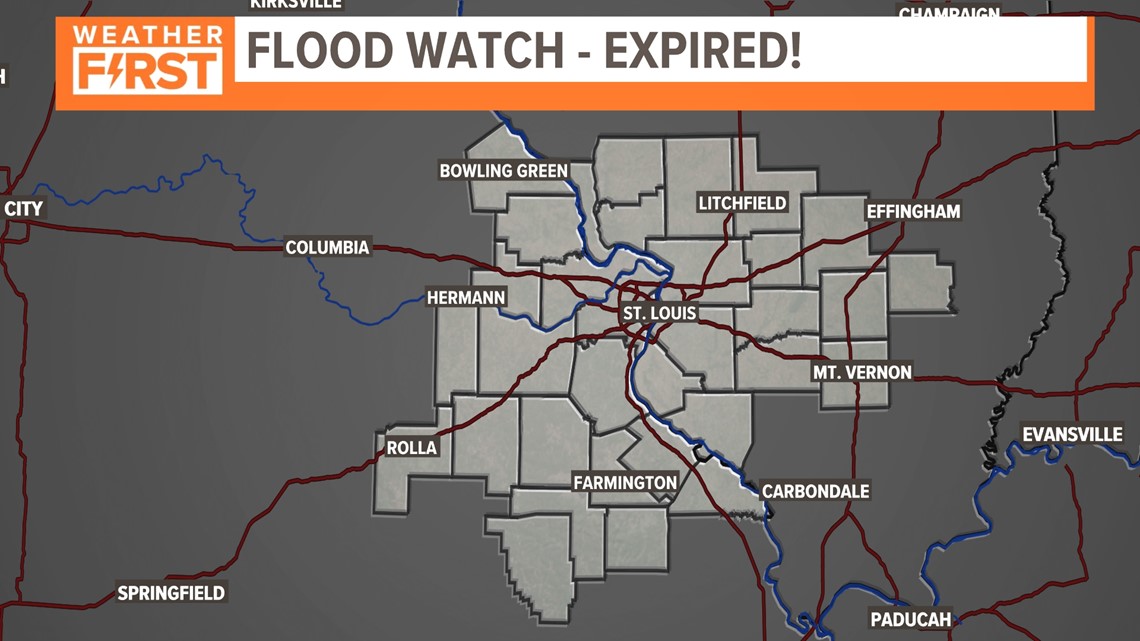
The earlier flood watch has been allowed to expire as of 6:45 a.m. Any additional rainfall should not lead to flooding, but could still cause minor impacts to local roadways.


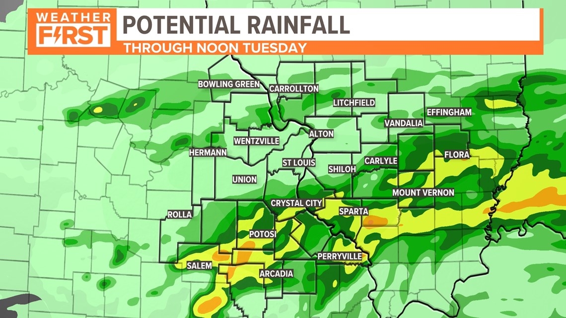
The NWS St. Louis reported locally heavy rain in Reynolds and Iron counties from storms late Monday evening. The storms will continue to develop and push to the east-northeast Monday evening. Flooding remains the main threat to the northeast.
On Sunday afternoon, flash flooding over southern portions of the St. Louis metro area was due to locally more than 6 inches of torrential rain falling from slow moving thunderstorms.


Areas that experienced flash flooding Sunday included the City of St. Louis, St. Louis and St. Clair counties which are at heightened concern for additional flooding.
Several other areas saw thunderstorms that effectively saturated the ground. Warm, muggy air is being pulled north over the cooler air that covers most of our area. This is very efficient at creating heavy rainfall.
Most of the rain will move out of the St. Louis area before lunchtime Tuesday. Don't drive into flooded roads.
"Weather Alert" refers to nuisance or disruptive weather and is indicated by orange icons and bars in our weather graphics on TV and online.
Download the free 5 On Your Side app to get the latest watches and warnings and track conditions live with our interactive radar. Use the links below to download now.


