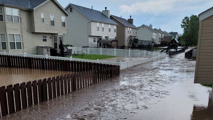
ST. LOUIS — 9:30 p.m. Flash Flood warnings continue for Madison, Montgomery and Fayette counties until 10:45 and 11 p.m. Most of the heavy rain is gradually moving out and should finally be out of these areas after midnight.
Flash flooding closed part of eastbound Interstate 44 at Interstate 64. The highway has since reopened.
At about 6:20, two separate storm cells merged in south St. Louis and St. Louis County and continued to dump heavy rain in the area. Some areas with the heaviest rainfall have seen almost five inches of rain.
A flash flood warning was issued for Fayette and Montgomery counties in Illinois until 10:45 p.m. The strongest of the rain began falling on the Illinois side of the river, where up to three inches of rain had already fallen.


A flood advisory has been issued for St. Clair County and St. Louis City, which has since expired.
Additionally, flood advisories were issued for parts of Dent, Maries, Phelps, Pulaski and Texas counties in Missouri until 7 p.m. Those have also expired.
Download the free 5 On Your Side app to get the latest watches and warnings and track conditions live with our interactive radar. Use the links below to download now.
5 On Your Side news app
iPhone | Google Play
Saturday's severe risk started just like this: the lowest category from the Storm Prediction Center. But storms developed quickly, with large hail and locally heavy rainfall. Even a brief tornado was reported in Madison County, Illinois.

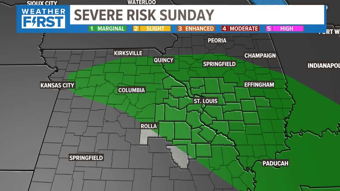
But much like Saturday, the threat of storm development remains in place for Sunday afternoon. The setup is very similar, so I expect the same type of storm threats to emerge during the afternoon Sunday.
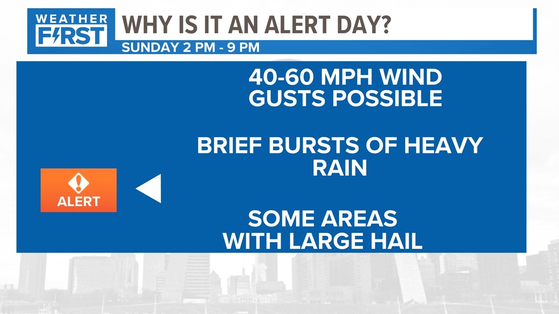
That's why Sunday is our next Alert Day starting at 2 p.m. Winds 40-60 mph may be possible with a few of these storms, but that wasn't really a huge threat Saturday. It was the production of hail and the slow movement of these storms as they merged and produced heavy rainfall.


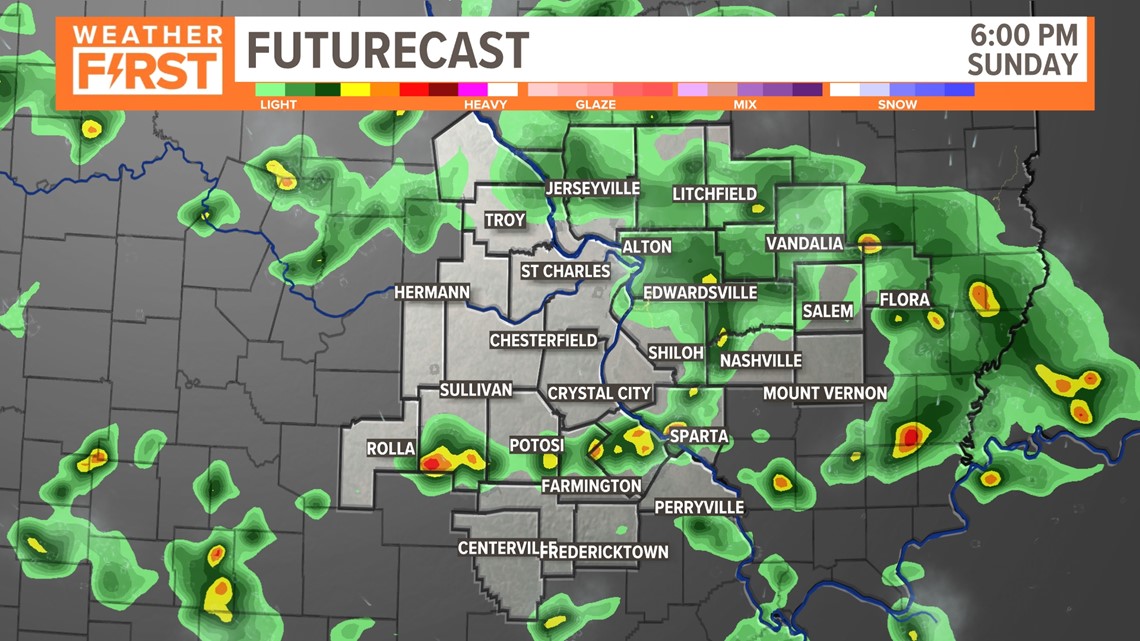
As rain continues to fall and remain very scattered, expect a similar timeline from Saturday. The heating of the day will fuel these storms and the cooler pockets of air within will offer the potential for more storms to develop.


This still leads to the potential for storms to develop in the afternoon again. While it's possible storms may be around in the morning, the majority of the morning is expected to be dry. Plan ahead for a potential storm to develop in the afternoon and have a plan B to be indoors.
5 On Your Side news app
iPhone | Google Play
To watch 5 On Your Side broadcasts or reports 24/7, 5 On Your Side is always streaming on 5+. Download for free on Roku or Amazon Fire TV.


