ST. LOUIS — A lack of cold air and snowfall over the last few years has kept St. Louis below average in terms of snowfall the last five seasons.
As the Bi-State starts decorating for the holiday, the region has rarely had a snowy backdrop in December. Does the active start to the month mean residents are in for a treat this holiday season?
St. Louis wad just shy of 4 inches through Dec. 2, to the joy of snow lovers. That's almost half of what the region experienced last winter season. The last five years have actually had below-average snowfall for several months in a row.
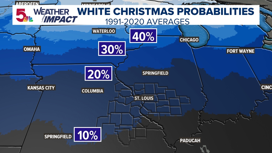
At face value, the region's chances for a "White Christmas" haven't all been that great over the last few years. Using the 1991-2020 averages, most of the Bi-State lies between a 10-20% percent chance. Use this interactive map to find your exact city's White Christmas probability.


A "White Christmas" is officially defined as having at least 1 inch of snow on the ground at 7 A.M. local time on Christmas Day. This is called snow depth.
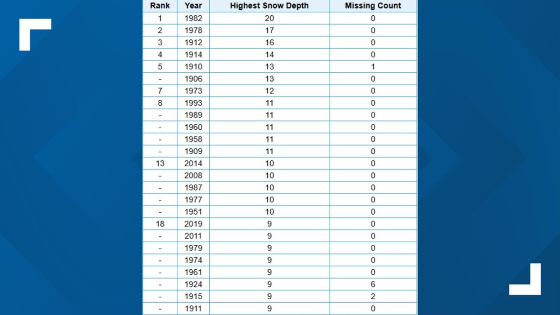
Christmas Day snow depth records have been kept in St. Louis since 1893. Those records show that while the region has seen some impressive snow depths on Christmas Day, including the region's highest snow depth at 20 inches in 1982, only 25 of the highest Christmas Day snow depths have been in the 2000s.


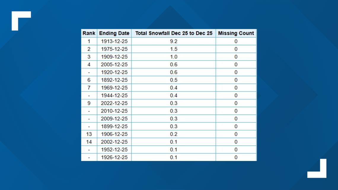
St. Louis has actually only had measurable snowfall on Christmas Day just 16 times in the city's history history. The region even had a little bit of snow on the holiday a couple of years ago.


While a White Christmas is possible, recent temperature swings may prove this a little bit more difficult.
The Climate Prediction Center currently has the second half of the month outlined as "above average" temperatures in our region. While this doesn't mean the region won't have snow, any snow may have a hard time sticking around.
The nature of the "above average" temperatures and the bigger swings are coming from the inconsistencies we have in terms of a weather pattern. This represents air 3,000 to 5,000 feet above the surface over the next 2 weeks. As the region is stuck in one of those irregularly cold air masses now, the "blow torch" of a stronger high will settle in the western half of the United States. These swings seem to be with us off and on for most of the month.
So what does that mean for St. Louis' snow chances on Christmas? My hunch at this point is that the region doesn't really see a great opportunity.
The snow in the region right now is effectively gone by the end of the week, even with coming low sun angles. The ground is still very warm below, and the region is still tied for the warmest year on record. There isn't much of a reason to believe warm temperatures won't eventually win out. But for now, the region's chances are still there. The historical average remains, for now.

