ST. LOUIS — Heavy rain and flooding have been weather concerns for the St. Louis area Tuesday. Tornado warnings expired in the region.
Headlines:
8:30 p.m. - Jersey County Sheriff Nick Manns confirms that an elderly couple from Alton died after their car was stuck in flash flooding. The couple are the first confirmed deaths in the St. Louis region from the flash flooding.
4:24 p.m. - IDOT District 8 is close to reopening I-64 between Okawville and Richview, saying that debris cleanup is almost complete and the road will be reopened within the hour.
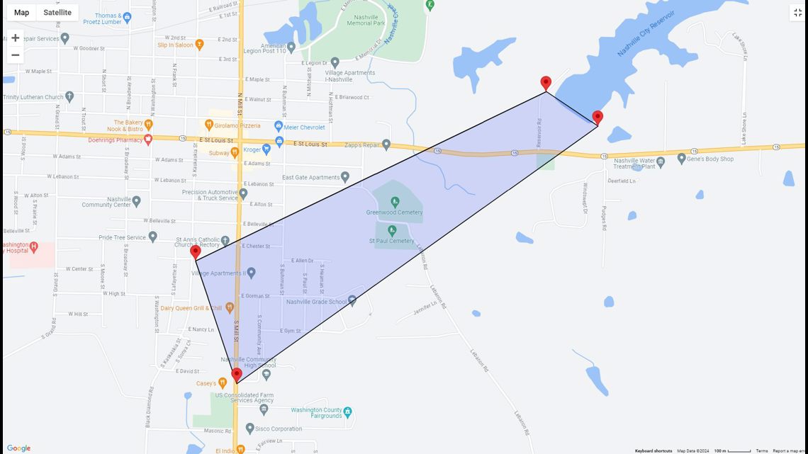
1:55 p.m. - Washington County EMA gives an update on the Nashville, Illinois flooding.
A spokesperson for the department says evacuation is complete at this time with an estimated 200 homes evacuated due to the flood. While the immediate danger has been managed, several roads are still closed including I-64 between Ashley and Nashville.
The spokesperson also confirms at this time, there have not been any significant injuries or deaths as a result of the flood.
A shelter has been set up at Trinity Lutheran Church at 680 West Walnut in Nashville.
1:41 p.m. - St. Louis Fire Department is dealing with flooding in one of their stations. Video on Twitter shows the basement of Engine House 29 flooding.
1:37 p.m. - Belleville Fire Department is responding to South 29th Street for a tree falling on a residence. For the past few hours, that department along with Mascoutah, East Side and Northwest Fire Departments have been responding to calls of water rescues in St. Clair County.
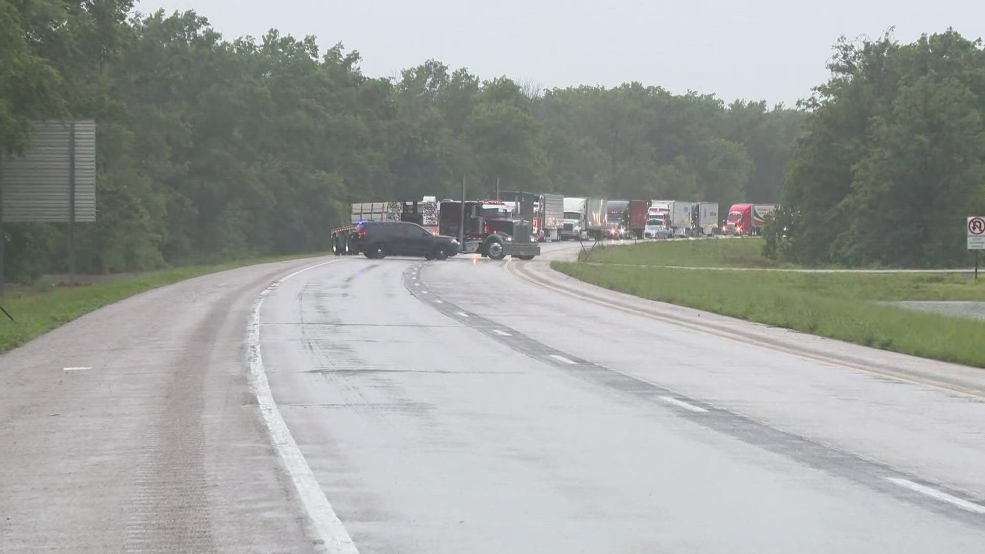
1:24 p.m. - MODOT issued road closures on parts of I-44 W and I-44 E near Eureka due to flooding. Traffic can be seen on MODOT cameras completely halted on a stretch of I-44 and Lewis Road.
12:56 p.m. - The St. Louis Fire Department showed video of high water at S. Vandeventer and Market streets.
12:49 p.m. - Several roadways in the southern part of Warren County are reported to be under a foot or more of water. One water rescue was in progress. There were multiple road closures in Eureka.
12:42 p.m. - I-55 northbound was closed at Loughborough Drive due to high water.
12:41 p.m. - A flash flood warning was issued for a large area from Sullivan, Missouri, to east of Belleville, Illinois.
12:37 p.m. - Tornado warnings in the region expired.
12:25 p.m. - Interstate 64 was closed for 20 miles between Okawville and Richview.
12:23 p.m. - St. Clair County Animal Services is flooding and evacuating animals to Gateway Pet Guardians.
Tuesday started with some pockets of heavy rain, mainly on the Illinois side of the river. A tornado warning was issued for parts of Warren and Jefferson counties.
A severe thunderstorm warning was issued for parts of St. Louis County, Franklin County and Jefferson County.
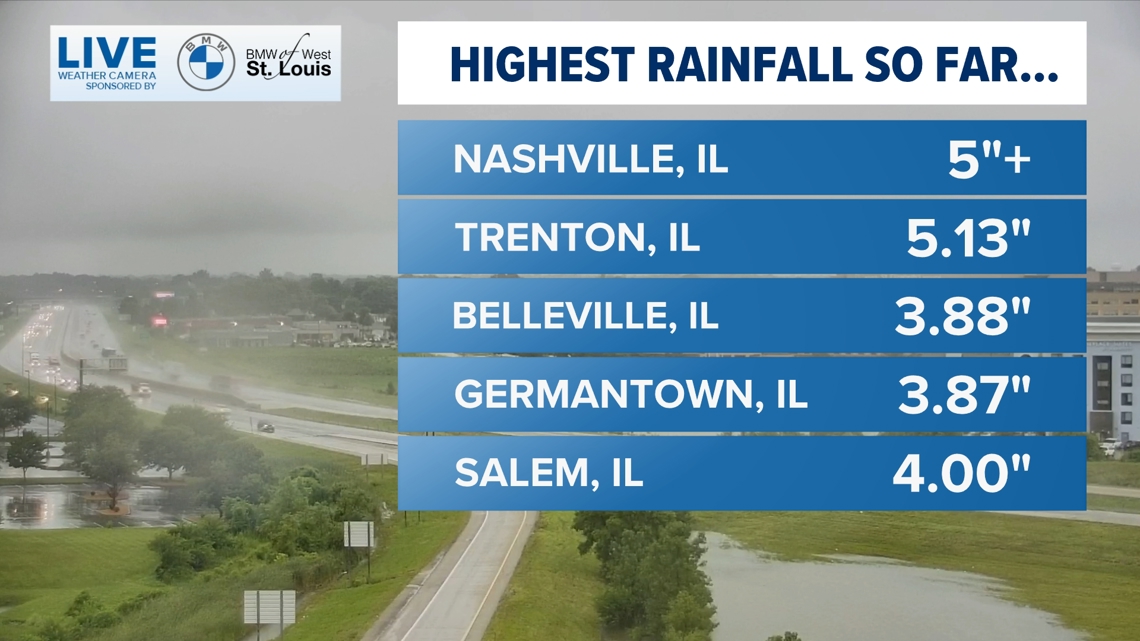
Flooding and flash flooding has been widespread. Rain will taper off this afternoon, but rain and storm chances continue until Wednesday morning. Rain totals have been from 3 to 7" in many areas.


The Washington County Emergency Management Agency warned residents in Nashville, Illinois, that failure of the Nashville Dam was imminent. They asked people below the dam to evacuate.

St. Clair County officials were responding to multiple water rescues. The East Side Volunteer Fire Department in Belleville was doing a water rescue on Richland Prairie Drive. Mascoutah Fire Department was headed to State Route 161 and State Route 4 for a water rescue.
In Lincoln County, Missouri, crews were responding to a car filling with water on Highway 79 near Foley, Missouri.
Most of the St. Louis area will see some cooler weather as a result of the clouds and rain. In fact, on Monday afternoon St. Louis Lambert reached a high temperature of 98. Temperatures on Tuesday afternoon are expected to be in the mid to upper 80s.
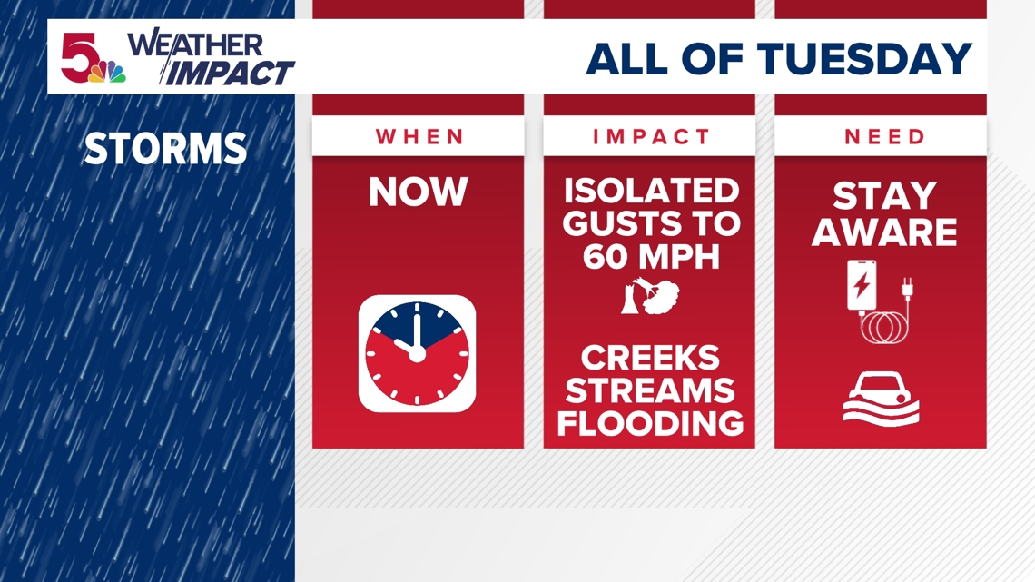
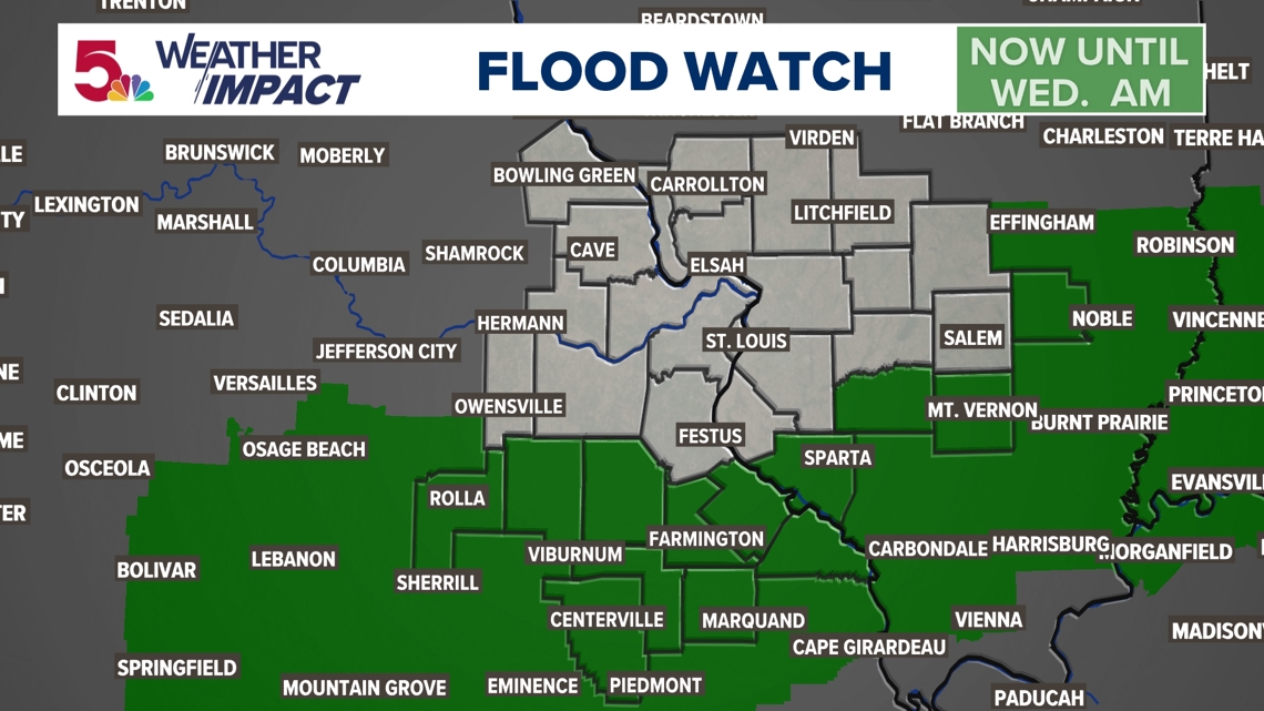
The heavy rain moves away from the St. Louis region by lunchtime with more storms firing up into Tuesday evening and night well south of the metro. The next round of the heaviest rain looks to fall from St. Louis and southeastward where a Flood Watch has been posted through Wednesday morning.

There's also a slight risk of severe weather with damaging wind gusts over 60 mph possible Tuesday evening and night in our southern counties. The lesser risk of hail and tornadoes are not expected.


The worst of the heat is over for a while.
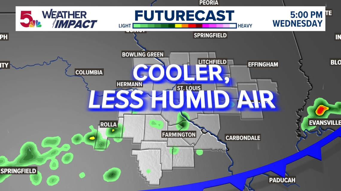
The cold front moves through our area sometime on Wednesday with cooler air and much less humid air later in the day on into Thursday and through the entire weekend. Highs will be in the low 80s with dew points in the 50s to near 60. Enjoy!