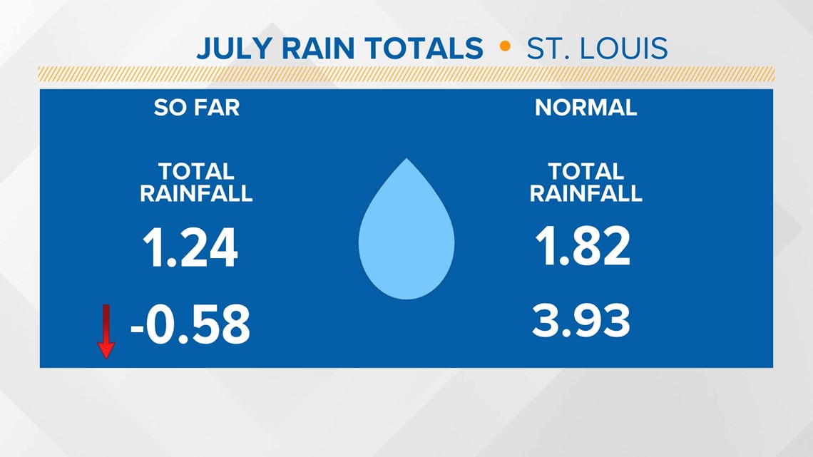
ST. LOUIS — It's pretty apparent by looking at any grassy surface that we've been incredibly dry of recent. We're halfway through the month and we're about a half an inch below normal, with not much rain in sight.
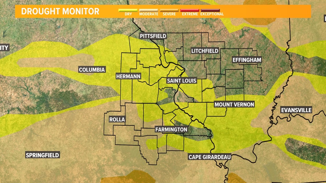
Our most recent drought monitor has more areas in the second category of drought. The showers we're expecting will provide much needed rain for some in the region, while others miss out completely.


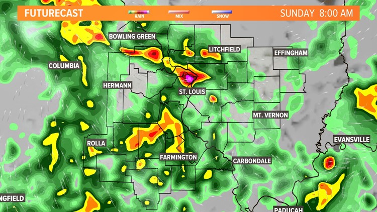
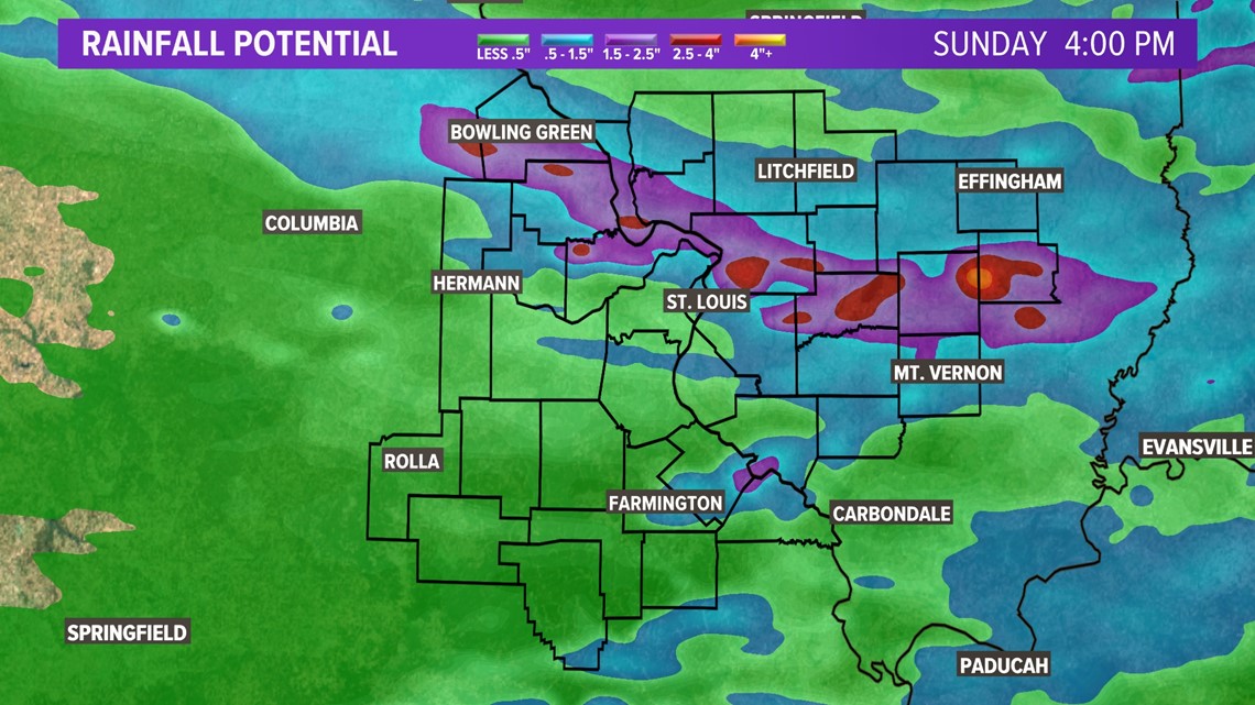
Rain will roll in later tonight and last through most of Sunday. Much like recent rainfall, some areas will see abundant rain, others will not. Check out the Futurecast for a guideline of what to expect over the next 24 hours.
Every county will get hit with some rain, but a few totals will leave a lot to be desired. Take some of the extreme totals with a grain of salt. There will be a few areas that get a quarter of an inch of rain, but some that get over an inch.

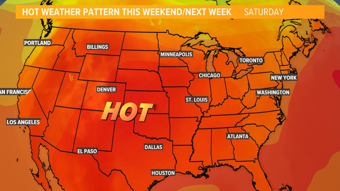
After the rain on Sunday, this heat dome returns. High pressure will bring hot weather and sinking air, which effectively ends our rain chances for several days.
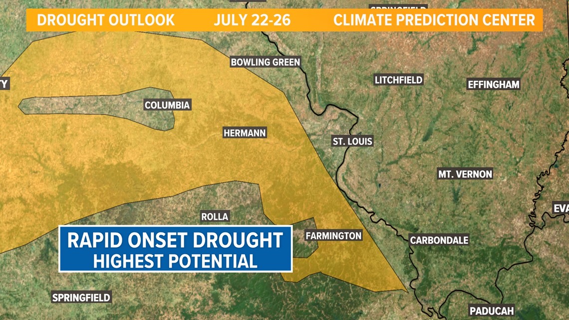
Because of this and the weather pattern settling in, the Climate Prediction Center has placed many areas under a high potential for a rapid onset drought. Hot temperatures, lots of sunshine, and low amounts of rain will allow the potential for our drought to worsen.
We'll keep you posted on this and the rain chances in the coming days.


Download the free 5 On Your Side app to get the latest watches and warnings and track conditions live with our interactive radar. Use the links below to download now.
5 On Your Side news app
iPhone | Google Play