ST. LOUIS — Gusts over 30 mph for the majority of the day helped us warm up into the mid 60s today. But that wind will be even higher as our next impactful system arrives during the day Monday.

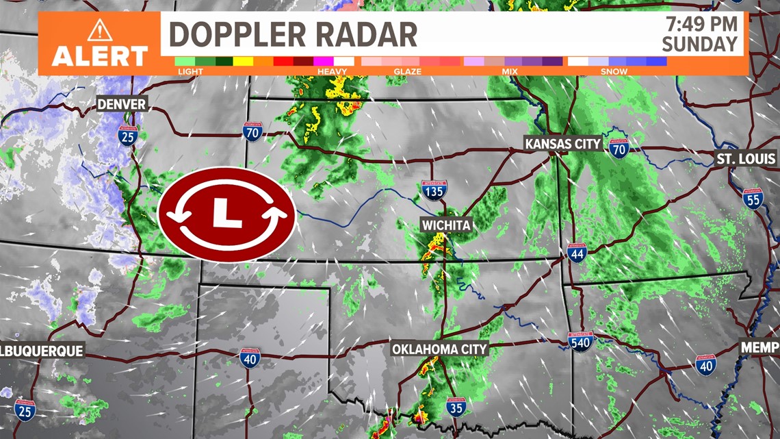
The culprit for all this wind, rain, severe weather and snow is this strong area of low pressure that's currently sitting near the panhandles. It's drawing up moisture from the gulf, there's a lot of wind above the surface, and the pressure gradient is very high. That puts us in a very windy setup for the next 36 hours.

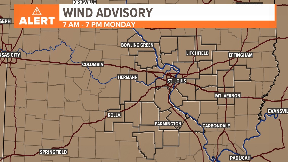
Our entire area is under a wind advisory from 7 a.m. to 7 p.m. on Monday. In fact, some 13 states are under wind advisories for this particular system.

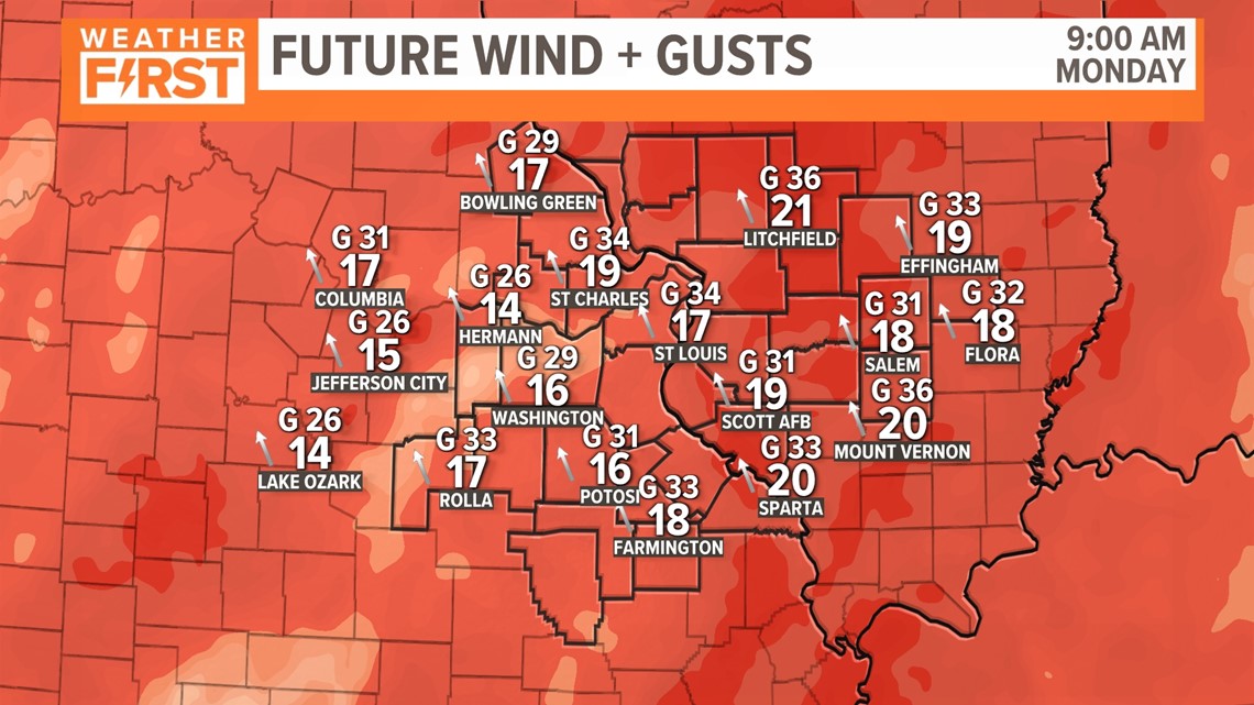
Strong sustained winds between 20-30 mph are possible. As you can see above, gusts near 40 pretty regularly are expected as early as Monday morning. I wouldn't be surprised to see a few of the windier areas see a 50 mph wind gust or two as well.

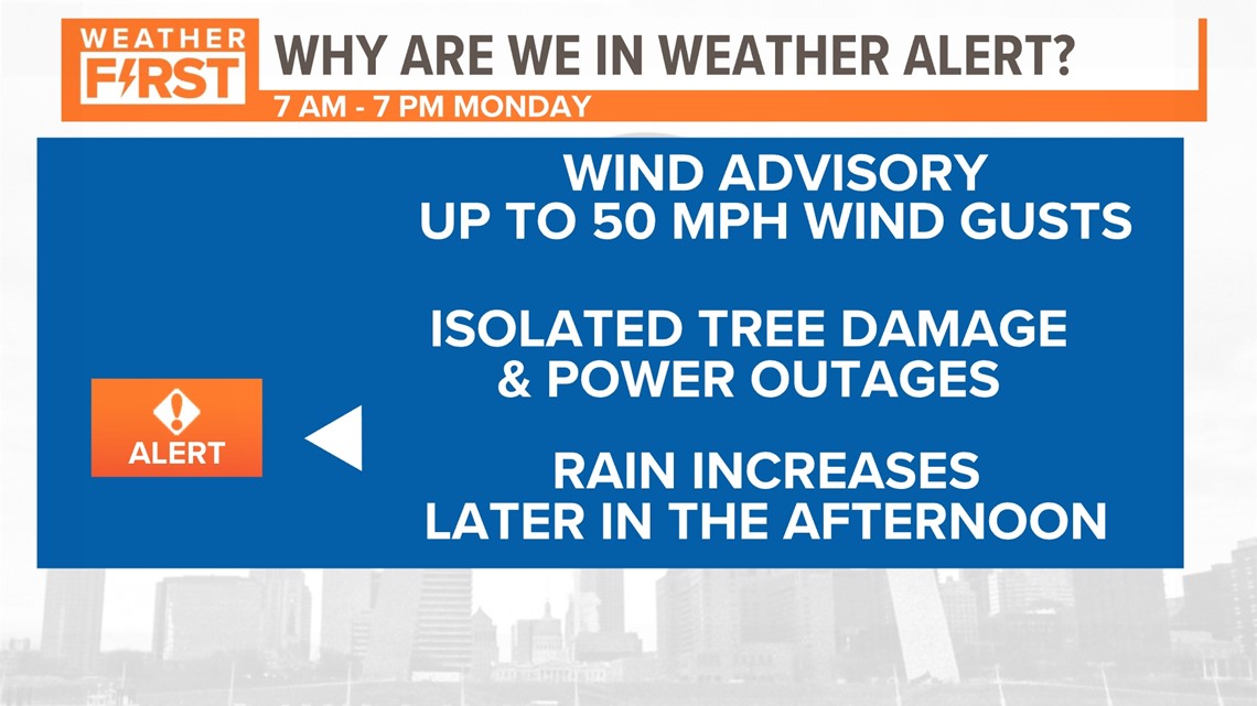
That's the reason Monday is a Weather Alert Day. Wind gusts up to 50 mph will make it difficult for drivers along the east-west interstates and roads to travel. Isolated tree damage and power outages are possible as a result, as well. I think this is most likely to occur once we start to get a little bit of rain, and the soil is wet and loose, allowing some of these trees to be more impacted.

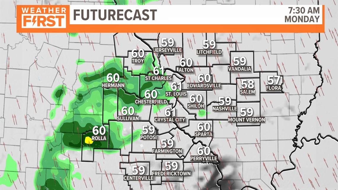
When it comes to rain, that's not really the reason for the Weather Alert Day, but it WILL play a role. Light rain and showers are possible early, but things are mostly cloudy early. The main line of rain is expected to increase by late morning into the early afternoon. That's when we may see a few impacts.

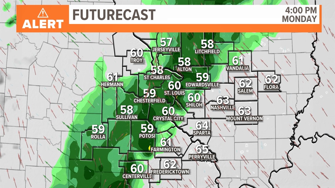
Later in the afternoon, we will see more of a widespread coverage in rain, and this may become heavy at times. This will be when the bulk of the precipitation falls in our area.

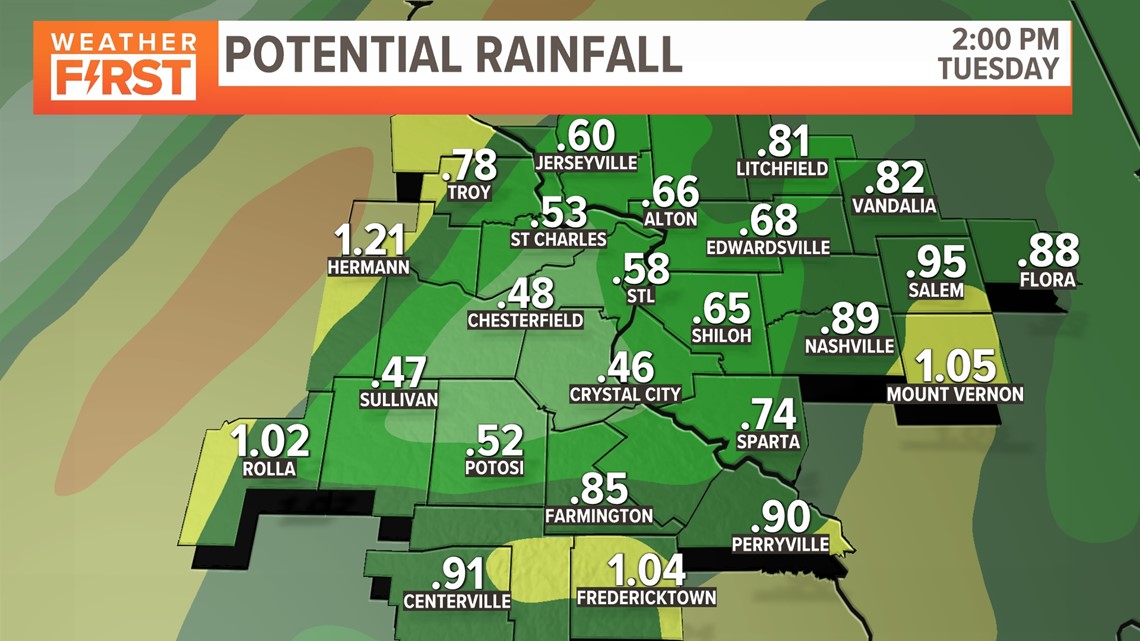
I remain skeptical that we will get much more than 1/2" to 3/4" of an inch in the city, despite some of the recent model guidance. You can see there are a few areas that are expected to get over an inch here. That's primarily because heavy rain seems to move over those locations a lot longer.
Be prepared for a windy and rainy day here in the St. Louis region. We need it. We're well behind already for the season, and the rest of the week looks pretty dry.


