ST. LOUIS — Most of us have noticed how mild it's been in the St. Louis area since an Arctic blast arrived in our area at the end of December. But just how mild is it?

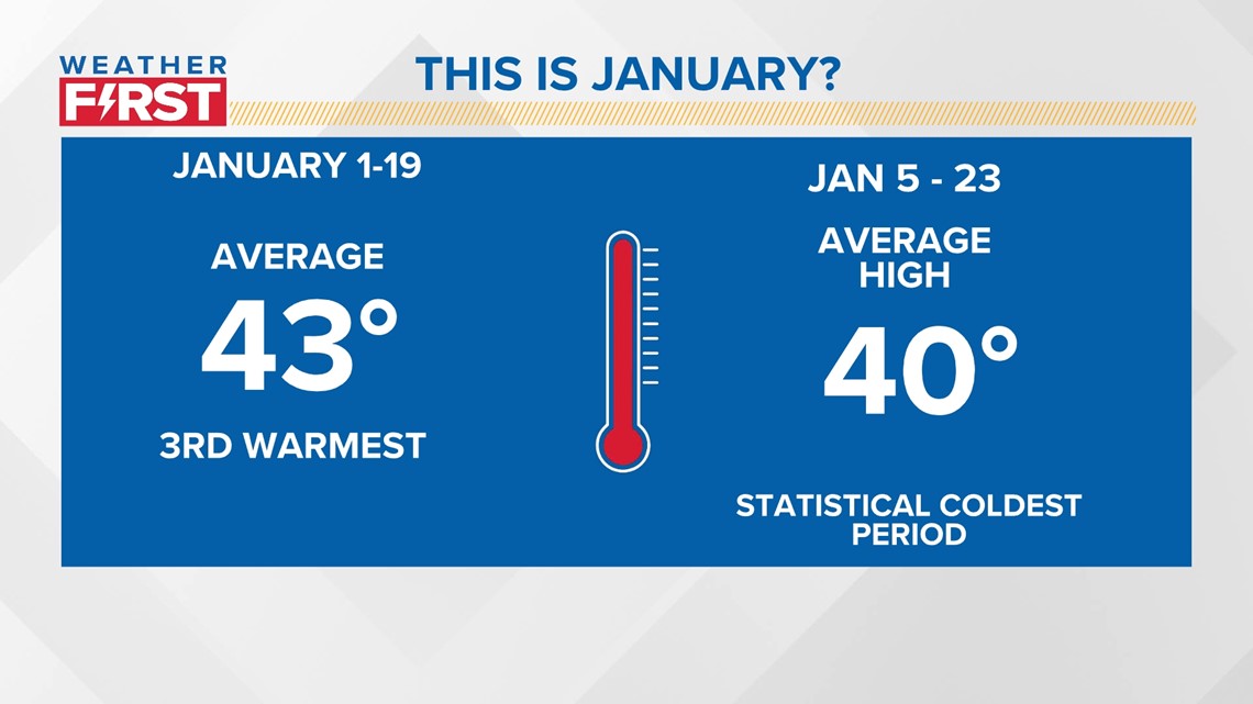
Through the first 19 days of month, our average temperature was 43 degrees. Part of this was during the statistically coldest part of the entire year.

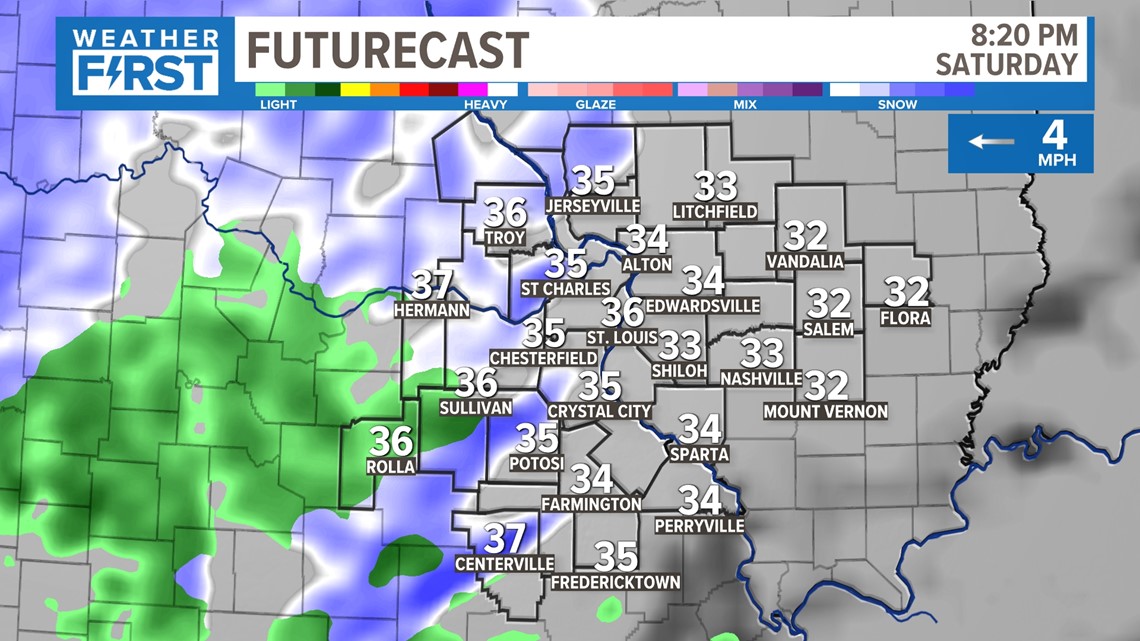
The snap shot above: Light rain and snow enters the conversation again Saturday evening. A few light bursts of rain and snow will likely develop during your evening and overnight plans.
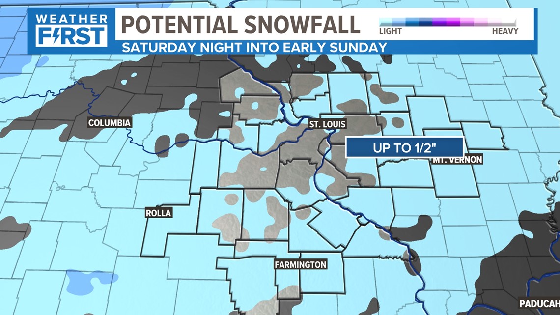
Up to 1/2" of snow is possible in the viewing area Saturday night into Sunday morning on grassy areas and mainly away from the metro. Limited travel issues are expected with the weekend system in the 5 On Your Side viewing area.

As slightly colder air moves in, most of us are still above freezing. Weather First Meteorologist Garry Frank doesn't anticipate many impacts from this, as most of the area will stay above 35 degrees overnight. But be advised just in case there is a brief accumulation on the grass before it quickly melts.

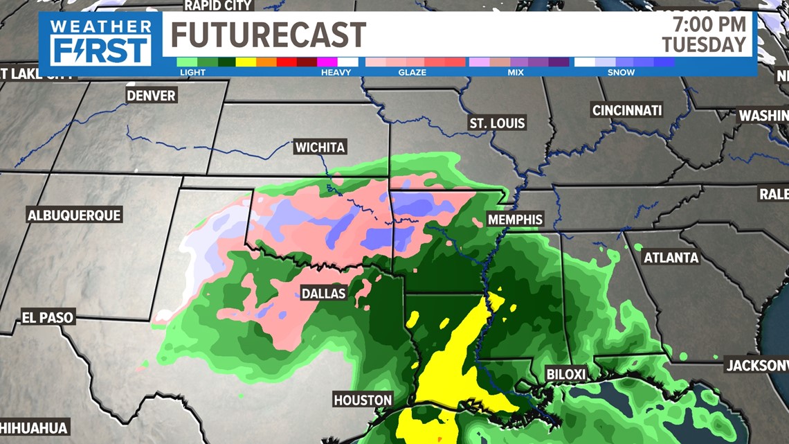
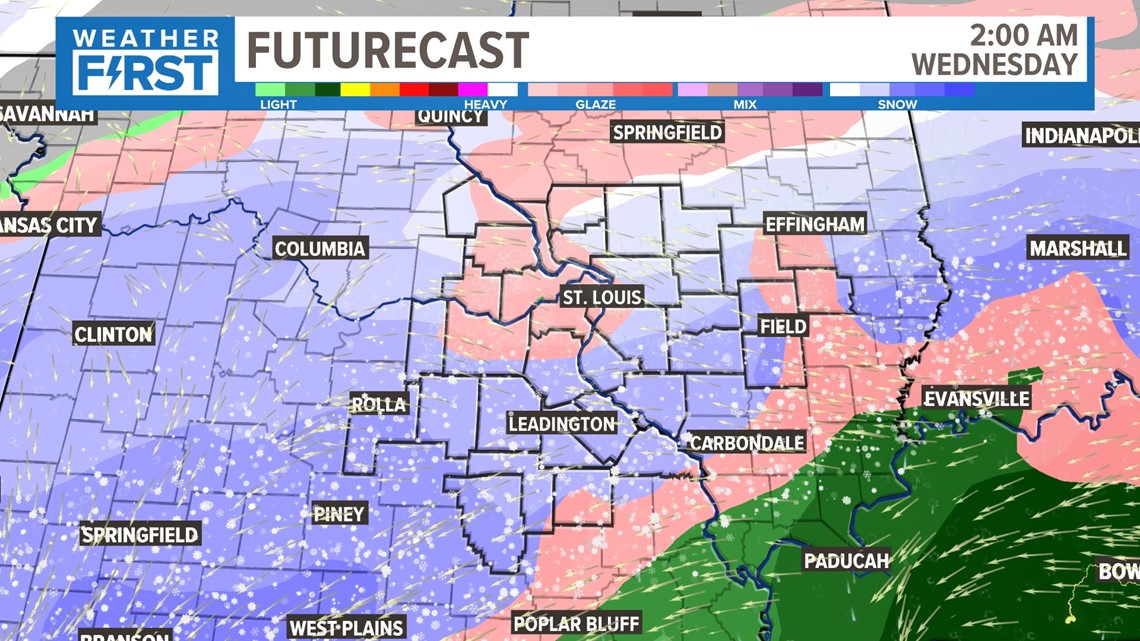
The system the Weather First team is watching a little more carefully enters our area Tuesday night into Wednesday. At this point, Tuesday looks mainly dry before rain changes to snow early Wednesday. This is something to watch and could provide our next best chance at accumulating snow.
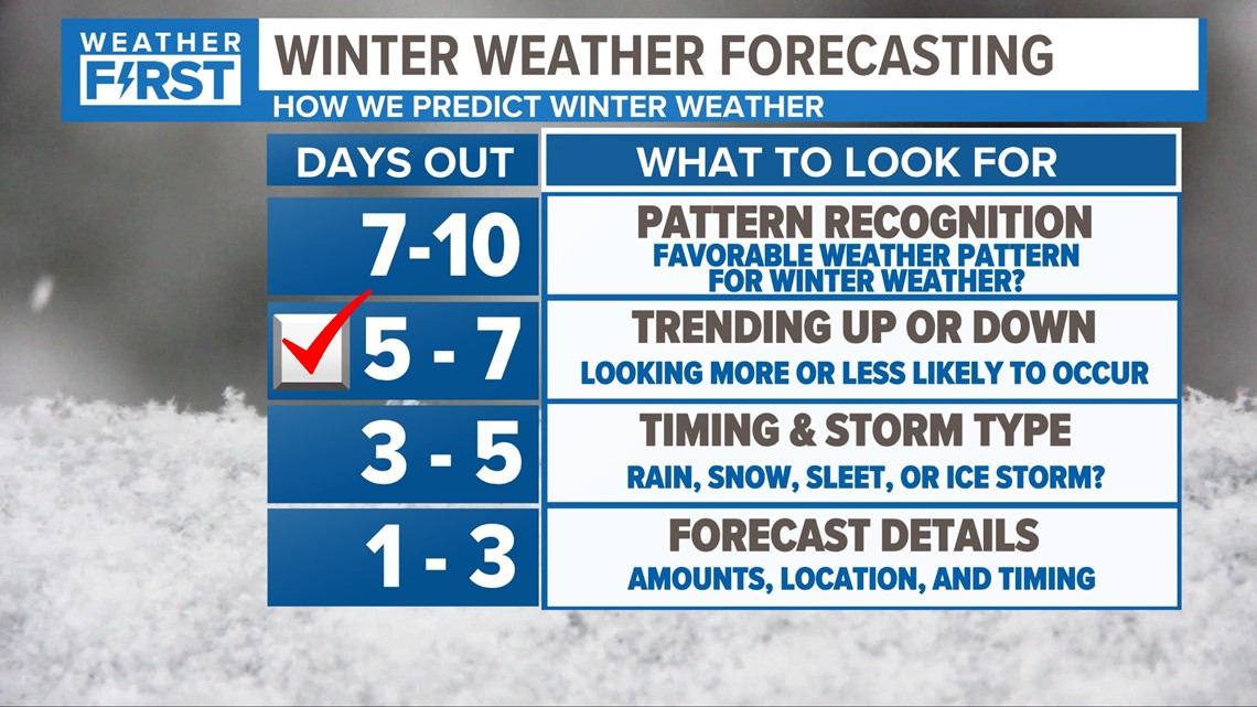
The Weather First team is still days away from nailing down the specific details. As a general rule, we are trending up based on this chart we've created for winter weather forecasting.

Below is the snapshot of 2 a.m. Wednesday with widespread snow and Winter mix.

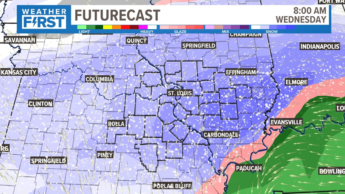
Below is the snapshot of 8 a.m. Wednesday with all snow in the viewing area.

Confidence is increasing in our area seeing accumulating snowfall overnight Tuesday into Wednesday.
This system is still in the Pacific, so it has yet to be measured for its strength and intensity. Once it moves inland, we'll get a better idea of its track and how it's going to impact our region over the coming days.
For the full Weather First forecast, click here.
To watch 5 On Your Side broadcasts or reports 24/7, 5 On Your Side is always streaming on 5+. Download for free on Roku or Amazon Fire TV.