ST. LOUIS — An intense couple of days of severe weather are expected Tuesday into Wednesday across the middle part of the country. The most active day locally in St. Louis will be Wednesday.
Strong to severe storms are expected to develop along a cold front during lunchtime and into the early afternoon. With the ingredients in play this week, we could hear sirens warning about impending severe weather.
Most people are used to outdoor tornado sirens or alerts coming to their phones, but as of last year, a new type of warning would result in similar alerts being dispatched.
Last summer, the National Weather Service introduced new categories to the Severe Thunderstorm Warnings that have been around for years. The most dangerous severe thunderstorm warning category is the "Destructive Thunderstorm Warning."
The National Weather Service will issue "Destructive Thunderstorm Warnings" when storms in the area are capable of producing 80+ mile per hour winds and/or baseball-sized hail. About 10% of severe thunderstorms fall into that category.
When a storm raises to that level, the National Weather Service will issue a wireless emergency alert to cell phones, similar to a tornado warning. The National Weather Service also coordinates with area emergency management teams to sound outdoor sirens around the same time the cell phone alerts go out.
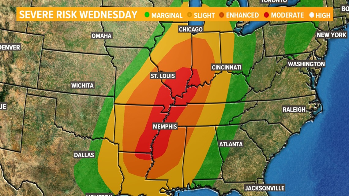
The Storm Prediction Center has placed much of the Midwest and Mid-South in an enhanced risk, level three of five, of severe weather for Wednesday. An area south and southeast of St. Louis has now been upgraded to a moderate risk, level four of five.


Ingredients for severe weather appear to be coming together for the development of thunderstorms with strong, damaging winds, large hail and a few tornadoes.
Download the free 5 On Your Side app to get the latest watches and warnings and track conditions live with our interactive radar. Use the links below to download now.
5 On Your Side news app
iPhone | Google Play


