ST. LOUIS — A series of potent storm systems are slamming into the Pacific Northwest and they are headed our way. Saturday night and Sunday, the first system moves in and will bring a heightened risk for severe weather by Sunday evening.
RELATED: Check our live interactive radar
Download the free 5 On Your Side app to get the latest watches and warnings and track conditions live with our interactive radar. Use the links below to download now.
5 On Your Side news app
iPhone | Google Play
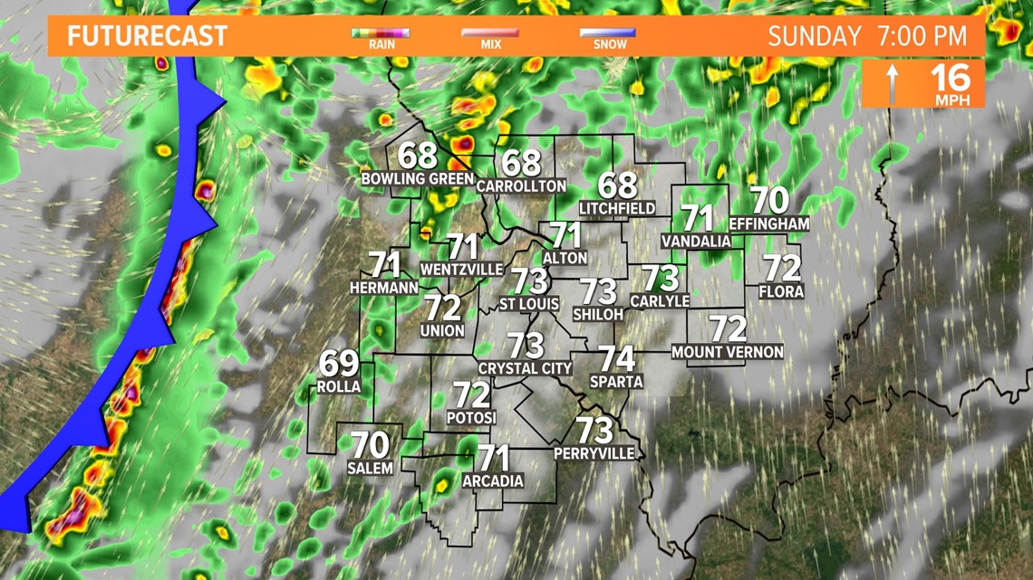
Temperatures are expected to climb into the 70s, perhaps close to 80°, by Sunday afternoon. That extra fuel will have ample humidity and strong upper level winds to work with leading to the severe weather concerns.
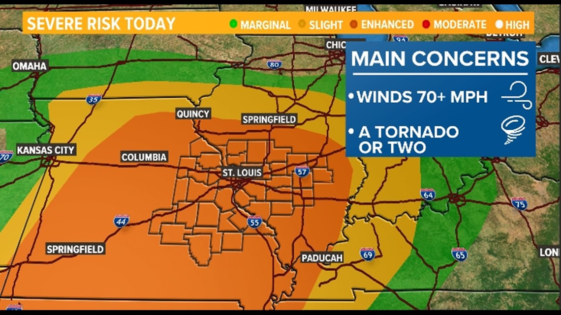
Much of the 5 On Your Side viewing area is highlighted under an "enhanced risk" from the Storm Prediction Center. This is the third highest risk out of five, which means there could be more than just a couple strong storms, but perhaps numerous.


The primary concerns with this system will be damaging, gusty winds and tornadoes with hail being a secondary risk.
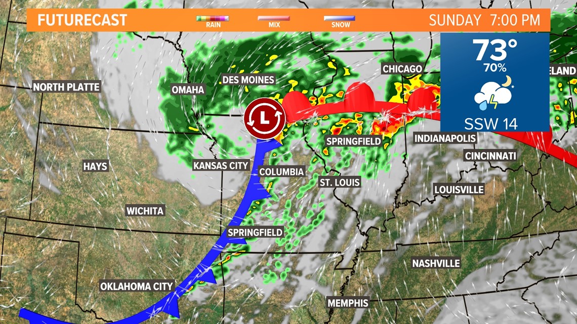
As the storms develop Sunday afternoon and evening, we will have a strong jet stream overhead and that could produce fast-moving tornadoes but also dangerous straight-line winds within any storms that do develop.


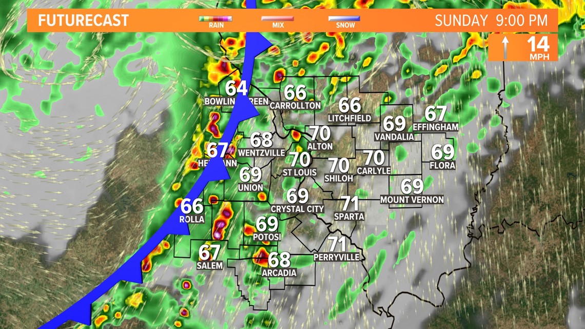
The storms will originate in western and central Missouri and move eastward through the evening with the best timing for the worst weather in St. Louis between 5 p.m. and 11 p.m.


As the storms move into central and eastern Illinois, they are expected to weaken slightly, but damaging winds and isolated tornadoes will still be possible, just perhaps not as many.


The severe threat moves out of the Bi-State just after midnight Monday morning, but there could still be a few lingering areas of rain through Monday morning, especially in Illinois, before completely drying out during the morning. It will be much cooler and breezy with limited sunshine.
Our next system slides in Wednesday with more rain.
Weather coverage:
- ShakeOut Day highlights importance of earthquake preparedness
- EF-2 Tornado confirmed in Illinois as severe weather moved through parts of the St. Louis area
- National Weather Service meteorologists tour Greene County, IL, tornado damage
- Fall foliage forecast: Here's when we could see colors peak in St. Louis


