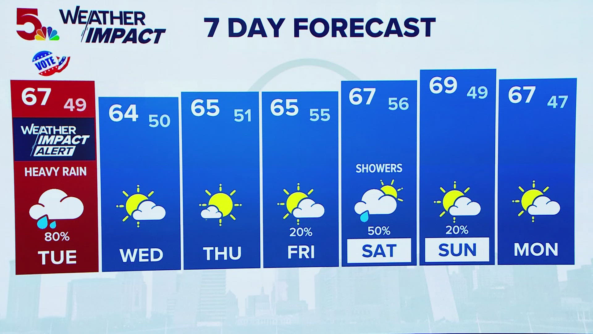
ST. LOUIS — Those standing in line to vote should be prepared for heavy rain to start the day, with rain gradually tapering off by lunchtime.
Click here for the full Weather Impact forecast.
8 a.m. Tuesday - St. Louis County EMA has opened a shelter at the Mid County YMCA branch on Urban Drive in Brentwood for people impacted by flash flooding.
7 a.m. Tuesday - Those impacted by flooding in the St. Louis County area can seek shelter at the Mid County YMCA, located at 1900 Urban Drive in Brentwood, according to the St. Louis County Office Of Emergency Management.
Flooding at Interstate 44 and 141 is causing a miles-long backup in the eastbound lanes of I-44 approaching the flooding. According to the MoDOT traveler map, the southbound lanes of 141 are also closed in that area.
In south St. Louis County, Bayless is flooded in both directions under Interstate 55.
Brentwood Boulevard is closed just south of Manchester due to flooding.
N Lindbergh Boulevard is closed in both directions from Loyola to Washington in Florissant. Washington is also closed from N Highway 67 to St. Charles.
Police in St. Louis said Skinker between Olive and Hodiamont is completely flooded.
6 a.m. Tuesday - Several schools have canceled classes on Tuesday due to flooding, including Citadel State School, Crawford County R1, Grandview R-II School District and Potosi R-3. Find the full list of closures here.
5:15 a.m. Tuesday - Continuing rain has caused flooding roadways in St. Louis County. The Maplewood Police Department said there are several roads closed due to flooding. The most significant of the closures is Hanley Road near Addie Avenue.
There have also been reports of cars stuck in floodwaters, including in St. Louis' Fairgrounds Park neighborhood, at Natural Bridge and Grand, and in southern portions of the St. Louis area like House Springs.
If you see water on the roadway, do not drive through it. Remember, turn around, don't drown.
The flooding has also resulted in impacts to MetroBus routes.
2:20 a.m. Tuesday - Our severe weather threat has come to a close, but Tuesday's main concern will be flooded roadways, with many drivers reported stranded in water overnight. Saturated ground and swollen creeks and streams will be an issue as heavy, steady rain brings the potential for more localized and flash flooding throughout the morning. Remember to never drive through flood waters. Turn around, don't drown.
Download the free 5 On Your Side app to get the latest watches and warnings and track conditions live with our interactive radar. Use the links below to download now.
5 On Your Side news app
iPhone | Google Play
10 p.m. Monday - A brief tornado was indicated by radar in St. Charles and Lincoln counties, which prompted the Tornado Warning and sirens to go off. This tornado is likely done at this point and probably lasted only a minute or so.
According to a National Weather Service storm report, a one-machine shed was destroyed and telephone poles and trees were downed at about 9:40 p.m. along Highway W in Foristell. A storm survey will be sent out Tuesday morning to confirm whether or not it was a tornado.

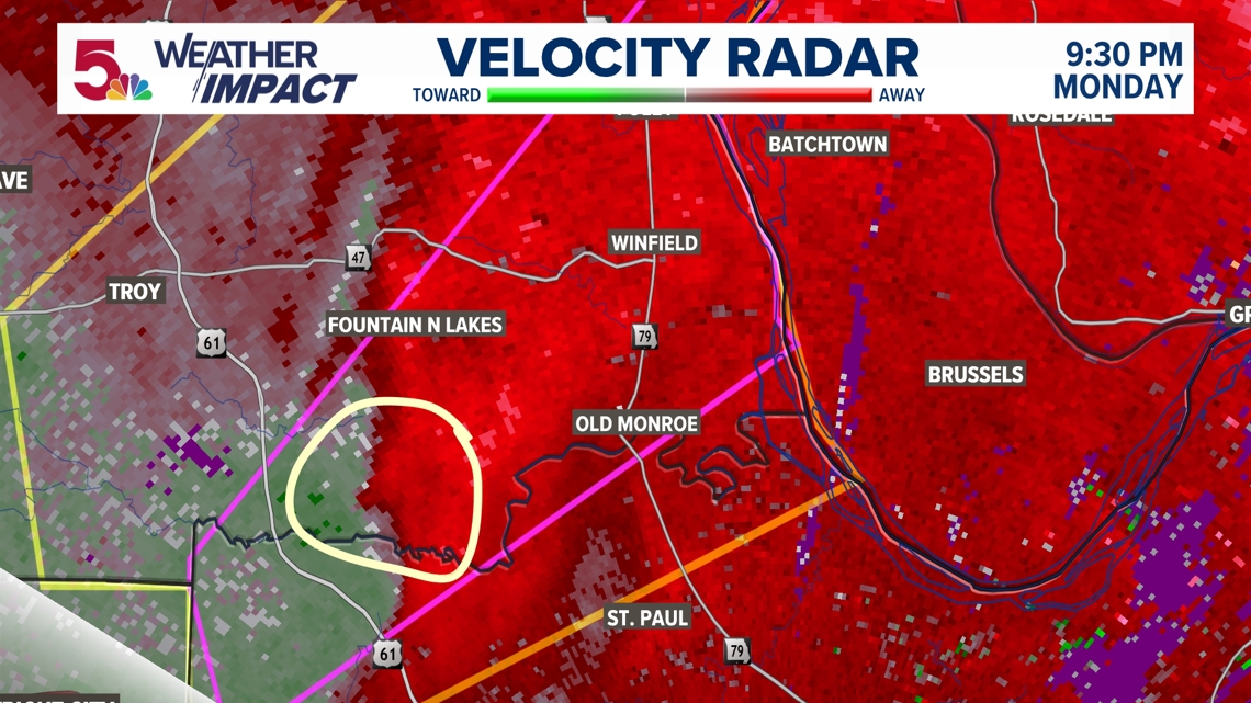
9 p.m. Monday - At this point, the storms we were monitoring for 60 mph wind gusts and some weaker rotation have continued to lose their intensity. As a result, there are currently no severe warnings. That doesn't mean we are out of the woods tonight, but we may be starting to transition to a flooding threat overnight.

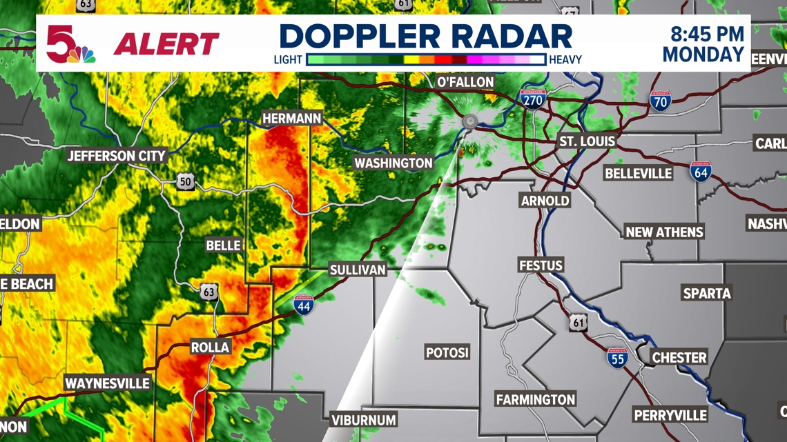
8:05 p.m. Monday - Our first severe thunderstorm of the night comes in the form of a warning for Phelps County until 8:45 tonight. This storm is moving NE at 60 mph and is producing 60 mph wind gusts.

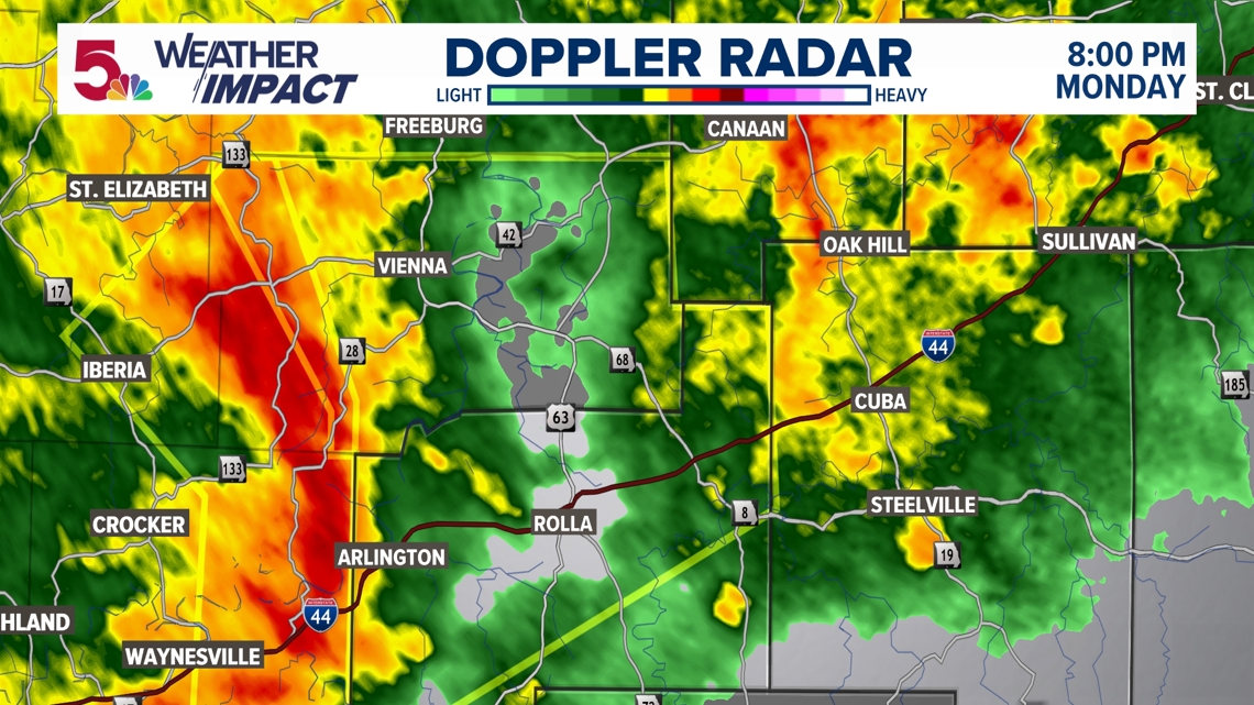
7:45 p.m. Monday - We still remain quiet when it comes to active severe weather, but a Flood Watch is now in place for a good majority of the area until noon Tuesday.

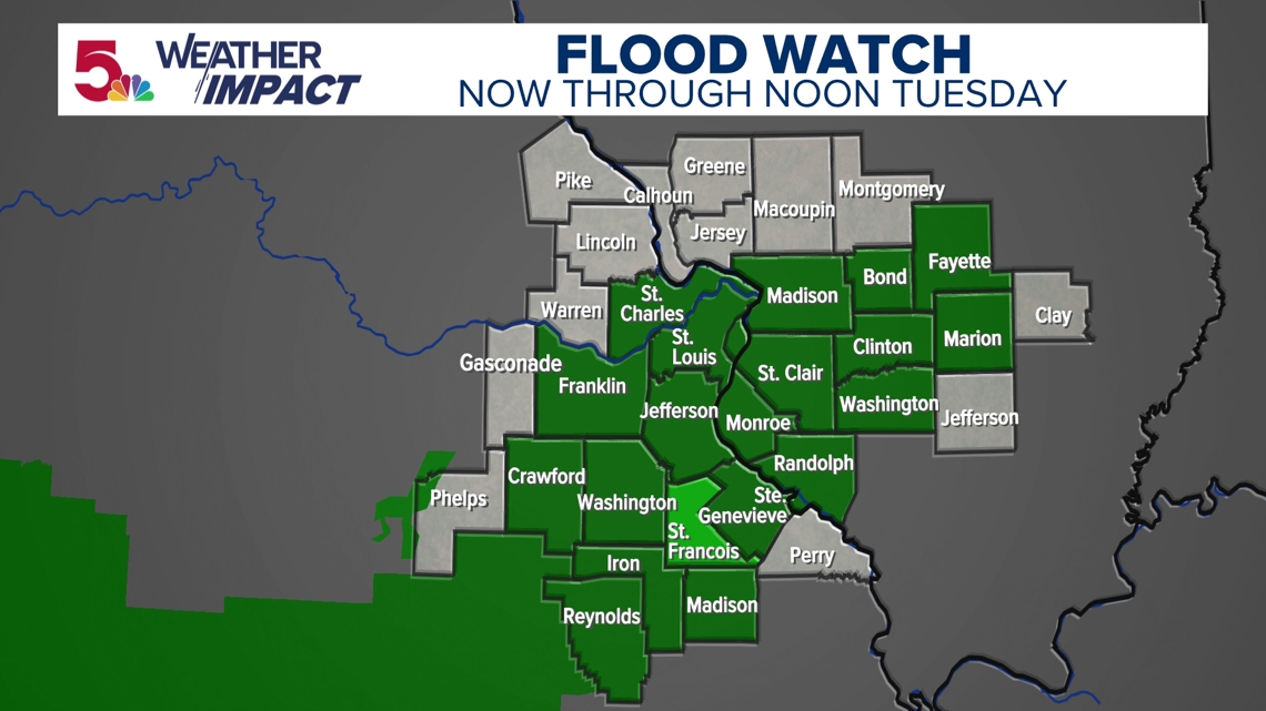
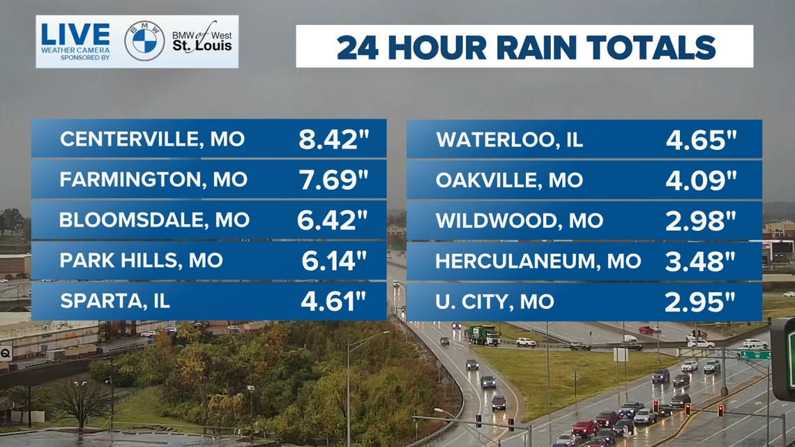
Heavy rain has fallen most of the day, with some spots in our area receiving between 3-6" of rain or more! Flash flooding was still a concern for parts of our area, despite the drought.

The Storm Prediction Center has the 5 On Your Side outlooked for a marginal and slight risk of severe weather Monday evening and night.

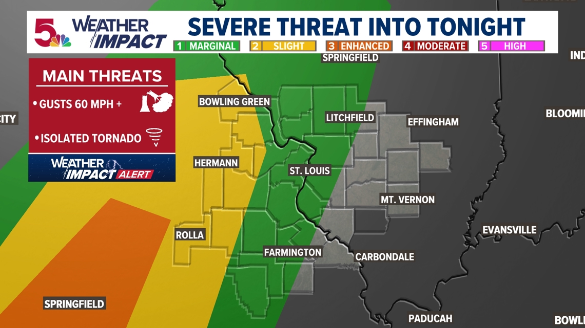
The line of storms that move into the area tonight into Tuesday morning could be strong to severe. The main risks will be additional heavy rain, damaging wind gusts over 60 mph and tornadoes.

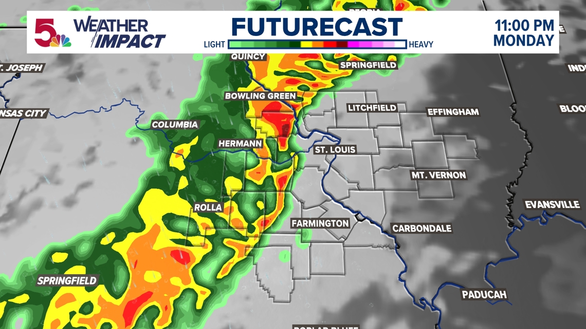

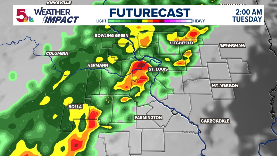

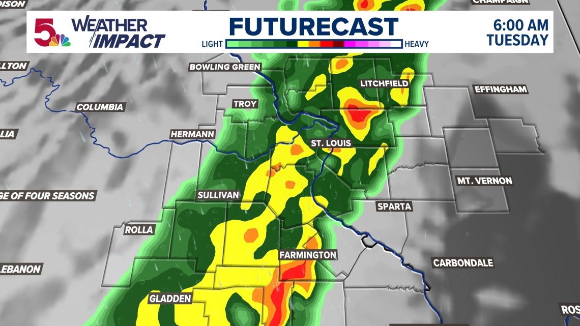

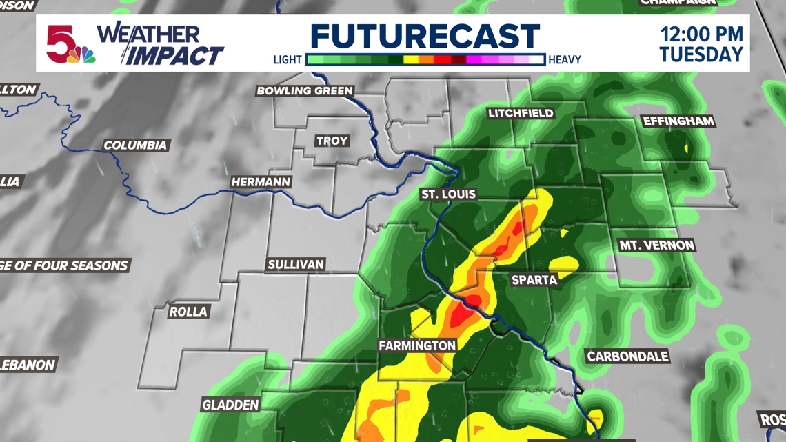
This threat gradually winds down into the early morning hours. Rain will gradually taper off through the lunch hour, but the severe threat will wind down at this time. The rain is expected to end by the afternoon.

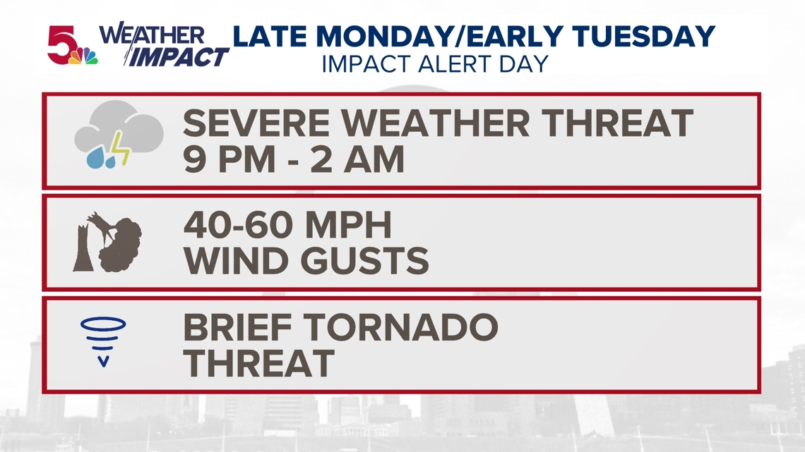
Because these storms are going to be moving in overnight, have your cell phones charged and a way to get overnight weather warnings. We will be streaming on 5+ when these storms develop and keep you posted overnight on-air, on our website and YouTube channel.

